Sunda Trench
From Wikipedia
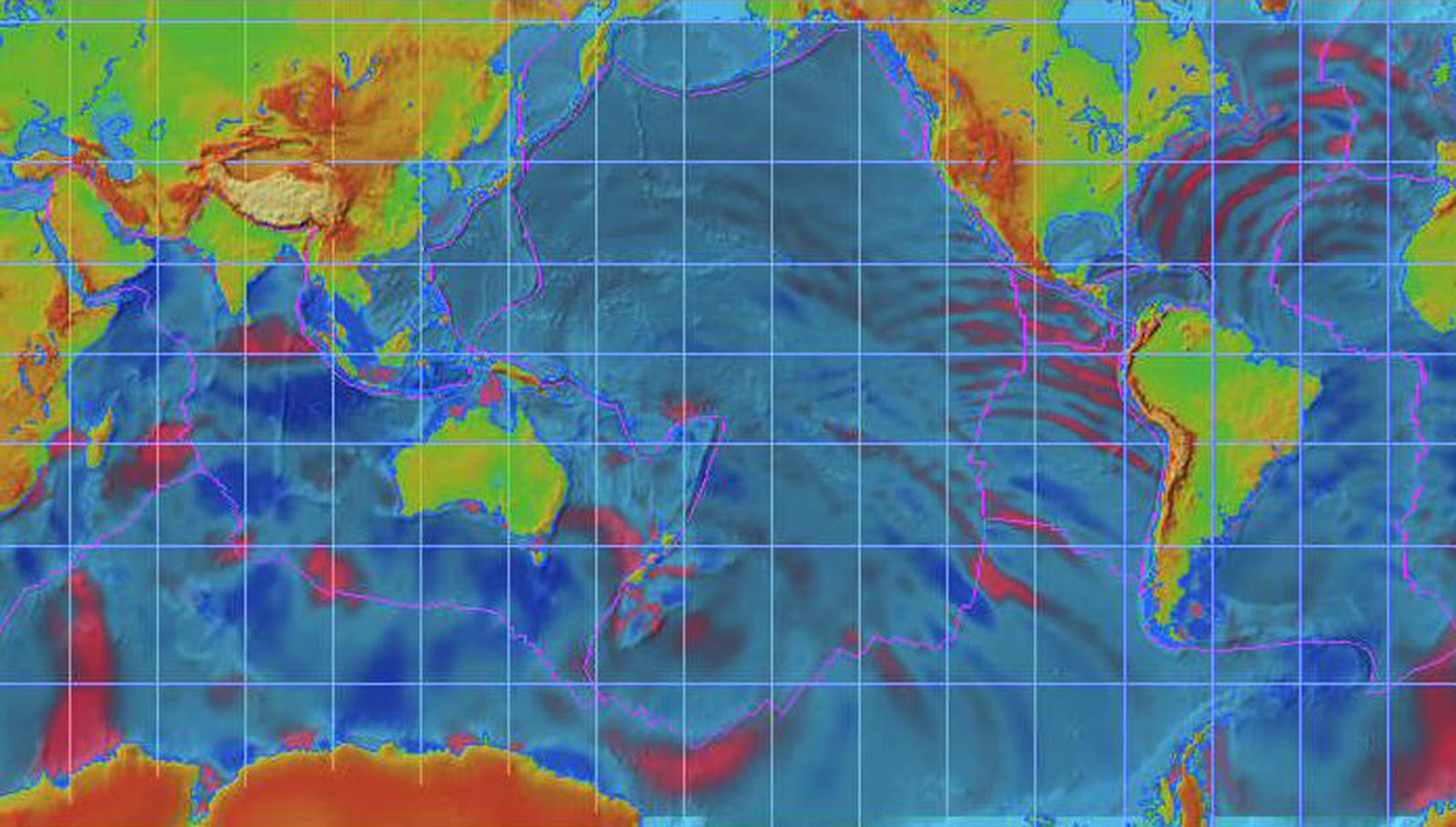
Map
showing earthquake activity in the vicinity of the Java Trench around the time
of the 2004 Indian Ocean earthquake. Prepared by the United States
Geological Survey
The Sunda Trench,
earlier known as, and sometimes still indicated as the Java Trench,[1] is located in the northeastern Indian Ocean, with a length of 3,200 kilometres
(2,000 mi).[2] The maximum depth of 7,725 metres (25,344 ft) (at
10°19'S, 109°58'E, about 320 km south of Yogyakarta), is the deepest point in the Indian Ocean.
The trench stretches from the Lesser Sunda Islands past Java, around the southern
coast of Sumatra
on to the Andaman Islands, and forms the boundary between
Indo-Australian Plate and Eurasian plate
(more specifically, Sunda Plate). The trench is considered to be part of the Pacific Ring of Fire as well as one of a ring
of oceanic trenches around the northern edges of
the Australian Plate.
There is scientific evidence that the 2004 earthquake
activity in the area of the Java Trench could lead to further catastrophic
shifting within a relatively short period of time, perhaps less than a decade.[3]
This threat has resulted in international agreements to establish a tsunami warning system in place along the Indian Ocean
coast.[4]
Characteristics
For about half its length, off of Sumatra,
it is divided into two parallel troughs by an underwater ridge, and much of the
trench is at least partially filled with sediments. Mappings after the 2004 Indian Ocean earthquake of the plate
boundary showed resemblance to suspension bridge
cables, with peaks and sags, indicative of asperity and locked faults, instead of the
traditional wedge shape expected.[5]
Exploration
Some of the earliest exploration of the Trench
occurred in the late 1950s when Robert Fisher, Research
Geologist at the Scripps Institution of Oceanography,
investigated the trench as part of a worldwide scientific field exploration of
the world's ocean floor and sub-oceanic crustal-structure. Bomb-sounding,
echo-train analysis and manometer were some of the techniques used to determine
the depth of the trench. The research contributed to an understanding of the
subduction characteristic of the Pacific margins.[6]
Various agencies have explored the trench in the
aftermath of the 2004 earthquake, and these explorations have revealed
extensive changes in the ocean floor.[7]
Associated seismicity
The subduction
of the Indo-Australian Plate beneath a bloc of the Eurasian Plate
is associated with numerous earthquakes. Several of these earthquakes are
notable for their size, associated tsunamis, and/or the number of fatalities
they caused.
Sumatra
segment
Java
segment
References
1.·
Sunda Trench (4°30' S 11°10' S 100°00'
E 119°00' Accredited by: SCGN (Apr. 1987) The trench was studied in some detail
in 1920's-1930's by Dutch geodesist F.A. Vening Meinesz, who made classic
pendulum gravity measurements in a Dutch submarine. Shown as Java Trench in
ACUF (Advisory Committee on Undersea Features Gazetteer). see also: http://www.gebco.net/
2.· · Java Trench
- article from Encylopedia Britannica
7.
· "The
underwater survey of the SUMATRA earthquake source area"
Further
reading
- Špičák, A., V. Hanuš,
and J. Vaněk (2007), Earthquake occurrence along the Java trench in
front of the onset of the Wadati-Benioff zone: Beginning of a new
subduction cycle?, Tectonics, 26, TC1005 (This page was last modified on 3 April 2016, at 19:05).
From the following article:
Suleyman S. Nalbant,
Sandy Steacy,
Kerry Sieh,
Danny Natawidjaja
and
John McCloskey
Nature 435, 756-757(9 June 2005)
doi:10.1038/nature435756a
a, Schematic of the Sumatran subduction zones with the overlying
plates removed. Calculated three-dimensional stresses, including
contributions from both earthquakes resolved directly on to the
structures of interest, have been projected on to a diagram of the
structural geometry and geography of the region. Here we use a low-value
coefficient of effective friction, 0.4, although the main results are
robust to large ranges of this value. Grey-scale values on the rupture
plane represent the amount of slip in metres experienced on the
southernmost 450 km of the Sumatra–Andaman earthquake and on the
Simeulue–Nias earthquake. Colour-scale values represent the co-seismic
stress change on the Sunda-trench subduction zone and the Sumatra fault.
Stress contours are in 2-bar intervals. Red dashed contours indicate
zero co-seismic stress. Black star indicates the location of Banda Aceh.
b, Locations of ruptures of recent and historical earthquakes on
the Sunda trench. Dotted lines indicate approximate extents of
historical ruptures (1833, 1861 and 1935); solid lines surrounding
dark-blue areas indicate seismological inversions of recent earthquakes;
red star, epicentre of December 2004 event; yellow star, epicentre of
March 2005 event; black star, Banda Aceh. The rupture area of the 1797
event, which is not shown here, probably overlaps significantly with the
1833 event under Sipura and Pagai Islands and may extend under Siberut
Island. The precise extent of this event strongly influences the
estimated slip deficit on the megathrust. (
nature.com)
The Earth’s solid surface floats on a layer of softer rock as a
collection of interlocking, movable puzzle pieces called tectonic
plates. At 7:58 a.m. (local time), on December 26, 2004, beneath the
Indian Ocean west of Sumatra, Indonesia, pent-up energy from the
compressional forces of one tectonic plate grinding under another found a
weak spot in the overlying rock. The rock was thrust upward, and the
Earth shook as a 9.0 magnitude earthquake sent its vibrations out into
the ocean. Tsunamis spread out in all directions; the massive waves
washed over islands and crashed against coastlines in Sri Lanka,
Southern India, and even the east coast of Africa. Tens of thousands of
people were killed; millions are homeless.
The image above shows how the tectonic puzzle pieces fit together
around Indonesia. The epicenter of the recent quake is marked with a red
star in the image. It is located just to the east of the Sunda Trench,
where the India Plate begins to get subducted beneath (forced under) the
Burma Plate. The blue arrows along the plate boundary show the
direction of subduction.
As the India Plate slides beneath the Burma Plate, it meets pockets
of resistance, which causes compressional forces to build up. Weakened
overlying rock gets forced upward. Based on the location of aftershocks
(red shaded circles on the image), the United States Geological Survey
reports that approximately 1,200 kilometers of the plate boundary
probably slipped as a result of the quake. The initial rupture was
likely more than 100 kilometers wide, and probably produced an average
vertical displacement along the fault plane (the slope along which the
two plates meet) of 15 meters.
When the bottom of the ocean is deformed by this type of “megathrust”
quake, the upward force acts like a fist rising up from underwater.
Water rolls down off the sides of the “fist,” creating massive waves
that can travel as fast as an airplane. The waves can move across the
ocean and barely disturb the surface, but when they reach shallow
coastal water, the earthquake’s energy thrusts them tens of meters into
the air. The tsunami created by this earthquake reached India and Sri
Lanka in about four hours. The wave eventually reached Africa, the
Pacific Ocean, Hawaii, and the west coast of North and South America.
For more information about this earthquake and plate tectonics, visit the Website of the
USGS.