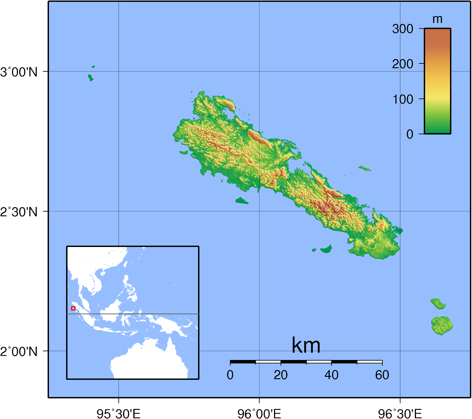
Simeulue
Coordinates 2°35′N 96°05′E
Area 2,310 km2 (890 sq mi)
Highest elevation 567 m (1,860 ft)
Population 82,100 (as of 2007 census)
Simeulue is an island of Indonesia, 150 kilometres (93 mi) off the west coast of Sumatra. Its capital is Sinabang. Simeulue was once a part of West Aceh Regency but was split off in 1999 and became a separate Simeulue Regency.
Demographics
From the ethnic point of view the inhabitants of Simeulue are similar to the people of neighboring Nias Island. Three languages are spoken on the island: Devayan, Sigulai and Lekon, all of which are different from the languages spoken in the north of Sumatra.[1] The majority of the islands population are Muslim.
2004 Indian Ocean earthquake and tsunami
Simeulue was close to the epicenter of the 9.3 magnitude 26 December 2004 earthquake.
On 28 March 2005, an 8.7 magnitude earthquake struck with its epicenter just off the south end of the island.[2] During the earthquake, Simeulue rose at least six feet on the western coast; this left the flat top of its coral reefs above high tide. On the east coast, the land was submerged, with seawater flooding fields and settlements.[3]
Local wisdom
Although Simeulue Island was only 60 kilometers from the epicenter, while Banda Aceh was about 250 kilometers, only six residents died while the remaining 70,000 persons were safe, due to local wisdom called 'smong'; this dictated that after an earthquake, if the tide suddenly receded, people should evacuate to highland as soon as possible.[4]
References
1. BPS Kabupaten Simeulue (2003). Simeulue Dalam Angka 2012. Badan Pusat Statistik. Com. ISBN 0-0100-0021-6.
2. Gibbons, Helen (April 2005) "Second Tsunami Causes Damage in Indonesia—USGS Scientists Post Observations on the World Wide Web" United States Geological Survey
3. Saved by tsunami folklore, BBC News From Our Correspondent, 10 March 2007
4. "Pulau Simeulue". October 13, 2013.
Simeuluë
ist eine indonesische Insel vor der Westküste von Sumatra. Sie liegt 150
Kilometer vor der Westküste Sumatras im Malaiischen Archipel im Indischen
Ozean.
Geografie
Die
Insel ist mit 2.310 Quadratkilometern doppelt so groß wie Rügen. Hauptstadt ist
Sinabang im Südosten der Insel. Simeuluë liegt 60 km nordwestlich der
Banyak-Inseln und 140 km nordwestlich von Nias.
Bevölkerung
Die
meisten der 82.000 Einwohner sind Muslime. Ein Großteil lebt von Landwirtschaft
und Fischerei. Wichtigste Erzeugnisse sind Gewürznelken und Kokosnüsse.
Sprache
Die
Sikule-Sprache gehört zum Nordwest-Sumatra-Zweig der malayo-polynesischen
Sprachen.
Natur
Simeuluë
gilt als Naturparadies. Die Insel hat eine einzigartige Flora und Fauna
entwickelt. Im Norden liegen Mangrovenwälder, das Landesinnere ist bewaldet.
Entlang der Küste finden sich Korallenriffe und zahlreiche kleine Inseln.
Simeuluë liegt abseits der Pfade des Massentourismus. Nur einige Surfer haben
bisher den Weg dorthin gefunden.
Katastrophen
Simeuluë liegt nur wenige Kilometer vom
Epizentrum des Seebebens vom 26. Dezember 2004 entfernt. Es gab damals zwar
gewaltige Sachschäden, aber nur wenige Tote. Die Menschen flohen rechtzeitig in
die Berge, weil sie durch Erzählungen gewarnt waren: Als Simeulue 1907 von
einem schweren Tsunami getroffen wurde, starben Tausende. Auch damals hatte
sich das Meer zunächst zurückgezogen. Infolge der Verschiebung der tektonischen
Platten, die zu dem Erdbeben geführt hatte, wurde die Insel versetzt: Sie liegt
heute etwa 15 Meter weiter südwestlich als vor dem Beben.
Durch einen Großbrand nach den drei
Meter hohen Flutwellen im Zuge des schweren Seebebens mit Epizentrum Nias vom
28. März 2005 wurde ein Großteil der Insel zerstört. Auch die angrenzenden
Banyak-Inseln wurden schwer getroffen.
(Wiki)