Powered By Blogger

Samstag, 31. Dezember 2016

IMO, COMSAR AND OTHER UNO-MORONS


Introduction to IMO


IMO – the International Maritime Organization – is the United Nations specialized agency with responsibility for the safety and security of shipping and the prevention of marine pollution by ships.


​​​​​​​​​​
A​​s a specialized agency of the United Nations, IMO is the global standard-setting authority for the safety, security and environmental performance of international shipping. Its main role is to create a regulatory framework for the shipping industry that is fair and effective, universally adopted and universally implemented.
In other words, its role is to create a level playing-field so that ship operators cannot address their financial issues by simply cutting corners and compromising on safety, security and environmental performance. This approach also encourages innovation and efficiency.
Shipping is a truly international industry, and it can only operate effectively if the regulations and standards are themselves agreed, adopted and implemented on an international basis. And IMO is the forum at which this process takes place.
International shipping transports more than 80 per cent of global trade to peoples and communities all over the world. Shipping is the most efficient and cost-effective method of international transportation for most goods; it provides a dependable, low-cost means of transporting goods globally, facilitating commerce and helping to create prosperity among nations and peoples.
The world relies on a safe, secure and efficient international shipping industry – and this is provided by the regulatory framework developed and maintained by IMO.
IMO measures cover all aspects of international shipping – including ship design, construction, equipment, manning, operation and disposal – to ensure that this vital sector for remains safe, environmentally sound, energy efficient and secure.
Shipping is an essential component of any programme for future sustainable economic growth. Through IMO, the Organization’s Member States, civil society and the shipping industry are already working together to ensure a continued and strengthened contribution towards a green economy and growth in a sustainable manner. The promotion of sustainable shipping and sustainable maritime development is one of the major priorities of IMO in the coming years.
Energy efficiency, new technology and innovation, maritime education and training, maritime security, maritime traffic management and the development of the maritime infrastructure: the development and implementation, through IMO, of global standards covering these and other issues will underpin IMO's commitment to provide the institutional framework necessary for a green and sustainable global maritime transportation system.​ 
​​

© Copyright 2016 International Maritime Organization (IMO)

 http://www.imo.org/en/About/Pages/Default.aspx


IMO = Intelligenzbolzen Missetäter Obergauner/COMSAR = COmmittee von Maulhelden Scharlatanen And Ramschverwaltern


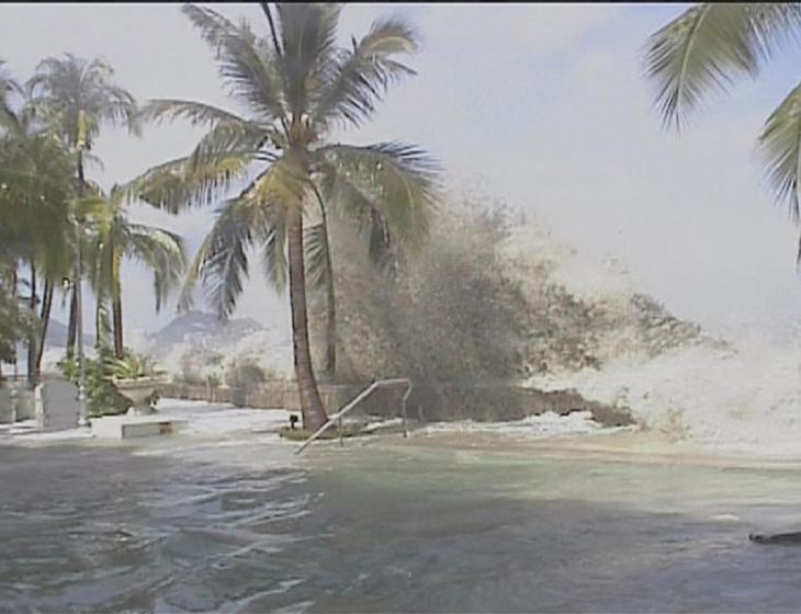
= 26. Dezember 2004 =

Focus on tsunami

The IMO Sub-Committee on Radiocommunications and Search and Rescue (COMSAR) devoted an entire day to a special session on responses to the Indian Ocean tsunami crisis when it met for its 9th session from 7-11 February 2005.

Presentations were given by a number of Governments, non-governmental organizations and the IMO Secretariat to update delegates on the measures that had been taken, so far, in the maritime context and with plans that were currently being put in place to enhance maritime recovery and reconstruction activities.

Much discussion focussed around the contribution that IMO might make towards the development of a tsunami early-warning system for the Indian Ocean, particularly in view of the robust and well-proven satellite and radio-based communication infrastructure that IMO had established, in co-operation with IHO and WMO, for the promulgation of maritime safety information to ships which had the ability to play an important role in the dissemination of tsunami warnings. It was agreed that IMO should participate in the wider efforts to establish a tsunami early-warning system for the Indian Ocean, being co-ordinated by the Intergovernmental Oceanographic Commission of UNESCO.

The Sub-Committee agreed a COMSAR circular providing advice on the promulgation of tsunami and other urgent natural disaster warnings via the existing International SafetyNet and NAVTEX systems. A correspondence group was established to consider the issue of the promulgation of tsunami and other natural disaster warnings to vessels which are not subject to the 1974 SOLAS Convention, as amended.

Sub-Committeeon Radiocommunications and Search and Rescue (COMSAR), 9th session: 7-11February 2005

Opening addressby Efthimios E. Mitropoulos, Secretary-General of the International MaritimeOrganization


Good morning, distinguished delegates,

It is a great pleasure for me towelcome you to the ninth session of the Sub Committee on Radiocommunicationsand Search and Rescue. I particularly welcome those delegates who may beattending this Sub-Committee for the first time.

Before I move on to address items on the Sub-Committee's agenda, I wish torefer to the decision of the Council, last November, that the theme for thisyear's World Maritime Day be "International Shipping - Carrier of WorldTrade", a theme which will give us the opportunity to direct our attentionto the image of shipping as it is widely perceived nowadays. I have the feelingthat the overall contribution shipping makes to the global economy and thecommunity as a whole, by providing the facilitation mechanism for more than 90per cent of world trade, is far too easily overlooked. Overall, shipping can, Ibelieve, claim to be largely safe, secure, efficient and environmentallyfriendly; it can also claim to be constantly striving to improve its overallperformance; yet it is, on occasions, pretty much taken for granted, at best,and, at worst, condemned as an uncaring and selfish industry displaying scarceconcern about the environment. I do not think such a perception is fair and,therefore, I call on you and those who care about shipping to work together toput this right by reversing this mistaken perception. Let us use everyopportunity available, including the occasion of this year's World Maritime Daycelebrations, in order to highlight the role of shipping and the progress ithas made in terms of safety and the environment.

Distinguished delegates,
Since you last met, the MaritimeSafety Committee has held its seventy-eighth and seventy-ninth sessions and,under agenda item 2, you will be informed of its various decisions on theoutcome of your last session. Responding to your recommendations, the Committeeadopted amendments to the SOLAS and SAR Conventions and associated Guidelineson the treatment of persons rescued at sea, so that the obligation of mastersto render assistance to persons in distress at sea will be complemented by acorresponding obligation of Governments to co-ordinate and co-operate so thatships providing assistance by embarking persons in distress are released fromtheir further obligations with minimum deviation from the ship's intendedvoyage. These amendments and the associated Guidelines are intended to ensurethat all relevant aspects are addressed and appropriate action taken tomaintain the integrity of the global search and rescue system, as has been putin place by IMO after many years of persistent and consistent efforts. Inaddition, the Committee adopted a revised NAVTEX Manual and proposed amendmentsto the IAMSAR Manual. These are milestones in our endeavours to maintainup-to-date operational standards for the safety of life at sea and to providesound advice to Governments, shipowners and seafarers in all theircorresponding activities.

Among the many important issues before you this week, I would single out theconsideration, from your Sub-Committee's perspective, of measures to enhancemaritime security, as part of our ongoing endeavours to build strong defencesto protect shipping against international terrorism.

In this context, you are expected to consider technical matters related to thedevelopment of long-range identification and tracking systems for ships, anissue falling within the Organization's work which commenced following adoptionby the Assembly of resolution A.924. Your advice to the MSC will assist theCommittee, at its May session, to progress the consideration of the issuebefore it adopts relevant amendments to SOLAS chapter XI-2. Although I amadvised that there have been only a few submissions addressing the substance ofthe issue, I hope that you will be able to make real progress this time andadvise the MSC accordingly.

In the same context and of particular importance for masters and seafarers isthe ship security alert system priority signal and the development of aprotocol for testing such alert systems. The revision of MSC/Circ.623/Rev.3 onPiracy and armed robbery against ships was intended to provide further guidanceto rescue co ordination centres, which may receive information on any securitythreats, to assist seafarers facing such threats. This is the secondconsecutive session, since MSC 77 instructed your Sub-Committee to deal withthe matter, that no submissions for the revision of the circular have beenreceived and, therefore, you should consider what advice you may be able toprovide to the Committee in order for the task to be completed without furtherdelay.

With regard to the work on passenger ship safety, MSC 79 approved, lastDecember, casualty threshold criteria for return to port, a time to remainhabitable for evacuation and a time to recover. These criteria are of keyimportance as they will guide your work and enable you to develop, from theSub-Committee's specific perspective, relevant requirements for passenger shipsto enable them to maintain their essential systems and return safely to port.

In considering matters related to the "time to recover", the Committeeagreed to a five-day maximum timeframe during which persons could be expectedto stay in survival craft, taking into account their personal needs and thehazards to life and health persons may face while on board. Having consideredmatters related to the time to rescue, the Committee agreed that the issueneeded further examination and, to this effect, instructed your Sub-Committeeto prepare a "time to rescue" timeframe and advise MSC 81accordingly.

Since its establishment in 1993, the Joint ICAO/IMO Working Group onHarmonization of Aeronautical and Maritime SAR has played a significant role tothe further development of a mutually supportive regulatory and administrativeframework for a global SAR system by preparing amendments to the Maritime SAR Convention,the IAMSAR Manual and Annex 12 to the ICAO Convention, as well as to thedevelopment of a number of associated guidelines. At this session, you willconsider the report of the eleventh session of the Joint Group, which was heldin the Caribbean last September, and addressessuch issues as medical assistance in SAR services and further amendments to the IAMSAR Manual.

In response to the recommendation of the 2000 Florence Conference on SAR andthe GMDSS that regional maritime RCCs should be established at strategiclocations around the African coastline facing the Atlantic and Indian Oceans,you will know by now that an International SAR Fund was established last yearas a multi-donor trust fund pursuant to your proposal endorsed by the MSC and theCouncil. To date, the Fund has a balance of US$ 21,886.79 and I wish to takethis opportunity to thank all donors and those who have pledged contributionsfor their generosity; also to add my voice to that of the Council in invitingpotential donors to come forward to enable the Organization to further assistdeveloping countries to enhance their maritime SAR capability and thus be in astronger position to contribute to the effective implementation of the GlobalSAR Plan. I am hopeful that our co-operation with the International LifeboatFederation will bear fruit in the near future. The recent commitment ofInmarsat Ltd. to provide 6 Fleet F77 and 3 Inmarsat C installations will enrichthe Mombasa regional MRCC and its two subordinate MRSCs in the Seychelles andTanzania with valuable communications equipment. Thereafter, training of therespective personnel can begin and we hope the centres will soon becomeoperational in the 3 locations I just mentioned and serve, as a pilot project,in the not too distant future. Further financial pledges to the Fund have beenreceived from Inmarsat and I thank them for that.

Distinguished delegates,
Your task this week may not alwaysbe easy at times, as some of the issues you will be dealing with are complexand deserve substantial consideration. However, I am confident that, with theusual spirit of co operation and under the able leadership of your chairman,Mr. Hallberg of Sweden,you will arrive at solutions which will serve well the causes of maritimesafety and security and the protection of the marine environment.

Mr.Chairman, distinguished delegates,
I could not possibly conclude my address to you today without mentioning the tsunami disaster in south Asia and outlining IMO's response to it - in view, in particular, of the specific role this Sub-Committee may decide to take in the context of issues that came to light in the aftermath of that catastrophe.

From the very outset, we joined the rest of the world in expressing our shock and sadness at those dreadful events and I should like to take this opportunity, once again, to convey our deepest compassion to all those caught up in this tragedy. In the immediate aftermath of the Boxing Day disaster, I wrote to the United Nations Secretary-General and to the representatives in London of all the countries affected to express the maritime community's sadness at the enormity of the catastrophe and to offer all available assistance in support of the wider efforts to bring aid and comfort to those in need. I later inaugurated the Tsunami Maritime Relief Fund, through which the contributions of the Organization, the shipping industry and the maritime community as a whole could be channelled to support the UN-wide disaster relief efforts. The Fund is still open and the boxes in this room and elsewhere in the building are still there for any donation you may wish to make. So far, some GBP £35,000 have been collected and I am grateful to all donors, including the IMO staff and interpreters, for their generosity. I hope I will be able, by the end of the session, to report on a much higher total. I have also welcomed offers of in-kind assistance that have been forthcoming from various sectors ofthe maritime industry, including IMSO and Inmarsat, and I would certainly welcome more.

Subsequent to these activities and following a request from the United NationsEnvironment Programme, we sent two IMO experts from the MED to help establishan environmental crisis centre in Indonesia. We have also developed ajoint plan for future actions to be undertaken together with the InternationalAssociation of Marine Aids to Navigation and Lighthouse Authorities and theInternational Hydrographic Organization. Prime amongst these is our intention,in conjunction with those organizations, to undertake an evaluation of theextent of damage to the navigation and communications infrastructure in theaffected regions in order to determine the scope and extent of the re-buildingwork required. And I should like to take this opportunity to express my thanksto the President of IHO and the Secretary-General of IALA for replyingpositively and at short notice to my invitation to come to London to discuss and agree on the actionplan.

As the crisis moves into the recovery and restoration phases, the threeorganizations (IMO, IHO and IALA), together with the World MeteorologicalOrganization, will be focusing their attention principally on restating theintegrity of the maritime infrastructure in the region affected, mainly byensuring the safe navigation of ships, including those carrying relief suppliesand undertaking any other necessary work, including the promulgation ofmaritime safety information, taking into account any lessons learnt in theprocess. This is in addition to our involvement, as appropriate, in an earlyIndian Ocean tsunami warning system, similar to that which exists for the Pacific Ocean. The aim, in this respect, would be to makemore effective use of the well-established IMO/IHO Maritime Safety Informationnetworks to disseminate tsunami warnings and other vital information on naturaldisasters through the World-Wide Navigational Warning Service. In this regard,your session this week is very timely as you will be invited to considerproposals for the amendment of the NAVTEX and SafetyNET Manuals and theWorld-Wide Navigational Warning Service Guidance Document.

I have also proposed that it may be beneficial, at this stage, for experts fromthe four organizations to undertake, with the agreement of the nationalGovernments concerned, joint assessment missions to the affected areas, tofurther assess the damage to navigational aids and the needs for restoration,as well as proposing improvements to the system of promulgation of maritimesafety information in the region.

You will be able to discuss these, and other relevant issues, during thesession on the tsunami disaster arranged for Wednesday, when you may wish toalso take into account the outcome of the United Nations World Conference onDisaster Reduction, recently held in Kobe, Japan.

Following the Indian Ocean disaster, the UN General Assembly emphasized theneed for the international community to maintain its focus beyond the presentemergency relief, in order to sustain the political will to support the medium-and long-term rehabilitation, reconstruction and risk reduction efforts led bythe Governments of the affected countries at all levels. I am certain thatthese sentiments are shared not only by us but also by the entire maritimecommunity which has shown itself to be ready and willing to provide furtherhelp wherever practical and appropriate - not only to restore and rehabilitatethe stricken region but, more importantly, to restore, among the peoples of thecountries affected, their faith in humanity, to give them hope and, amongsttheir children, an assurance that they are not and will not be left alone.Thank you.

*************************

Maritime  communications can play part in tsunami warning system, IMO agrees

The 9th meeting of the IMOSub-Committee on Radiocommunications and Search and Rescue (COMSAR) devoted anentire day earlier this week (Wednesday 9th February) to a special session onresponses to the South Asian tsunami crisis.

Presentations were given by a numberof Governments, non-governmental organizations and the IMO Secretariat toupdate delegates on the measures that had been taken, so far, in the maritimecontext and with plans that were currently being put in place to enhancemaritime recovery and reconstruction activities.

Much discussion focussed around thecontribution that IMO might make towards the development of a tsunami earlywarning system for the Indian Ocean. TheDirector of IMO's Maritime Safety Division reported on his attendance, on theOrganization's behalf, at January's World Conference on Disaster Reduction in Kobe, Japanand on IMO's willingness to help in that regard. He had highlighted to theinternational community attending the Conference the robust and well-provensatellite and radio-based communication infrastructure that IMO had establishedin co-operation with IHO and WMO for the promulgation of maritime safetyinformation to ships which had the ability to play an important role in thedissemination of tsunami warnings. It was agreed that IMO should participate inthe wider efforts to establish a tsunami early warning system for the Indian Ocean, under the co-ordination of theIntergovernmental Oceanographic Commission of UNESCO.

Delegates discussed the likely rolethat such a system might play and agreed that promulgation of tsunamiinformation to the maritime community held the greatest potential. The meetingdiscussed the suitability of the existing infrastructure for such a functionand whether changes might be needed to items such as the NAVTEX, SafetyNET andthe World-Wide Navigational Warning Service manuals in order for it to takeeffect. An ad-hoc group to progress this work was established to consider theoperational aspects of dissemination of tsunami warnings to mariners and theneed for the possible development of measures to enhance preparedness andresponse to tsunami in ports and harbours.

On related matters, the IMOsecretariat, IHO and IALA updated the meeting on progress made under the jointaction plan formulated by the three Organizations in the immediate aftermath ofthe event to assess damage and to re-instate navigational infrastructure. Itwas noted that, in general, the integrity of key shipping lanes did not appearto have been affected by the tsunami and that, in the medium term, assessingany local changes to waterways and damage to navigational aids was the firstpriority in advance of undertaking any necessary repairs. Overall, it wasreported that damage to ports represented some 5 per cent of the totalinfrastructure damage.
The IMO Secretariat reported that ithad made preliminary contact with the Food and Agriculture Organization (FAO)of the United Nations to see how the long-established collaborativerelationship between the two Organizations in the areas of fishing vesselsafety and the training of personnel might be extended in the context of thetsunami. FAO had reported that up to 60,000 fishermen had lost their lives inthe tragedy and that much of the maritime-related damage has been inflicted onthe fishing industries in the affected areas.

As part of IMO's response to thetsunami disaster, IMO's Regional Co-ordinator for the East Asian region hadconducted meetings with the Indonesian maritime authorities. From thesediscussions it had emerged that there was no major concern regarding possiblechanges of water depths at the country's ports, although coastal radio stationsand maritime safety offices in Aceh province had been destroyed and the needfor the assessment of the extent of damage to the navigational aids was recognized.

In addition, IMO had also agreed tosecond two IMO staff members to become part of the United Nations EnvironmentProgramme (UNEP) response team to the tsunami disaster in Indonesia. Themeeting received an update on the first stage of this initiative, in whichdetails were given of damage sustained by ports and ferries and of reportedlocal changes in sea bed topography.

IMO re-iterated its readiness tosend a joint needs' assessment mission, as soon as possible, in conjunctionwith IHO and IALA, to the countries affected by the tsunami, and thatdiscussions with representatives of those countries had begun.

11 February 2005
______________

IMO - the International Maritime Organization - is the United Nationsspecialized agency with responsibility for the safety and security of shippingand the prevention of marine pollution by ships.

Web site:www.imo.org

IHO (International Hydrographic Organization) is an Inter-GovernmentalOrganization with an agreement of co-operation with IMO (www.iho.shom.fr)

IALA (International Association of Marine Aids to Navigation and LighthouseAuthorities) is a Non-Governmental Organization in consultative status with IMO
(www.iala-aism.org)

For further information please contact:
Lee Adamson, Head, Public Information Services on 020 7587 3153 (media@imo.org) or
Natasha Brown, External Relations Officer on 020 7587 3274 (media@imo.org )

http://www.imo.org/MediaCentre/MeetingSummaries/COMSAR/Archives/Pages/default.aspx

Samstag, 17. Dezember 2016

GEOFON GLOBAL EARTHQUAKE MONITORING 2016


Our Mission

GEOFON seeks to facilitate cooperation in seismological research and earthquake and tsunami hazard mitigation by providing rapid transnational access to seismological data and source parameters of large earthquakes, and keeping these data accessible in the long term.
It pursues these aims by operating and maintaining a global network of permanent broadband stations in cooperation with local partners, facilitating real time access to data from this network and those of many partner networks and plate boundary observatories, providing a permanent and secure archive for seismological data. It also archives and makes accessible data from temporary experiments carried out by scientists at German universities and institutions, thereby fostering cooperation and encouraging the full exploitation of all acquired data and serving as the permanent archive for the Geophysical Instrument Pool at Potsdam (GIPP). It also organises the data exchange of real-time and archived data with partner institutions and international centres.
Using real-time data streams, GEOFON determines rapid automatic location estimates for all globally recorded earthquakes and most regional ones, and provides manually revised solutions for the largest earthquakes with minimal delay. This service provides basic rapid earthquake information to earthquake and tsunami warning centres worldwide, governmental agencies, disaster management teams, news media and scientists at the GFZ and elsewhere. The GEOFON earthquake monitoring system acts as key node for rapid global earthquake information for the European-Mediterranean Seismological Centre (EMSC) and as background centre of many tsunami warning centres in the Indian Ocean and in the Mediterranean.
It develops and improves methods of rapid analysis of real-time data, works at the forefront of software development to incorporate methodological developments elsewhere into its analysis streams, and cooperates with other national and international data centres in the setting of standards of seismological data exchange.
The access to data and earthquake parameters contributes to basic research into Earth structure and dynamics, primarily of the solid Earth, but also the hydrosphere and atmosphere, applied research related to the hazard from large earthquakes and tsunamis, seismic monitoring for hazard mitigation purposes by national and transnational agencies, and rapid information of the general public.
GEOFON is part of the Modular Earth Science Infrastructure (MESI) housed at the GeoForschungsZentrum providing services within the “Permanent networks”, “Data Distribution and Archiving” and “Communications” groups of MESI. GEOFON's activities are supervised by an external steering committee, the GEOFON Advisory Committee. It directly supports the Helmholtz mission by providing the scientific infrastructure, in the form of the global seismic network, data archival and monitoring facilities, to research the complex system Earth and thus contributes to solving the grand challenge of mitigating the hazard from earthquakes and tsunamis.
Ernst von Rebeur-Paschwitz
Wir wollen in erster Linie die Gründung eines internationalen Netzes von Erdbebenstationen in Anregung bringen, dessen Aufgabe es sein soll, die Ausbreitung der von großen Erdbebencentren ausgehenden Bewegungen auf der Erdoberfläche und durch den Erdkörper in systematischer Weise zu beobachten.
Primarily we would seek the establishment of an international network of earthquake stations, whose purpose would be to systematically observe the propagation of movements generated at earthquake centers, along the Earth's surface and through its interior.
Ernst von Rebeur-Paschwitz 1895

GEOFON Earthquake Information Service

Rapid global earthquake information is a major task of the GEOFON Program of GFZ Potsdam. As a key node of the European Mediterranean Seismological Centre (EMSC), GFZ has the responsibility for rapid global earthquake notifications. GFZ has also become a driving force in earthquake monitoring for tsunami warning in the Mediterranean and the north-east Atlantic as well as for the Indian Ocean.
The GEOFON Earthquake Information Service is
  • one of the fastest sources for earthquake information worldwide,
  • at first fully automatic (type A solutions), therefore errors may occur,
  • only later verified by GEOFON seismologists on an ad hoc (non 24/7) basis (type M solutions, or type C confirmed automatic solutions)
  • based on a virtual seismic network (GEVN: GEOFON Extended Virtual Network, > 700 stations) composed of GEOFON real-time stations as well as from compatible stations from partner networks (in Europe mostly from the VEBSN: Virtual European Broadband Seismic Network).
  • issuing notification e-mail and RSS feeds.

Global Seismic Monitor

The GEOFON Global Seismic Monitor is a world map of global seismicity located automatically using the global virtual seismic network. Detailed information including hypocenter coordinates and a location map are displayed for the last major earthquake. There is also a large version suitable for display on a 1280x1024 screen, e.g. by using a web browser in full-screen mode.

Earthquake Bulletin

Event classification criteria

  • Normal
    • All events which are located automatically by a sufficient number of stations (>=25) or manually revised events.
  • BIG
    • all events with M >= 4.5 in Central Europe, or
    • >= 5.0 in the wider Europe/Mediterranean area, or
    • >= 5.5 in the rest of the world.
  • XXL
    • All events with M >= 5.0 in Central Europe, or
    • >= 5.5 in the wider Europe/Mediterranean area, or
    • >= 6.5 in the rest of the world.
Subscribe (or unsubscribe) for automatic earthquake notification e-mail, using our form.
Recent earthquakes of the GEOFON bulletin are also accessible through an RSS feed.


GEOFON real-time earthquake monitoring - how does it work?

Every day there are tens of earthquakes causing small to severe ground shaking. Only a few of these can be felt immediately by people in the vicinity of the epicenter. Many more earthquakes can be located only using a sensitive, global, network of instruments.
Here we describe how earthquakes are located by our instruments and quantified here at GEOFON.

Global earthquake monitoring

When an earthquake ruptures it radiates seismic energy in the form of seismic waves. These waves propagate away from the earthquake source at wave speeds that depend on the mechanical properties of the rocks that the seismic waves travel through. If the earthquake and hence the energy of the seismic waves is large enough, the waves may be registered as a signal at a distant seismic sensor.
Since earthquake waves travel at a finite speed the signals are recorded at seismic stations with a delay, which depends on the wave type and the path the wave has travelled. Compressional waves, so-called P waves, are the fastest and travel with speeds ranging from about 6 km/s in the Earth's crust to up to about 14 km/s in the mantle. P waves are the signals most commonly used in earthquake location.
The distribution of the seismic wave speeds is relatively well known for most parts of the Earth. Allowing a prediction of the arrival time for any point on Earth for any earthquake hypocenter and time. By measuring the arrival times at many stations and comparing these with the times predicted for certain hypocenter locations and times, the latter can be estimated quite accurately. This is the principle of earthquake location.
Using sensitive modern digital broadband seismometers deployed at seismic stations, recording the ground motion continuously, seismic waves radiated from earthquakes can be detect anywhere on Earth, provided the earthquake signal amplitude is sufficiently above the background noise. As a rule of thumb, earthquakes above a magnitude of about 5, sometimes a bit less, can be recorded at quiet world-wide. Smaller earthquakes are normally recorded at shorter distances only. For instance a magnitude 3 earthquake in Central Europe is usually well recorded up to distances of about 100-200 km.

Data acquisition

Before the arrival times of seismic phases can be measured, the waveform data must reach the GEOFON data center at Potsdam. Nowadays, real-time data telemetry is standard for permanent seismic stations. Often stations are installed in very remote areas, where there is no other means than satellite connection. In other places, permanent internet connections, or even dial-up lines, can be used. To keep operating costs to a minimum, GEOFON stations are connected to the GEOFON data center by the technology that provides the best reliablility at the lowest possible cost. At stations within Europe where the infrastucture is excellent, costly satellite telemetry can mostly be avoided. In contrast, in the Indian Ocean region, VSAT is often the only option, not only because of the lack of land-based alternatives, but also because data must remain available immediately after major earthquakes, when Internet connections or mobile phone lines may have failed. Often a combination of VSAT and terrestrial Internet connections are used: VSAT connects the remote station site to a regional satellite hub, from where the data are streamed through terrestrial Internet connections to Potsdam. A protocol called SeedLink, developed by our group in 2001, is used to cope with the diversity of possible data transport links. Advanced: This protocol has become a de facto standard for reliable data transmission from the stations to the data centers but also amongst data centers. Data transmission is very fast, with delays typically in the range of 5-30 seconds.

Virtual network

In addition to the approximately 80 stations currently active in its own network, GEOFON acquires data from partner networks, which are included in our processing. This increases the number of stations available in real time to form a virtual network of well over 500 stations [Now 600-700? UPDATE!] and ensures good global coverage with stations. Even at times when some networks are unavailable due to technical problems, there are always enough stations providing data to allow a reliable earthquake monitoring.

Automated analysis in real time

Once the data arrive at the GEOFON data center they are analyzed in real time. At the same time, they are archived permanently and made available to the scientific community. At the first stage, phase [Link: IASPEI (2001)? MSOP (1979)?] arrivals must be detected and timed. Advanced: Usually phase arrivals are characterized by a rather sudden increase in amplitude within a relatively narrow frequency band at around 1 Hz, where the signal-to-noise ratio is usually favorable to observe signals from earthquakes thousands of kilometers away. By comparing the short-term average amplitude to the long-term average amplitude, sudden amplitude increases can be detected quite reliably. The time of the onset of the amplitude increase is then taken as the arrival time of the seismic phase. This procedure is normally referred to as "phase picking". P waves are the fastest seismic waves and usually provide the best defined onset times, so normally the vertical component of ground motion is used for phase picking, where the P wave can be observed best. The continuously flowing waveform data produces frequent phase picks with sometimes hundreds of picks per hour [per stream?]. The vast majority of these picks do not correspond to seismic phase onsets i.e. actual earthquakes, but represent noise generated by human activities ( e.g., mining, traffic) or weather phenomena (e.g., thunderstorms). It is important to prevent these from being misinterpreted as seismic phase onsets. The software that analyses the phase picks in real time has to recognize picks corresponding to the same event while at the same time it has to keep the wrong picks out of the solution. The more picks are available for a given seismic event, the better this distinction will work, because questionable or inconsistent picks can be identified more easily.
Internally an earthquake is often located within a few minutes of its occurrence. Much of the delay is due to the time for seismic waves to reach enough stations to form a rough initial location. As more picks are received from stations further away from the epicenter, the initial location gets refined. In parallel to locating the earthquake, amplitudes are measured, which are then used to compute the magnitude of the event. Once a certain publication threshold is reached, usually defined by the number of picks contributing to the location, the information on the earthquake is published. As the automatic analysis continues, updated solutions - both in terms of location and magnitude - are provided immediately on the GEOFON earthquake bulletin web site and the RSS feed. E-mail is normally sent only once for an event, immediately after the publication threshold is reached. (You can sign up for e-mail alerts.) The GEOFON publication criteria are chosen to ensure a reasonable quality of the solution, but it is recommended to check the GEOFON earthquake bulletin website for the latest updates.

Manual revision

Up to this point in the processing chain, the analysis and publication is fully automatic. This ensures that within a short time after an important earthquake, the main parameters epicenter location, depth and magnitude are made available on the GEOFON website day and night, 7 days a week. Automatic solutions, however, are subject to uncertainties. One parameter which is often difficult to determine with good accuracy is the focal depth. Especially for shallow earthquakes where a difference of 10 km in depth might make a big difference in terms of expected damage. Advanced: The depth uncertainty is related to the geometry of the waves leaving the source. To allow a good depth estimate, it is important to have data from stations close to the epicenter. This is often not the case, especially in remote regions, or due to restrictive data policies. As an alternative to using data from nearby stations, it is possible to constrain the source depth using so-called depth phases. These are waves initially travelling upwards from the hypocenter and then being reflected at the Earth's surface, resulting in a seismogram in which both the direct and the reflected phase are visible. From the time difference between the two phases, the depth can be estimated quite accurately. Unfortunately these depth phases require observations from at least 3000 km away from the epicentre, and even there depth phases cannot always be identified. Furthermore, depth phases of shallow events follow the direct waves very closely and it requires an experienced analyst to distinguish them reliably. This unfortunately prevents the use of depth phases in automatic processing. At GEOFON depth phases are hand picked if present, improving the depth accuracy during a manual revision of an event. Manually revised events are marked with a green M in the event list.
[Mention: we do not run a 24-hour operation.] Left: Schematic view of the data flow at the GEOFON data center. Blue arrows represent the flow of seismic waveform data, whereas red arrows represent derived parametric data. Human interaction with the mainly automatic system is represented by orange arrows.

Further reading

  • Bormann, P. (Ed.) (2012). New Manual of Seismological Observatory Practice (NMSOP-2), IASPEI, GFZ German Research Centre for Geosciences, Potsdam; http://nmsop.gfz-potsdam.de; DOI: 10.2312/GFZ.NMSOP-2 urn:nbn:de:kobv:b103-NMSOP-2

GEVN network

To fullfill its global earthquake monitoring task, data from the permanent GEOFON network and from many of its partner networks as well as from other public networks in Europe and worldwide are collected over Internet, forming the so-called GEOFON Virtual Network (GEVN). Broad-scale real-time data exchange within Europe (Virtual European Seismic Network (VEBSN)) is mainly an achievement of the EC projects MEREDIAN and NERIES, coordinated by ORFEUS and based mainly on GFZ developments and initatives, globally by the FDSN (Federation of Digital Seismograph Networks) . The GFZ earthquake information service must therefore be regarded as a joint effort of all involved institutions and credit has to be given to all of them. SeedLink real-time data feeds are mostly provided directly by the individual network data centers. However, data feeds for BE, BS, NO, NS, SS networks are obtained from the ORFEUS Data Centre (De Bilt, Netherlands), and data feeds from CU, GT, IC, JP, MS, MY, US are retrieved from the IRIS Data Management Center (Seattle, USA), which acts also as the data center for the FDSN backbone network.
For more information about the GEOFON Global Seismic Network (network code GE) please visit our archived network information page.


GEVN virtual network list

Network Description Start Date # Station(s)
AF  South Africa National Seismograph Network (SANSN-Net) 2007 7
AU  Australian National Seismograph Network 1998 38
AW  AWI Network Antarctica (AWI-Net) 2006 18
C  Servicio Sismologico de Chile Network 2001 18
CK  CAREMON, Central Asian Cross-border Network (CAREMON) 2009 7
CM  Red Sismologica Nacional de Colombia - RSNC 2008 5
CN  Canadian National Seismograph Network 1989 14
CR  CR - Croatian Seismograph Network 1999 3
CU  (GSN affil) Carib/USGS (CU), Nat Res Env, UH, UWI 2006 9
CX  IPOC Seismic Network (Integrated Plate boundary Observatory Chile) 2006 20
CZ  Czech Regional Seismic Network 1995 19
DK  Danish National Seismic Network 1999 19
EE  Estonian Seismological Network 2005 2
EI  Irish National Seismic Network, DIAS, Dublin, Ireland 2011 3
ES  ES - SPANISH DIGITAL SEISMIC NETWORK 1980 10
EV  No Description 2014 1
FN  Northern Finland Seismological Network 2005 4
FR  RESIF - OMP - Toulouse, France 1994 17
G  GEOSCOPE 1982 26
GE  GEOFON Program, GFZ Potsdam, Germany 1993 79
HE  Finnish National Seismic Network 2006 6
HT  Aristotle University Thessaloniki (HT-Net) 2006 15
HU  Hungarian National Seismological Network, MTA CSFK GGI (GGI_Net) 2004 14
IA  BMG-Net, Indonesia (IA-Net) 2000 143
IG  IG network 2008 3
II  (GSN) Global Seismograph Network (IRIS/IDA) 1986 38
IN  Indian Seismic Network 2006 3
IO  EvK2-CNR Pyramid Laboratory - Mount Everest 2014 1
IQ  Plate Boundary Project Iquique, GFZ Potsdam, Germany 2009 1
IS  Israelian Broadband Seismological Network (GII-Net) 2002 37
IU  (GSN) IRIS/USGS (IU), Pacific 21, and GSRAS 1988 72
JP  Japan Meteorological Agency Seismic Network 1996 23
JS  Jordanian Seismological Network 1983 19
KC  CAIAG Network Kyrgyzstan (CAIAG-Net) 2010 4
KP  KOPRI glisn station 2013 1
KZ  KAZAKH NETWORK IGR NNC 2000 3
MK  MK-Net 2000 3
MS  Singapore Seismological Network 1996 4
MX  Mexico 2013 11
MY  Malaysian National Seismic Network 1970 7
NU  Nicaragua National Seismological Network (NU-Net) 2006 8
NZ  New Zealand National Seismograph Network 2001 9
PA  PA-Net 2010 1
PL  Polish Seismic Network 1995 8
PM  Portugese National Seismic Network (IM_Net) 2006 5
PS  Ocean Hemisphere Network, a part of Pacific21 1993 2
RM  RIMES 2008 4
SJ  Serbian Network of Seismic Stations (SJ-Net) 2000 6
SK  Slovak National Network of Seismic Stations (SK-Net) 2004 8
TM  THAI Seismic Network 2006 11
TT  Tunisia BB Network (TT_Net) 2010 3
TU  National Seismic Network of Turkey 2009 11
TW  Broadband Array in Taiwan for Seismology 2010 7
US  ANSS-NEIC 1992 19
WA  Trillium 120P, 120 s, 1201 V/m/s-Q330SR, gain 1, 1 2011 1
WM  Western Mediterranea Seismic Network (WM-Net) 1997 14
Z3  AlpArray backbone temporary stations 2015 10

Database last updated at 2016 Dec 17 07:22:54
 

Waveform Access

The GFZ Seismological Data Archive is the largest seismological data archive in Europe. It holds data from the permanent GEOFON VBB seismic network. For many GEOFON partner networks, GEOFON acts as backup archive and data distribution center. Additionally, data from many temporary station deployments are permanently archived at GEOFON, in particular passive seismological experiments of the GFZ Geophysical Instrument Pool Potsdam (GIPP) and the German Task Force Earthquake (data archival pending).
Real-time data streams from permanent networks are mostly acquired over the Internet and are immediately accessible as continuous data stream by SeedLink real-time feeds or on request from the archive. Most of the acquired European networks are members of the Virtual European Broadband Seismic Network (VEBSN). Although the archive consists mostly of data from broad band stations, a substantial amount of short period data is archived as well as some strong motion and OBS data.
The GEOFON Data Archive is linked by GFZ's ArcLink protocol to other partner data centers in Germany (German Integrated Data Archive - GIDA) and Europe (European Integrated Data Archive - EIDA). This integrated data archive infrastructure allows transparent access to the data of all participating archives through a single front-end data portal. All data are accessible in a unified way through ArcLink, SeedLink, web forms or by e-mail.

Archive Access Overview

MethodData:Open GFZ NetsRestricted GFZ DataOther EIDA Nets1
ArcLinkYesYesYes
WebDC3YesYesYes
fdsnws-stationYesYesNo
fdsnws-dataselectYesYes (trial version)No2
1 EIDA nets are third-party contributions to the EIDA collaboration, hosted at other nodes.
2 Except where the EIDA contributor lists GFZ as an alternative route.

Data availability

Archive access

Several methods are available to access waveform data from the GEOFON archive:
  • Using the FDSN web services, for data archived at GFZ.
  • Direct access through ArcLink, e.g. by using the arclink_fetch command line client.
  • Web-based requests through our web portal, especially for smaller requests.
Archive data shipments by HTTP (web portal or direct ArcLink requests) or FTP (BREQ_FAST requests) only!

Archive access to restricted data

Access is restricted for:
  • data from recent temporary deployments (limited-duration embargos)
  • some permanent third-party stations/networks for which GEOFON also acts as archive and distribution point
Access to these data may be granted only if the data user can produce written permission from the data producer to use the data, i.e. from the PI of the experiment or a representative of the institution that operates the network. Requests for data access must be sent to GEOFON including the permission statement. Requests using FDSN web services can now be made for restricted data; data requested by Arclink will be encrypted and needs to be decrypted before use.

Real-Time data feeds

GEOFON/GEVN data are available as real-time data feeds without special permission by the SeedLink protocol from the GEOFON SeedLink server at geofon.gfz-potsdam.de:18000. A visualization of the GEOFON real-time stations is provided in the form of "live" seismogram plots.
The telemetry status can be displayed by the following SeedLink monitors:

Data formats

  • SeedLink real-time data comes in 512 byte Mini-SEED format.
  • Archive data shipments in 512 or 4096 byte SEED format.
  • Instrument response information as Dataless SEED volumes or ArcLink XML response files are available through ArcLink and the WebDC3 data request interface (http://eida.gfz-potsdam.de/webdc3).
  • Restricted data is encrypted using OpenSSL.
 

Alert classification criteria (for automatically classified events)
  • Normal (valid location solution)
    • all events which are located by a sufficient number of stations (>=6),
  • Bold
    • all events with M >= 3.5 in Central Europe (mainly Germany),
    • >= 5.0 in Europe/Mediterranean area and
    • >= 5.5 outside of Europe/Mediterranean area,
  •  Bold Red
    • all events with M >= 4.5 in Central Europe (mainly Germany),
    • >= 5.5 in Europe/Mediterranean area and
    • >= 6.5 outside of Europe/Mediterranean area.
Manual vs. confirmed vs. automatic locations Earthquake locations are published automatically without review by a geophysicist if the event was observed at least at 25 stations. While this usually ensures both decent location and magnitude, automatically determined earthquake locations may be erroneous, unless revised by a geophysicist! Automatic locations are therefore marked with an A in the respective row. Manually revised locations are marked with an M instead. Also, small events with less than 25 observations are always manual, because these events are published only after review. If an automatic solution was checked and found to be acceptable without manual revision, it is marked as confirmed with a C.
 
This real-time bulletin is a product of the GEOFON Extended Virtual Network (GEVN) and credit belongs to all involved institutions!
Disclaimer: Unless revised by a geophysicist, automatically determined earthquake locations may be erroneous!
This bulletin is customizable and also available as RSS news feed.
New search    FAQ   
Earlier events No newer events
Origin Time
UTC
Mag Latitude
degrees
Longitude
degrees
Depth
km
A
M
Flinn-Engdahl Region Name
2016-12-17 23:54:13 4.1 42.87°N 13.19°E 10 A
Central Italy
2016-12-17 22:21:32 5.3 26.83°S 177.22°W 156 A
South of Fiji Islands
2016-12-17 21:17:21 5.3 16.28°N 146.11°E 10 A
Mariana Islands
2016-12-17 18:54:25 5.2 6.21°S 154.25°E 10 A
Solomon Islands
2016-12-17 18:45:07 5.2 29.15°S 61.11°E 10 C
Southwest Indian Ridge
2016-12-17 17:54:07 4.4 21.61°S 67.15°W 214 A
Chile-Bolivia Border Region
2016-12-17 17:46:36 5.1 6.06°S 153.99°E 10 A
New Britain Region, P.N.G.
2016-12-17 16:12:13 4.9 15.32°N 93.07°W 69 C
Near Coast of Chiapas, Mexico
2016-12-17 15:29:45 5.2 5.80°S 153.93°E 10 A
New Ireland Region, P.N.G.
2016-12-17 13:55:01 5.2 6.25°S 154.12°E 95 A
Solomon Islands
2016-12-17 13:40:49 5.3 5.29°S 153.60°E 98 A
New Ireland Region, P.N.G.
2016-12-17 13:22:34 6.7 6.37°S 154.47°E 39 C MT Solomon Islands
2016-12-17 13:16:31 5.4 4.61°S 153.62°E 124 A
New Ireland Region, P.N.G.
2016-12-17 12:52:35 5.7 5.70°S 153.66°E 10 A
New Ireland Region, P.N.G.
2016-12-17 12:27:29 5.2 6.14°S 154.28°E 54 C
Solomon Islands
2016-12-17 12:01:01 5.2 6.28°S 154.52°E 28 C
Solomon Islands
2016-12-17 11:27:40 6.4 5.70°S 153.84°E 34 C MT New Ireland Region, P.N.G.
2016-12-17 11:22:38 5.7 4.47°S 153.46°E 83 C
New Ireland Region, P.N.G.
2016-12-17 10:51:10 7.8 4.52°S 153.46°E 93 C MT New Ireland Region, P.N.G.
2016-12-17 10:39:37 4.4 40.06°N 19.89°E 10 C
Albania
2016-12-17 09:30:38 5.1 51.59°N 177.24°E 43 C
Rat Islands, Aleutian Islands
2016-12-17 07:23:27 4.8 10.83°S 78.79°W 10 C MT Near Coast of Peru
2016-12-17 06:18:28 4.7 25.87°N 128.47°E 10 A
Ryukyu Islands, Japan
2016-12-17 03:50:06 4.6 36.54°N 70.94°E 183 A
Hindu Kush Region, Afghanistan
2016-12-17 03:02:09 4.6 5.38°N 125.60°E 194 A
Mindanao, Philippines
2016-12-16 23:11:42 5.2 30.44°S 71.67°W 32 C MT Near Coast of Central Chile
2016-12-16 22:39:33 4.8 3.09°S 139.23°E 70 A
Irian Jaya, Indonesia
2016-12-16 21:21:53 4.3 39.73°N 39.71°E 10 A
Turkey
2016-12-16 14:58:05 4.8 5.98°S 129.64°E 195 A
Banda Sea
2016-12-16 11:34:58 5.4 14.19°N 90.62°W 80 M MT Guatemala
2016-12-16 09:40:41 4.7 32.31°S 67.51°W 34 M
Mendoza Province, Argentina
2016-12-16 09:17:19 4.8 10.02°S 160.41°E 10 C
Solomon Islands
2016-12-16 06:46:51 4.6 51.57°N 16.10°E 1 M
Poland
2016-12-16 04:13:23 4.5 23.99°S 66.76°W 189 M
Jujuy Province, Argentina
2016-12-16 03:50:38 4.6 65.43°S 179.50°W 10 C
Pacific Antarctic Ridge
2016-12-16 01:35:52 4.9 2.78°S 128.14°E 47 C
Ceram Sea
2016-12-16 00:34:33 4.5 13.35°N 90.31°W 55 C
Near Coast of Guatemala
2016-12-15 23:32:19 4.5 9.67°S 161.05°E 23 C
Solomon Islands
2016-12-15 22:23:25 5.3 9.93°S 160.54°E 10 C MT Solomon Islands
2016-12-15 22:15:57 3.9 2.24°S 120.08°E 19 M
Sulawesi, Indonesia
Earlier events
GEOFON Program
Automatic GEOFON Global Seismic Monitor
big map
The events displayed occurred within the last 24 hours / 1-4 days / 4-14 days .
regional map
Most recent large event:
New Ireland Region, P.N.G.
Magnitude:7.8 (Mw)
Origin time:2016-12-17 10:51:10 UTC
Epicenter:153.46°E  4.52°S
Depth:93 km
Location status:confirmed
See also:

Last updated 2016-12-17 22:37:31 UTC
 
 F-E Region:

New Ireland Region, P.N.G.
Mw Beach Ball
Time: 2016-12-17 10:51:10.9 UTC
Magnitude: 7.8 (Mw)
Epicenter: 153.46°E  4.52°S
Depth: 93 km
Status: C - confirmed
Event Map
  • Additional information about this event
  • Moment tensor solution
  •  
    GFZ Event gfz2016ysdb
    16/12/17 10:51:10.84
    New Ireland Region, P.N.G.
    Epicenter: -4.49 153.47
    MW 7.8
    
    GFZ MOMENT TENSOR SOLUTION
    Depth  64        No. of sta: 159
    Moment Tensor;   Scale 10**20 Nm
      Mrr= 6.71       Mtt=-2.88
      Mpp=-3.82       Mrt=-2.96
      Mrp= 0.90       Mtp= 2.80
    Principal axes:
      T  Val=  7.55  Plg=74  Azm=182
      N       -0.83      11      314
      P       -6.72      11       47
    
    Best Double Couple:Mo=7.2*10**20
     NP1:Strike=150 Dip=35 Slip= 109
     NP2:       307     57        77
    
               -----------           
            -----------------        
         ##---------------------     
        ##----------------------     
      ----########-----------------  
      ---#############-------------  
     ----###############------------ 
    -----#################-----------
    -----###################---------
    ------###################--------
    ------#########   ########-------
    -------######## T #########------
     -------#######   ##########---- 
      -------####################--  
      --------###################--  
        --------#################    
         ----------#############     
            -----------######        
               -----------
    
    
    Analysis performed by J. Saul
    Last updated 2016-12-17 11:58:21 UTC
    
  • Epicenter location in Google Maps
Method Origin Time
UTC
MagLatitude
degrees
Longitude
degrees
Depth
km
StrikeDipRake
GEOFON standard1 2016-12-17 10:51:10 7.8 4.49°S 153.47°E 64 150
307
35
57
109
77
beachball
W-Phase2 2016-12-17 10:51:10 7.8 4.49°S 153.47°E 96 140
301
50
41
102
76
beachball
  1. GEOFON standard inversion using body and surface waves. [Details].
  2. GEOFON W-Phase solution.
This is a product of the GEOFON Extended Virtual Network (GEVN) and credit belongs to all involved institutions.

The 2016-12-17 M 7.46 earthquake and aftershocks in New Ireland Region, P.N.G.

GEOFON locations for main shock(s)

GEOFON waveform recording(s)

Seismogram recorded at GEOFON station Fakfak, Indonesia (FAKI).
Caption: Seismogram recorded on 2016-12-17 at GEOFON station Fakfak, Indonesia (FAKI). For other days and locations, use our Live Seismogram service.
Credit: Section 2.4, Deutsches GeoForschungsZentrum GFZ Potsdam.
Contact: GEOFON
This real-time bulletin is a product of the GEOFON Extended Virtual Network (GEVN) and credit belongs to all involved institutions!
Origin Time
UTC
Mag Latitude
degrees
Longitude
degrees
Depth
km
A
M
Flinn-Engdahl Region Name
2016-12-17 15:29:45 5.2 5.80°S 153.93°E 10 A
New Ireland Region, P.N.G.
2016-12-17 13:40:49 5.3 5.29°S 153.60°E 98 A
New Ireland Region, P.N.G.
2016-12-17 13:16:31 5.4 4.61°S 153.62°E 124 A
New Ireland Region, P.N.G.
2016-12-17 12:52:35 5.7 5.70°S 153.66°E 10 A
New Ireland Region, P.N.G.
2016-12-17 11:27:40 6.4 5.70°S 153.84°E 34 C MT New Ireland Region, P.N.G.
2016-12-17 11:22:38 5.7 4.47°S 153.46°E 83 C
New Ireland Region, P.N.G.
2016-12-17 10:51:10 7.8 4.52°S 153.46°E 93 C MT New Ireland Region, P.N.G.
2016-12-10 16:24:36 6.0 5.71°S 154.37°E 151 C MT Solomon Islands
2016-12-04 04:41:07 5.0 5.52°S 151.85°E 25 M
New Britain Region, P.N.G.
Earlier events No newer events

GEOFON moment tensor solutions

Geophysical Background

Peak ground acceleration, in New Ireland Region, P.N.G. Caption: Peak ground acceleration with 10% exceedance probability in 50 years. Excerpt from the GSHAP Global Seismic Hazard Map*. Provided by the Equator II system, GFZ Potsdam, 2016-12-17.
* Giardini, D., Grünthal, G., Shedlock, K. M. and Zhang, P.: The GSHAP Global Seismic Hazard Map. In: Lee, W., Kanamori, H., Jennings, P. and Kisslinger, C. (eds.): International Handbook of Earthquake and Engineering Seismology, International Geophysics Series 81 B, Academic Press, Amsterdam, 1233-1239, 2003.

Other data access

Data and metadata from the GE and other seismic networks are available. You may use:
If you make use of this data, please acknowledge it appropriately. This can best be done by citing data providers of individual networks (network name and/or network code). Some data sets distributed by GEOFON, including the GE network, have DOI associated with their seismic network, following a standard procedure approved by the FDSN. Where a DOI is available, this is shown on the network list page (or by an FDSN service), and you are requested to use this in your acknowledgments or citations as appropriate.

Related resources

  1. GFZ Pressemitteilungen, Kurzmeldungen, usw. (German)

About this page

This special event page provides a platform for GFZ scientists working on this event to quickly disseminate results from preliminary analysis in the immediate aftermath of the event. Some parts of this page are static, and updated manually with new results/information as soon as they are made available by the contributors.
Disclaimer: Some of the results on this page are preliminary and sometimes obtained with procedures still under development. The content here may rapidly change as additional information about the event becomes available.

M 7.9 - NEW IRELAND REGION, P.N.G. - 2016-12-17 10:51:09 UTC

http://www.emsc-csem.org/Earthquake/earthquake.php?id=553230#scientific


AuthorEMSC
Date/Time UTC2016/12/17 10:51:09.9
Distances to cities887 km NE of Port Moresby, Papua New Guinea / pop: 284,000 / local time: 20:51:09.9 2016-12-17
137 km E of Kokopo, Papua New Guinea / pop: 26,300 / local time: 20:51:09.9 2016-12-17
Latitude4.49 S
Longitude153.49 E
Depth83.2 Km
MagnitudeMw 7.9
RegionNEW IRELAND REGION, P.N.G.
rms1.45 s
Nphases, Nstation358, 348
Gap10 °
95% confidence Ellipse Semi major
Semi minor
Azimuth
4.3 Km
4.2 Km
176 °
Location Typemanual
Publication Time2016-12-17 12:30 UTC
Source parameters reviewed by a seismologist


More information at:

 Badan Meteorologi, Klimatologi, dan Geofisika Djakarta, Indonesia
 USGS/NEIC Denver, USA
 GeoForschungsZentrum (GEOFON) Potsdam, Germany

Tsunami information at:

 Japan Meteorological Agency  Tokyo, Japan
 Pacific Tsunami Warning Centre  Hawai, USA
Explanation of Parameters

Explanation of Parameters

AuthorReporting agency
Date/Time (UTC)The time in UTC the earthquake occurred
Distances to citiesDistances from epicenter to local cities + population and local time in these cities when the earthquake occurred
LatitudeEpicenter latitude in degrees
LongitudeEpicenter longitude in degrees
DepthHypocentral depth
MagnitudeMagnitude type and value


RegionFlinn-Engdahl region
rmsRoot-mean-square travel time residual, in seconds
Nb stationsNumber of seismic stations which reported arrival times for this earthquake.
Nb PhasesNumber of arrival-time observations used to compute the hypocenter location.
GapThe largest azimuthal gap between azimuthally adjacent stations (in degrees).
95% confidence Ellipse95% confidence ellipse on the epicentral coordinate
Semi-major axisLength of the semi-major axis of the 95% confidence ellipse
Semi-minor axisLength of the semi-minor axis of the 95% confidence ellipse
AzimuthAzimuth of the semi-major axis of the 95% confidence ellipse
Location typeA= Automatic; M=Manual


Publication timeThe time this information was published by EMSC.
StaInternational station code
DistDistance in degrees between the epicenter and the station
EvAzAzimuth of Epicenter-Station segment compared to the North direction
AMType of picking : A=Automatic; M=Manual
CDDirection of the first motion : C=Compression; D=Dilation
IEOnset quality (i=impulsive, e=emergent)
PhasePhase code
Pick timeThe UTC time the phase was picked
TresResidual in seconds
AzimObserved backazimuth (degrees)
SlowObserved slowness (seconds/degree)
Tif T, this phase has been used in the location. If empty, this phase has not been used in the location.
Aif A, this azimuth has been used in the location. If empty, this azimuth has not been used in the location.
Sif S, this slowness has been used in the location. If empty, this slowness has not been used in the location.
Amp0-peak amplitude measurment in nm
PerPeriod measurment in seconds
MagMagnitude type and value computed at this station
RNReporting network (EMSC code)
IRSSOperating network IRSS code
FDSNOperating network FDSN code
Sta
Dist
EvAz
AM
CD
IE
Phase
Pick Time
Tres
Azim
Slow
T
A
S
Amp
Per
Mag
RN
Operating Network
IRSS
FDSN
RABL1.36282.7m

Pn2016/12/17 10:51:36.02.5

T


NEIR
AUST
RABL1.36282.7m

P2016/12/17 10:51:36.12.6

T


MAD
AUST
RABL1.36282.7m

Sn2016/12/17 10:51:55.94.6

T


NEIR
AUST
MANU6.59291.5m

Pn2016/12/17 10:52:46.22.2

T


NEIR
AUST
MANU6.59291.5a

P2016/12/17 10:52:47.43.4

T

6015.11.20
GFZ
AUST
PMG7.96231.8a

P2016/12/17 10:53:05.22.5

T

43188.80.80
GFZ
PMG
PMG7.96231.8m

Pn2016/12/17 10:53:05.22.5

T


NEIR
PMG
HNR8.08127.8m

Pn2016/12/17 10:53:04.0-0.3

T


NEIR
HNR
HNR8.08127.8a

P2016/12/17 10:53:06.52.2

T

33459.11.00
GFZ
HNR
PATS12.2523.2m

Pn2016/12/17 10:53:58.9-2.1

T


NEIR
ERIJ
PATS12.2523.2a

P2016/12/17 10:53:59.3-1.7

T

42571.20.80
GFZ
ERIJ
JAY12.92278.3a

P2016/12/17 10:54:12.11.8

T

1185.11.00
GFZ
DJA
GENI13.44277.6a

P2016/12/17 10:54:20.0-0.7

T

4031.81.80
SC3
COEN13.87226.5a

P2016/12/17 10:54:24.8-3.2

T

2403.91.60
GFZ
AUST
COEN13.87226.5m

Pn2016/12/17 10:54:24.82.3

T


NEIR
AUST
MTSU16.27212.8a

P2016/12/17 10:54:56.82.1

T

2485.70.90
GFZ
AUST
CTA17.04203.8a

P2016/12/17 10:55:04.91.7

T

3856.61.70
GFZ
BRS
CTAO17.04203.8a

P2016/12/17 10:55:04.91.7

T

3481.61.70
GFZ
BRS
KOUNC19.13147.6m

P2016/12/17 10:55:26.50.5

T


NEIR
KWAJ19.3346.8a

P2016/12/17 10:55:31.53.3

T

7250.01.60
GFZ
RKPI19.53278.1a

P2016/12/17 10:55:32.01.6

T

4207.61.50
GFZ
MWPI19.77279.8a

P2016/12/17 10:55:35.12.2

T

1660.31.30
GFZ
GUMO19.92334.6a

P2016/12/17 10:55:37.93.3

T

1690.60.90
SC3
NEIC
TARA20.2973.8a

P2016/12/17 10:55:40.72.1

T

7558.01.70
GFZ
EIDS20.91186.1a

P2016/12/17 10:55:45.80.5

T

2225.81.40
GFZ
AUST
QIS20.93219.0a

P2016/12/17 10:55:46.00.4

T

2665.91.10
GFZ
AUST
LIFNC21.02141.6a

P2016/12/17 10:55:51.04.6

T


NEIR
FAKI21.28273.5a

P2016/12/17 10:55:49.30.1

T

1018.51.80mb 5.9SC3
DJA
DZM21.54145.5a

P2016/12/17 10:55:51.3-0.9

T

4600.51.30mb 6.7
GFZ
NOU
ONTNC21.73145.8a

P2016/12/17 10:55:55.41.3

T

5375.11.40mb 6.7SC3
OUENC22.04145.3a

P2016/12/17 10:56:00.02.7

T

3375.62.40mb 6.3SC3
KDU22.33247.3m

P2016/12/17 10:56:00.0-0.3

T


MAD
AUST
SAUI22.35260.0a

P2016/12/17 10:56:03.22.6

T

11633.61.30mb 7.1
GFZ
DJA
SIJI22.47278.5a

P2016/12/17 10:56:02.10.2

T

1081.01.10mb 6.1
GFZ
BNDI23.54269.0m

P2016/12/17 10:56:11.1-1.2

T


MAD
DJA
MTN23.61248.0a

P2016/12/17 10:56:12.5-0.5

T

2476.21.20mb 6.5
GFZ
AUST
QLP23.70201.0a

P2016/12/17 10:56:13.6-0.3

T

4372.51.60mb 6.6
GFZ
AUST
WRAB24.17228.9a

P2016/12/17 10:56:18.0-0.1

T

2022.70.90mb 6.6
GFZ
CAN
WRA24.18228.9m
iP2016/12/17 10:56:16.9-1.4

T


GSRC
CAN
MSAI24.56271.8a

P2016/12/17 10:56:23.92.3

T

72.80.60
GFZ
DJA
KRAI25.09271.8a

P2016/12/17 10:56:26.80.4

T

461.21.30mb 5.8
GFZ
AAI25.27270.9a

P2016/12/17 10:56:29.01.0

T

673.60.90mb 6.1
GFZ
DJA
ARMA25.87183.7a

P2016/12/17 10:56:33.6-0.1

T

1156.71.20mb 6.3
GFZ
AUST
FUNA25.88100.2a

P2016/12/17 10:56:34.30.8

T

1311.30.80mb 6.5
GFZ
NLAI26.39271.8a

P2016/12/17 10:56:39.11.0

T

392.61.50mb 5.7
GFZ
DJA
TNTI26.65280.7a

P2016/12/17 10:56:41.10.6

T

680.31.50mb 6.0
GFZ
DJA
KNRA26.75243.6a

P2016/12/17 10:56:42.00.6

T

1556.31.10mb 6.5
GFZ
AUST
ASAR26.86222.9a

P2016/12/17 10:56:41.7-0.8

T


NEIR
AUST
WAKE26.9828.3m

P2016/12/17 10:56:43.40.0

T


MAD
LHI27.41169.6a

P2016/12/17 10:56:46.5-0.9

T

1124.70.80mb 6.5
GFZ
AUST
MSVF27.44120.6a

P2016/12/17 10:56:47.80.1

T

296.21.40mb 5.7
GFZ
SVA
SANI27.59274.2a

P2016/12/17 10:56:48.90.0

T

472.31.10mb 6.0
GFZ
CMSA27.91194.3a

P2016/12/17 10:56:51.1-0.7

T

1628.81.00mb 6.6
GFZ
AUST
NFK28.03152.3m

P2016/12/17 10:56:51.0-1.9

T


MAD
AUST
OOD28.74214.3a

P2016/12/17 10:56:58.3-0.9

T


KAN
SGSI29.13285.8a

P2016/12/17 10:57:04.92.4

T

896.10.80mb 6.5
GFZ
DJA
STKA29.46200.9a

P2016/12/17 10:57:04.8-0.8

T

144.10.80mb 5.7
GFZ
AUST
SOEI29.48258.1a

P2016/12/17 10:57:06.50.6

T

800.41.40mb 6.2
GFZ
DJA
LCRK29.59207.4a

P2016/12/17 10:57:05.9-0.8

T


KAN
BATI30.14257.4a

P2016/12/17 10:57:12.71.2

T

1615.81.00mb 6.7
GFZ
DJA
FITZ30.44241.4a

P2016/12/17 10:57:13.4-0.8

T

144.41.00mb 5.7
GFZ
AUST
LUWI30.90275.5a

P2016/12/17 10:57:18.20.0

T

1540.51.20mb 6.6
GFZ
DJA
CNB30.93186.6a

P2016/12/17 10:57:19.81.1

T

528.21.10mb 6.2
GFZ
AUST
CAN30.98187.1a

P2016/12/17 10:57:20.21.1

T

642.41.30mb 6.2SC3
CAN
MMRI31.34260.8a

P2016/12/17 10:57:22.50.4

T

1240.31.60mb 6.4
GFZ
DJA
MULG31.56213.4a

P2016/12/17 10:57:22.9-1.2

T


KAN
WRKA31.70227.3m

P2016/12/17 10:57:24.5-0.9

T


MAD
AUST
KKSI31.78269.3a

P2016/12/17 10:57:26.80.9

T

652.41.10mb 6.3
GFZ
HTT31.86203.5m

P2016/12/17 10:57:26.2-0.6

T


MAD
ADE
BBOO32.57208.0a

P2016/12/17 10:57:32.4-0.6

T

1011.40.90mb 6.6
GFZ
AUST
MILA32.67186.4a

P2016/12/17 10:57:35.91.9

T

564.62.70mb 5.9
GFZ
AUST
BASI33.15258.2a

P2016/12/17 10:57:38.20.3

T

3396.81.20mb 7.1
GFZ
TOLI233.19278.9a

P2016/12/17 10:57:37.8-0.4

T

375.31.20mb 6.1
GFZ
JCJ33.28341.4a

P2016/12/17 10:57:38.8-0.3

T


NEIR
KAPI33.66267.7a

P2016/12/17 10:57:42.40.1

T

550.81.20mb 6.3
GFZ
DJA
SPSI33.67269.6a

P2016/12/17 10:57:42.1-0.3

T

457.61.00mb 6.3
GFZ
DJA
TOO33.75191.5a

P2016/12/17 10:57:44.81.5

T

410.01.40mb 6.1
GFZ
AUST
ARPS33.88196.9a

P2016/12/17 10:57:44.50.1

T

1879.30.90mb 6.9
GFZ
AUST
FORT35.49219.6a

P2016/12/17 10:57:57.4-0.8

T

1951.30.60mb 7.2
GFZ
AUST
AFI35.53107.7a

P2016/12/17 10:57:59.20.6

T

367.11.10mb 6.2
GFZ
WEL
PLAI35.76261.2m

P2016/12/17 10:57:57.3-3.1

T


MAD
OUZ35.81151.2a

P2016/12/17 10:58:01.40.4

T

723.90.90mb 6.6
GFZ
WEL
MYLDM36.28285.0a

P2016/12/17 10:58:07.12.3

T

963.61.30mb 6.6
GFZ
KLM
TWSI36.63261.4a

P2016/12/17 10:58:07.0-0.8

T

633.31.10mb 6.4
GFZ
BKB36.70273.9a

P2016/12/17 10:58:09.61.2

T

761.12.30mb 6.2
GFZ
DJA
MBWA36.75240.2a

P2016/12/17 10:58:07.8-1.1

T

857.12.00mb 6.3
GFZ
AUST
JMZ37.11325.5a

P2016/12/17 10:58:12.70.8

T

1392.81.10mb 6.8
GFZ
JMA
SRBI38.24262.7a

P2016/12/17 10:58:21.50.1

T

460.50.90mb 6.4
GFZ
DJA
MOO38.22187.5a

P2016/12/17 10:58:23.01.5

T

1044.01.70mb 6.5
GFZ
AUST
DNP38.28261.7a

P2016/12/17 10:58:22.40.7

T

1074.81.10mb 6.7
GFZ
DJA
IGBI38.35261.5a

P2016/12/17 10:58:21.5-0.8

T

528.70.60mb 6.6
GFZ
DJA
NIUE38.56115.2a

P2016/12/17 10:58:25.61.5

T

927.21.00mb 6.6
GFZ
AUST
BBKI38.61270.1a

P2016/12/17 10:58:25.71.2

T

1310.91.40mb 6.6
GFZ
DJA
TAU38.67187.3a

P2016/12/17 10:58:26.31.1

T

867.01.20mb 6.5
GFZ
TAU
KKM38.71285.4a

P2016/12/17 10:58:26.00.6

T

531.11.10mb 6.3
GFZ
KLM
MTKI38.75274.1a

P2016/12/17 10:58:25.80.2

T

436.01.50mb 6.1
GFZ
BYJI39.10262.5a

P2016/12/17 10:58:28.80.2

T

2317.41.30mb 6.9
GFZ
DJA
HIZ39.08153.0a

P2016/12/17 10:58:29.20.6

T

1278.71.00mb 6.8
GFZ
WEL
ABJI39.20263.2a

P2016/12/17 10:58:28.6-0.8

T

562.51.20mb 6.3
GFZ
DJA
JAGI39.31262.1a

P2016/12/17 10:58:29.3-1.1

T

1322.21.30mb 6.6SC3
DJA
JOW39.59323.3a

P2016/12/17 10:58:33.60.9

T

791.21.30mb 6.4SC3
JMA
BLJI39.83263.3a

P2016/12/17 10:58:34.4-0.2

T

432.71.00mb 6.2
GFZ
DJA
URZ39.94150.6a

P2016/12/17 10:58:34.9-0.8

T

747.31.00mb 6.4
GFZ
WEL
MEEK39.97232.8a

P2016/12/17 10:58:35.0-0.9

T

1104.90.70mb 6.8
GFZ
AUST
KMBL39.98224.3a

P2016/12/17 10:58:35.1-1.0

T

1826.41.20mb 6.8
GFZ
AUST
GMJI40.00262.5a

P2016/12/17 10:58:34.9-1.2

T

417.91.30mb 6.1
GFZ
DJA
QRZ40.04157.4a

P2016/12/17 10:58:37.40.8

T

1013.00.80mb 6.7
GFZ
WEL
BKZ40.36152.0a

P2016/12/17 10:58:38.3-1.0

T

717.80.60mb 6.7
GFZ
WEL
BWJI40.73266.3a

P2016/12/17 10:58:42.10.1

T

1933.61.20mb 6.8
GFZ
DJA
GRJI40.91264.6a

P2016/12/17 10:58:45.31.7

T

513.91.20mb 6.2
GFZ
DJA
KRKI40.98262.8a

P2016/12/17 10:58:39.5-4.6

T

179.40.70mb 6.0
GFZ
DJA
INZ41.30159.9a

P2016/12/17 10:58:45.0-2.0

T


NEIR
SNZO41.32155.6a

P2016/12/17 10:58:47.30.2

T

1921.51.40mb 6.7
GFZ
WEL
YOJ41.37315.6a

P2016/12/17 10:58:47.80.5

T

1621.90.90mb 6.8
GFZ
JMA
BFZ41.46153.6a

P2016/12/17 10:58:46.9-1.4

T

897.60.50mb 6.8
GFZ
WEL
FOZ41.49162.2m

P2016/12/17 10:58:47.3-1.2

T


NEIR
WEL
PWJI41.62263.0a

P2016/12/17 10:58:48.0-1.3

T

1291.01.00mb 6.7
GFZ
DJA
KHZ41.80157.6a

P2016/12/17 10:58:50.8-0.2

T

1239.71.10mb 6.6
GFZ
WEL
PBKI41.82271.0a

P2016/12/17 10:58:52.21.2

T

1822.71.10mb 6.8
GFZ
DJA
SBUM41.86278.7a

P2016/12/17 10:58:51.90.6

T

768.02.10mb 6.1
GFZ
KLM
CH
YULB41.93312.9a

P2016/12/17 10:58:51.90.0

T

823.40.90mb 6.5
GFZ
TATO
NGJI41.93264.0a

P2016/12/17 10:58:52.70.8

T

573.11.30mb 6.2
GFZ
DJA
JSU42.03330.0a

P2016/12/17 10:58:52.1-0.7

T

252.31.00mb 6.0
GFZ
JMA
GIRL42.05240.8a

P2016/12/17 10:58:54.51.5

T

1591.31.40mb 6.6
GFZ
AUST
RPZ42.06160.9a

P2016/12/17 10:58:52.4-0.8

T

7491.70.80
GFZ
WEL
NACB42.19314.0a

P2016/12/17 10:58:54.40.4

T

1158.10.80mb 6.7
GFZ
TATO
JOHN42.2459.1a

P2016/12/17 10:58:53.2-1.2

T

1941.71.60mb 6.7
GFZ
HON
JMN42.33335.5a

P2016/12/17 10:58:55.1-0.2

T

235.90.80mb 6.0
GFZ
JMA
TPUB42.36312.2a

P2016/12/17 10:58:55.1-0.4

T

790.50.80mb 6.6
GFZ
TATO
LBZ42.38162.2a

P2016/12/17 10:58:54.4-1.4

T


NEIR
WEL
SSLB42.42313.0a

P2016/12/17 10:58:56.50.6

T

552.60.80mb 6.4
GFZ
TATO
UWJI42.43265.4a

P2016/12/17 10:58:57.61.7

T

998.41.40mb 6.4
GFZ
DJA
WKZ42.44163.6a

P2016/12/17 10:58:56.80.5

T


NEIR
WEL
INU42.58340.0a

P2016/12/17 10:58:57.0-0.3

T

151.70.80mb 5.8SC3
NGY
MQZ42.59159.4a

P2016/12/17 10:58:56.0-1.4

T


NEIR
WEL
YHNB42.65314.4a

P2016/12/17 10:58:59.01.1

T

755.90.40mb 6.8
GFZ
TATO
JGF42.69340.5a

P2016/12/17 10:58:58.30.0

T

132.12.50
GFZ
JMA
TATO42.76314.9a

P2016/12/17 10:58:59.71.0

T

1110.11.10mb 6.5
GFZ
TATO
UGM42.88263.2a

P2016/12/17 10:59:01.41.8

T

1276.01.80mb 6.4
GFZ
SMRI42.94264.5a

P2016/12/17 10:59:00.80.7

T

983.61.30mb 6.4
GFZ
DJA
KLBR43.05226.9a

P2016/12/17 10:58:59.4-1.7

T

1101.21.20mb 6.5
GFZ
AUST
YOGI43.10263.4a

P2016/12/17 10:59:02.30.9

T

1164.22.10mb 6.2
GFZ
DJA
MORW43.11231.2a

P2016/12/17 10:59:00.3-1.3

T

905.41.90mb 6.2
GFZ
AUST
ODZ43.12162.2a

P2016/12/17 10:59:01.3-0.5

T

521.01.20mb 6.1
GFZ
WEL
JNU43.15331.8a

P2016/12/17 10:59:00.9-1.0

T

672.40.90mb 6.4SC3
JMA
MAJO43.28342.0a

P2016/12/17 10:59:01.5-1.5

T

146.60.90mb 5.7
GFZ
JMA
BLDU43.33228.8a

P2016/12/17 10:59:01.9-1.4

T

698.81.30mb 6.2
GFZ
AUST
KSM43.60276.8a

P2016/12/17 10:59:05.40.0

T

774.52.30mb 6.0
GFZ
KLM
JHS43.74335.6a

P2016/12/17 10:59:06.3-0.4

T

183.00.80mb 5.9
GFZ
JMA
JMM43.80345.4a

P2016/12/17 10:59:06.7-0.4

T

196.40.90mb 5.8
GFZ
JMA
NWAO44.12225.6a

P2016/12/17 10:59:08.3-1.4

T

714.62.00mb 6.1
GFZ
AUST
CTJI44.19264.6a

P2016/12/17 10:59:10.50.4

T

991.71.20mb 6.4
GFZ
SCJI44.22263.6a

P2016/12/17 10:59:10.50.2

T

976.01.10mb 6.5
GFZ
MUN44.38227.4m

P2016/12/17 10:59:10.6-1.1

T


MAD
AUST
KPJI44.45264.1a

P2016/12/17 10:59:12.40.3

T

1466.30.80mb 6.8
GFZ
DJA
JSD44.65342.8a

P2016/12/17 10:59:14.10.2

T

232.01.00mb 5.9
GFZ
JMA
CMJI44.93263.5a

P2016/12/17 10:59:14.9-1.1

T

2814.70.90mb 7.0
GFZ
DJA
JTU45.00331.5a

P2016/12/17 10:59:17.50.9

T

167.51.40mb 5.6
GFZ
JMA
JCJI45.09265.3a

P2016/12/17 10:59:17.80.5

T

2206.90.90mb 6.9
GFZ
DJA
RKGY45.21223.8a

P2016/12/17 10:59:18.2-0.2

T

1296.30.80mb 6.8
GFZ
AUST
LEM45.74264.9a

P2016/12/17 10:59:22.90.3

T

851.10.80mb 6.6
GFZ
DJA
CBJI46.51265.4a

P2016/12/17 10:59:29.20.8

T

1163.71.00mb 6.7
GFZ
DJA
JTM46.51347.0a

P2016/12/17 10:59:29.71.1

T

94.50.70mb 5.8
GFZ
JMA
TNG46.71265.8a

P2016/12/17 10:59:27.7-2.3

T

1094.70.50mb 7.0
GFZ
DJA
SKJI46.80264.6a

P2016/12/17 10:59:31.50.8

T

1549.40.90mb 6.9
GFZ
DJA
HKPS46.83306.3a

P2016/12/17 10:59:32.01.0

T

717.11.30mb 6.4
GFZ
SBJI47.23265.8a

P2016/12/17 10:59:32.4-1.6

T

305.11.50mb 6.0
GFZ
DJA
TJN47.47331.2mceP2016/12/17 10:59:35.1-0.9

T


GSRC
BLSI48.12266.8a

P2016/12/17 10:59:39.8-1.1

T

367.61.20mb 6.1
GFZ
DJA
RAR48.33114.5a

P2016/12/17 10:59:43.51.0

T

169.80.90mb 5.9
GFZ
WEL
KLI48.52267.5a

P2016/12/17 10:59:42.8-1.1

T

576.01.30mb 6.3
GFZ
DJA
PMBI48.69270.0a

P2016/12/17 10:59:46.10.9

T

1235.91.20mb 6.7
GFZ
DJA
PMBI48.69270.0a

pP2016/12/17 11:00:06.40.8

T


NEIR
DJA
INCN48.71331.4a

P2016/12/17 10:59:45.2-0.4

T

1143.21.00mb 6.8
GFZ
SEO
YUK48.82352.7mceP2016/12/17 10:59:44.5-2.0

T


GSRC
SKHL
KASI48.86266.6a

P2016/12/17 10:59:44.5-2.1

T

1233.70.90mb 6.8
GFZ
DJA
DSRI49.07273.2a

P2016/12/17 10:59:48.0-0.2

T

475.81.30mb 6.3
GFZ
DJA
MDSI49.21267.9a

P2016/12/17 10:59:47.1-2.1

T

583.31.20mb 6.4
GFZ
DJA
TPRI49.27275.1a

P2016/12/17 10:59:49.5-0.2

T

707.62.30mb 6.2
GFZ
LWLI49.31267.2a

P2016/12/17 10:59:50.60.5

T

2052.70.90mb 7.1
GFZ
JKA49.40349.7a

P2016/12/17 10:59:51.10.2

T

298.70.80mb 6.3
GFZ
XMAS49.5183.5a

P2016/12/17 10:59:52.40.9

T

684.40.90mb 6.6
GFZ
JMBI49.90271.6a

P2016/12/17 10:59:57.02.5

T

560.41.10mb 6.4
GFZ
MYKOM50.05276.1a

P2016/12/17 10:59:55.60.0

T

408.41.20mb 6.2
GFZ
KLM
BTDF50.07275.5a

P2016/12/17 10:59:55.5-0.3

T

201.70.70mb 6.2
GFZ
MCQ50.06175.8a

P2016/12/17 10:59:56.30.2

T

1512.01.00mb 6.9
GFZ
AUST
MNAI50.43268.1a

P2016/12/17 10:59:57.6-0.9

T


KAN
DJA
EGSI51.08266.7a

P2016/12/17 11:00:02.5-0.8

T

935.91.00mb 6.8
GFZ
UBSI51.14268.8a

P2016/12/17 11:00:02.3-1.5

T

810.11.20mb 6.6
GFZ
MASI51.20269.6a

P2016/12/17 11:00:02.7-1.6

T

640.90.70mb 6.7
GFZ
UBPT51.50293.5a

P2016/12/17 11:00:08.11.5

T

213.71.30mb 6.0
GFZ
YSS52.13350.7a

P2016/12/17 11:00:12.41.0

T

222.41.00mb 6.1SC3
SKHL
SDSI52.17272.3a

P2016/12/17 11:00:10.4-1.1

T

1459.00.80mb 7.0
GFZ
DJA
BKNI52.68273.8a

P2016/12/17 11:00:15.0-0.2

T

1316.61.00mb 6.9SC3
DJA
PDSI53.14272.2a

P2016/12/17 11:00:16.2-2.4

T

1283.20.70mb 7.0
GFZ
IPM53.22279.0a

P2016/12/17 11:00:18.7-0.6

T

668.91.50mb 6.4
GFZ
KLM
PPSI53.45269.9a

P2016/12/17 11:00:20.7-0.2

T

907.51.20mb 6.7
GFZ
DJA
KULM53.72279.9a

P2016/12/17 11:00:22.2-0.7

T

806.81.40mb 6.6
GFZ
KLM
KIP54.0959.5a

P2016/12/17 11:00:27.62.0

T

1232.71.60mb 6.7
GFZ
HON
MNSI54.18274.2a

P2016/12/17 11:00:25.1-1.1

T

591.40.90mb 6.6
GFZ
DJA
TRSI54.93275.6a

P2016/12/17 11:00:33.01.2

T

1465.90.80mb 7.1
GFZ
DJA
SBSI54.95275.0a

P2016/12/17 11:00:27.2-4.6

T

866.61.20mb 6.7
GFZ
SLVN54.99299.9a

P2016/12/17 11:00:32.90.7

T

348.72.20mb 6.0
GFZ
PLV
PSI55.05276.4a

P2016/12/17 11:00:31.1-1.6

T

2445.61.30mb 7.1
GFZ
DJA
SKR55.032.0mdeP2016/12/17 11:00:32.70.1

T


GSRC
SKHL
POHA55.6562.5a

P2016/12/17 11:00:39.11.9

T

2013.51.50mb 6.9
GFZ
HVO
GSI56.23274.6a

P2016/12/17 11:00:39.2-1.7

T

1194.11.90mb 6.6
GFZ
DJA
LASI56.23278.4a

P2016/12/17 11:00:41.70.7

T

2555.11.80mb 7.0
GFZ
KCSI56.30277.2a

P2016/12/17 11:00:39.2-2.3

T

769.80.90mb 6.7
GFZ
COCO56.54258.4a

P2016/12/17 11:00:44.71.5

T

1912.41.90mb 6.8SC3
AUST
KLR56.78343.1mceP2016/12/17 11:00:44.1-1.0

T


GSRC
OBN
PPTF57.24108.0a

P2016/12/17 11:00:50.22.0

T

484.11.40mb 6.3
GFZ
LHMI57.36279.1a

P2016/12/17 11:00:48.7-0.2

T

1777.50.90mb 7.1
GFZ
DJA
PET57.493.7a

P2016/12/17 11:00:51.41.3

T

225.60.70mb 6.3SC3
KRSC
PETK57.523.0a

P2016/12/17 11:00:49.0-1.4

T


NEIR
RIPT
PEA0B57.523.0a

P2016/12/17 11:00:50.40.0

T


NEIR
RIPT
MLSI57.75277.9a

P2016/12/17 11:00:49.7-2.0

T

1287.80.80mb 7.0
GFZ
CMAR58.43294.8m
iP2016/12/17 11:00:57.10.6

T


GSRC
OBN
CHTO58.54295.2a

P2016/12/17 11:00:57.50.3

T

12.51.30
SC3
BKK
SMY59.6414.4a

P2016/12/17 11:01:07.92.8

T

510.21.40mb 6.4SC3
PMR
NPW61.36295.3a

P2016/12/17 11:01:17.40.9

T

969.71.00mb 6.8
GFZ
ADK61.6720.5a

P2016/12/17 11:01:19.10.3

T

513.91.50mb 6.4
GFZ
PMR
ZEA62.08342.7mceP2016/12/17 11:01:20.9-0.7

T


GSRC
SKHL
MA263.92358.5a

P2016/12/17 11:01:32.1-1.8

T

413.70.70mb 6.5
GFZ
NERS
TAOE66.0697.7a

P2016/12/17 11:01:48.51.0

T

508.51.00mb 6.5
GFZ
PPT
ULN66.13327.8a

P2016/12/17 11:01:47.8-0.6

T

234.11.90mb 5.8
GFZ
OBM
SHL66.81300.2a

P2016/12/17 11:01:52.1-0.4

T

1070.91.10mb 6.7
GFZ
NDI
UNV67.0824.4a

P2016/12/17 11:01:54.0-0.2

T


NEIR
GIA
SEY67.26359.5mceP2016/12/17 11:01:53.5-1.9

T


GSRC
NERS
AKUT67.5924.5a

P2016/12/17 11:01:58.61.2

T

639.81.40mb 6.4SC3
PMR
CASY68.50197.2a

P2016/12/17 11:02:01.4-1.9

T

655.92.70mb 6.1
GFZ
AUST
YAK68.83348.2a

P2016/12/17 11:02:04.3-0.9

T

361.61.10mb 6.2SC3
YARS
SDPT70.6725.8a

P2016/12/17 11:02:16.1-0.3

T


NEIR
PMR
CCD72.64187.8a

P2016/12/17 11:02:27.2-1.9

T


KAN
BILL72.935.0a

P2016/12/17 11:02:28.8-1.4

T

508.81.40mb 6.2
GFZ
NERS
VNDA73.09178.1a

P2016/12/17 11:02:30.1-1.1

T

648.40.90mb 6.5
GFZ
WEL
HALK73.53277.7a

P2016/12/17 11:02:33.80.6

T

209.82.10mb 5.6
GFZ
PALK73.65278.9a

P2016/12/17 11:02:34.50.6

T

256.11.10mb 6.0SC3
II
SBA73.62177.1a

P2016/12/17 11:02:35.10.8

T

444.40.90mb 6.3
GFZ
WEL
MALK73.94280.0a

P2016/12/17 11:02:35.90.3

T

398.61.10mb 6.2
GFZ
OHAK74.9826.8a

P2016/12/17 11:02:42.60.6

T

382.30.80mb 6.3SC3
PMR
TNA75.3215.5ac
P2016/12/17 11:02:44.70.7

T


INGV
GIA
KDAK75.6126.5a

P2016/12/17 11:02:45.90.3

T

374.21.30mb 6.1
GFZ
GIA
AIS76.17232.2a

P2016/12/17 11:02:50.01.3

T

4661.11.80mb 7.1
GFZ
STR
TTA77.2421.2ac
P2016/12/17 11:02:53.5-1.5

T


INGV
PMR
DGZ78.29322.7mciP2016/12/17 11:02:59.2-1.6

T


GSRC
HIN79.6525.9a

pP2016/12/17 11:03:32.01.8

T


NEIR
AGS
MKAR80.58318.8a

P2016/12/17 11:03:12.0-1.1

T

1882.00.80mb 7.0
GFZ
NNC
KZ
MK3180.58318.8m
iP2016/12/17 11:03:12.1-1.0

T


GSRC
NNC
KAAM80.65271.2a

P2016/12/17 11:03:15.32.2

T

812.81.30mb 6.4
GFZ
MAKZ80.79318.8a

P2016/12/17 11:03:13.2-1.0

T

814.21.30mb 6.4
GFZ
NNC
II KZ
HMDM81.02277.6a

P2016/12/17 11:03:16.71.6

T

931.71.20mb 6.5
GFZ
SHLS81.25314.8m
eP2016/12/17 11:03:16.6-0.3

T


GSRC
ZALV81.30326.2m
iP2016/12/17 11:03:14.5-2.4

T


GSRC
RIPT
COLA81.3221.6a

P2016/12/17 11:03:14.5-2.6

T

708.41.00mb 6.5
GFZ
NEIC
PDGK81.57314.9m
iP2016/12/17 11:03:17.2-1.0

T


GSRC
NNC
KZ
UZB81.86314.6m
eP2016/12/17 11:03:19.3-0.7

T


GSRC
KPKS82.17314.9m
eP2016/12/17 11:03:22.10.5

T


GSRC
PAF82.24220.9a

P2016/12/17 11:03:22.70.8

T

6412.51.30
GFZ
STR
TARG82.41313.0a

P2016/12/17 11:03:22.9-0.2

T

347.71.20mb 6.1
GFZ
ASAI83.18312.0a

P2016/12/17 11:03:26.8-0.3

T

526.72.10mb 6.2
GFZ
AAA83.36314.4m
eP2016/12/17 11:03:28.81.1

T


GSRC
KAZK
EGAK83.8123.0a

P2016/12/17 11:03:29.3-0.8

T

360.11.20mb 6.2
GFZ
GIA
CRAG84.3733.2ad
PcP2016/12/17 11:03:34.0-2.4

T


INGV
PMR
CRAG84.3733.2a

P2016/12/17 11:03:35.12.3

T

113.52.10mb 5.5SC3
PMR
AAK85.00313.4a

P2016/12/17 11:03:35.7-0.4

T

2335.11.10mb 7.1
GFZ
KYRG
II
SGDS85.05314.2m
eP2016/12/17 11:03:35.5-0.8

T


GSRC
WHY85.0127.9a

P2016/12/17 11:03:35.9-0.4

T

149.52.10mb 5.6
GFZ
OTT
BTLS85.76315.7m
eP2016/12/17 11:03:38.6-1.1

T


GSRC
NRIK85.89341.0mceP2016/12/17 11:03:38.1-2.4

T


GSRC
MAW86.08202.5a

P2016/12/17 11:03:39.7-1.9

T

156.40.90mb 6.0
GFZ
AUST
OTUK87.47318.7m
iP2016/12/17 11:03:45.0-3.1

T


GSRC
HOPS87.7650.7a

pP2016/12/17 11:04:15.23.5

T


NEIR
BRK
KK3187.96313.4m
iP2016/12/17 11:03:48.8-1.6

T


GSRC
NNC
INK87.9220.8a

P2016/12/17 11:03:48.3-2.1

T

281.41.30mb 6.2
GFZ
OTT
KBL88.01304.8a

P2016/12/17 11:03:48.9-1.9

T

165.30.90mb 6.1
GFZ
IUG88.19312.4m
eP2016/12/17 11:03:51.1-0.5

T


GSRC
COR88.3345.1a

P2016/12/17 11:03:52.80.7

T

59.31.00mb 5.6
GFZ
COR
NLWA88.3342.3ac
P2016/12/17 11:03:52.80.6

T


INGV
NEIC
NLWA88.3342.3ad
PcP2016/12/17 11:03:53.0-0.9

T


INGV
NEIC
CHGR88.41308.9a

P2016/12/17 11:03:51.5-1.0

T

1751.21.00mb 7.1
GFZ
TAS88.63311.5a

P2016/12/17 11:03:55.11.6

T

410.82.30mb 6.1SC3
UZBK
BRVK89.49323.3a

P2016/12/17 11:03:55.2-2.5

T

645.91.10mb 6.7
GFZ
NNC
II KZ
EMB90.0651.0a

pP2016/12/17 11:04:26.03.2

T


NEIR
REN
WVOR91.4747.7a

P2016/12/17 11:04:06.6-0.3

T

59.11.00mb 5.8
GFZ
NEIC
TKX92.3857.6a

pP2016/12/17 11:04:36.63.3

T


NEIR
PFO92.5756.6a

P2016/12/17 11:04:12.00.1

T

54.21.20mb 5.7
GFZ
LJC
HLID94.6346.7a

P2016/12/17 11:04:21.60.0

T

26.42.10
GFZ
NEIC
Y14A95.4656.4a

pP2016/12/17 11:04:50.63.1

T


NEIR
FLAG
RER95.67248.2a

pP2016/12/17 11:04:50.01.6

T


NEIR
PAR
DUG95.7550.1a

P2016/12/17 11:04:26.4-0.2

T

25.92.10mb 5.4
GFZ
SLC
ARU96.45326.2a

P2016/12/17 11:04:26.2-3.6

T

196.11.10mb 6.6
GFZ
OBN
II
HWUT96.7048.7a

P2016/12/17 11:04:30.8-0.2

T

24.00.90mb 5.7
GFZ
SLC
AKTK96.95320.2m
iP2016/12/17 11:04:27.8-4.2

T


GSRC
NNC
KZ
AHID97.0447.5a

P2016/12/17 11:04:32.60.0

T

20.81.00mb 5.6
GFZ
SLC
TUC97.2958.1a

P2016/12/17 11:04:35.52.1

T

16.91.90
GFZ
NEIC
SLBS97.8966.8a

P2016/12/17 11:04:34.3-1.7

T

17.61.30mb 5.5
GFZ
ECX
X18A98.0055.8a

pP2016/12/17 11:05:02.63.4

T


NEIR
FLAG
UOSS98.56294.5a

P2016/12/17 11:04:37.7-1.2

T

92.61.60mb 6.1
GFZ
MVCO99.1453.1a

P2016/12/17 11:04:43.11.2

T

32.21.30mb 5.8
GFZ
NEIC
ANMO100.8655.3mdeP2016/12/17 11:04:50.71.2

T


GSRC
ALQ
KIRV101.13328.9mceP2016/12/17 11:04:49.1-1.7

T


GSRC
RMOD
ISCO101.2850.4a

P2016/12/17 11:04:52.81.2

T

12.81.10
GFZ
NEIC
MNTX101.8958.6a

P2016/12/17 11:04:56.32.5

T

8.71.60
GFZ
RSSD102.1045.9a

P2016/12/17 11:04:55.1-0.1

T

29.80.80
GFZ
NEIC
SNAA102.34187.4a

P2016/12/17 11:04:54.7-1.9

T

72.51.20
GFZ
AWIB
NOR102.73358.5a

P2016/12/17 11:04:56.5-1.6

T

23.31.30
GFZ
DNK
VNA3103.51185.5a

P2016/12/17 11:04:59.6-2.1

T

78.00.90
GFZ
AWIB
VNA2103.58186.3a

P2016/12/17 11:05:00.2-1.8

T

65.01.10
GFZ
AWIB
VOI103.86246.0a

P2016/12/17 11:05:02.5-0.1

T

39.71.50
GFZ
ABPO103.91249.2a

P2016/12/17 11:05:03.00.1

T

27.41.70
GFZ
TAN
VNA1103.92186.1a

P2016/12/17 11:05:02.4-1.1

T

148.51.20
GFZ
AWIB
TULEG104.329.3a

P2016/12/17 11:05:02.2-3.0

T

44.61.40
GFZ
OTT
KMBO116.18266.5a

PKPdf2016/12/17 11:09:44.30.8

T


NEIR
NAI
GE IU
ANTO116.23312.6a

PKPdf2016/12/17 11:09:43.1-0.5

T


NEIR
DDA
TU
WCI116.3549.2a

PKPdf2016/12/17 11:09:42.8-0.9

T


NEIR
SLM
BOSA120.40232.9a

PKPdf2016/12/17 11:09:50.4-1.2

T


NEIR
PRE
SSPA121.6344.1a

PKPdf2016/12/17 11:09:53.0-0.9

T


NEIR
SCP
JTS121.9680.7a

PKPdf2016/12/17 11:09:54.70.4

T


NEIR
HDC
MBAR122.72266.4a

PKPdf2016/12/17 11:09:56.10.2

T


NEIR
ENT
II
KHC124.00329.5mceP2016/12/17 11:09:57.5-1.1

T


GSRC
GFU
CZ
GRFO124.80331.2a

PKPdf2016/12/17 11:09:59.5-0.6

T


NEIR
GRF
IU GR
HRV124.9839.5a

PKPdf2016/12/17 11:10:00.50.2

T


NEIR
CAM
ESK125.88343.9a

PKPdf2016/12/17 11:10:02.1-0.1

T


NEIR
BGS
II
LCO126.09131.2a

PKPdf2016/12/17 11:10:01.7-1.1

T


NEIR
DTM
BFO127.11331.6a

PKPdf2016/12/17 11:10:03.6-1.0

T


NEIR
KRW
GR
NNA127.47108.8a

PKPdf2016/12/17 11:10:05.70.8

T


NEIR
LIM
GIVF127.38335.2a
eP2016/12/17 11:10:04.8-0.3

T

125.51.16
LDG
LDG
CDF127.55332.3a
eP2016/12/17 11:10:04.7-0.8

T

85.91.32
LDG
LDG
BAIF127.67335.6a
eP2016/12/17 11:10:05.4-0.2

T

104.21.40
LDG
LDG
HINF128.17332.1a
eP2016/12/17 11:10:06.90.3

T

153.21.28
LDG
LDG
HAU128.27332.5a
eP2016/12/17 11:10:06.3-0.5

T

170.41.36
LDG
LDG
MEZF128.49333.8a
eP2016/12/17 11:10:07.30.1

T

235.41.36
LDG
LDG
LOR129.94333.5a
eP2016/12/17 11:10:10.00.0

T

71.31.16
LDG
LDG
SSF130.26333.6a
eP2016/12/17 11:10:08.9-1.6

T

78.71.00
LDG
LDG
MBDF130.40329.3a
eP2016/12/17 11:10:07.1-3.9

T

43.21.00
LDG
LDG
SMF130.42333.0a
eP2016/12/17 11:10:10.8-0.1

T

145.11.28
LDG
LDG
AVF130.53333.4a
eP2016/12/17 11:10:11.50.5

T

30.81.00
LDG
LDG
LDF130.56337.3a
eP2016/12/17 11:10:10.6-0.5

T

244.91.88
LDG
LDG
FLN130.56337.7a
eP2016/12/17 11:10:10.9-0.2

T

296.81.80
LDG
LDG
SBF130.66328.0a
eP2016/12/17 11:10:10.9-0.4

T

57.00.80
LDG
LDG
PGF130.68325.8a
eP2016/12/17 11:10:11.40.0

T

194.00.96
LDG
LDG
ORIF130.72330.1a
eP2016/12/17 11:10:11.50.0

T

71.40.80
LDG
LDG
VIVF131.36330.8a
eP2016/12/17 11:10:09.3-3.3

T

57.90.96
LDG
LDG
TCF131.42333.8a
eP2016/12/17 11:10:13.00.2

T

87.20.92
LDG
LDG
LMR131.51328.2a
eP2016/12/17 11:10:11.2-1.6

T

129.61.00
LDG
LDG
SGMF131.75338.8a
eP2016/12/17 11:10:13.2-0.2

T

37.20.88
LDG
LDG
ROSF131.93339.4a
eP2016/12/17 11:10:14.50.8

T

102.31.56
LDG
LDG
MFF132.18335.8a
eP2016/12/17 11:10:13.5-0.7

T

90.71.32
LDG
LDG
QUIF132.25339.1a
eP2016/12/17 11:10:15.41.1

T

44.61.08
LDG
LDG
LASF132.33330.7a
eP2016/12/17 11:10:14.1-0.4

T

100.10.88
LDG
LDG
RJF132.49333.5a
eP2016/12/17 11:10:13.5-1.3

T

278.52.08
LDG
LDG
LFF133.12333.7a
eP2016/12/17 11:10:15.2-0.7

T

35.30.92
LDG
LDG
EPF134.79332.4a
eP2016/12/17 11:10:19.90.8

T

32.61.04
LDG
LDG
SJPF135.43333.7a
eP2016/12/17 11:10:19.9-0.4

T

24.40.80
LDG
LDG
PAB139.69333.4a

PKPdf2016/12/17 11:10:26.5-1.7

T


NEIR
MDD
IU
CDVI140.4567.3a

PKPdf2016/12/17 11:10:29.20.1

T


NEIR
RSPR
BOAV146.1692.4a

PKPdf2016/12/17 11:10:37.0-2.1

T


NEIR