
Tsunami, Indonesia and Thailand
https://www.disasterscharter.org/web/guest/-/tsunami-indonesia-and-thail-45
Tuesday, 28 December 2004
Type of Event:
Tsunami, Earthquake
Location of Event:
Indonesia and Thailand
Date of Charter Activation:
27/12/2004
Charter Requestor:
UNOOSA on behalf of UNOPS
Project Management:
UNOSAT
Description of the event
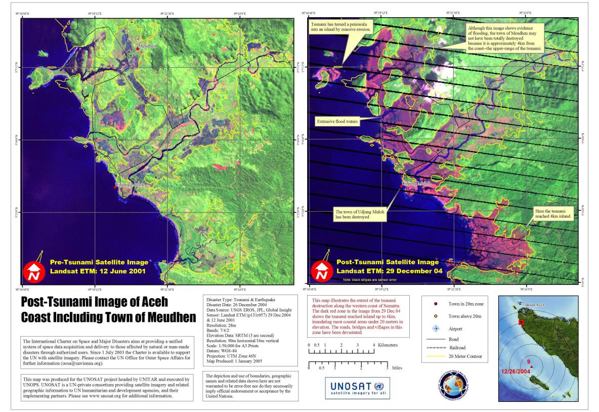
On December 26, 2004, an earthquake of magnitude 9.0 struck off the west coast of Sumatra in the Indonesian Archipelago. This earthquake triggered a devastating tsunami and caused tremors that killed over 104,000 people in Indonesia and over 5,000 in Thailand.Indonesia was the worst affected followed by Sri Lanka, India, Thailand, Somalia, Maldives, Malaysia and Myanmar.
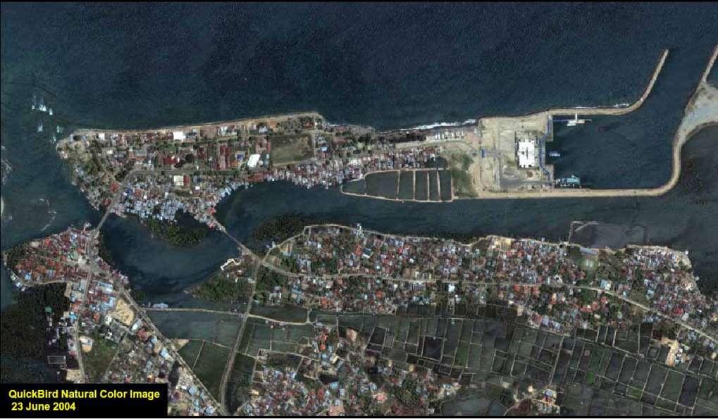
QuickBird Image, 23 June 2004
Source: --
Acquired: --
Copyright: --
Other info: --
Satellite map of Banda Aceh Damage.
Source: GLCF, JPL, Global Insight; SPOT 5.
Acquired: --
Copyright: Map produced 30/12/2004 by UNOSAT.
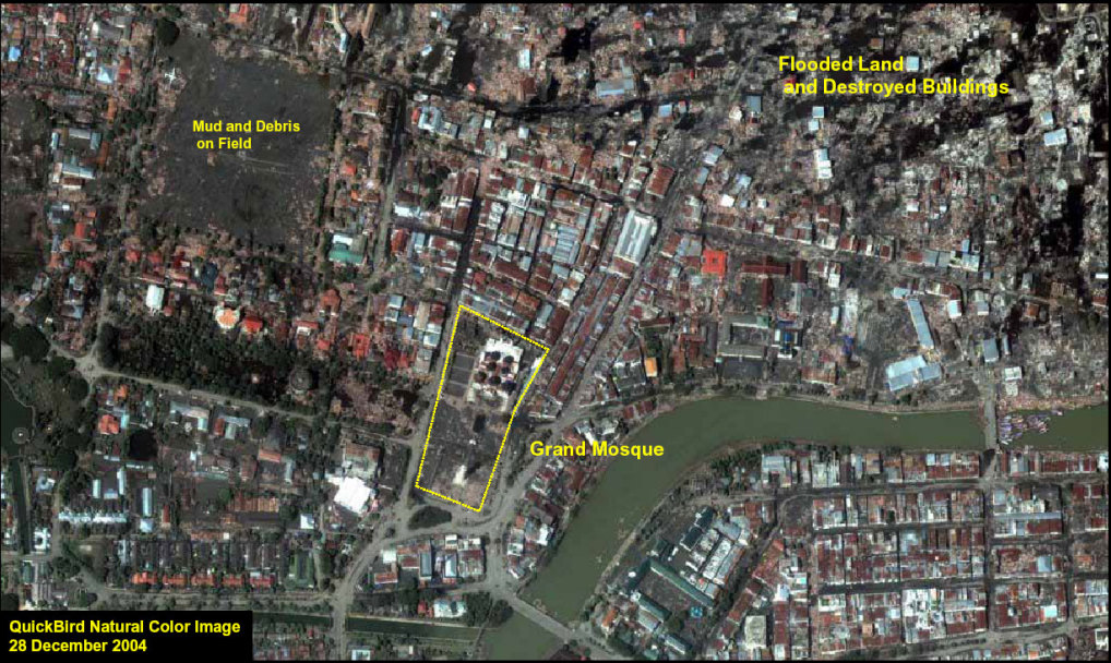
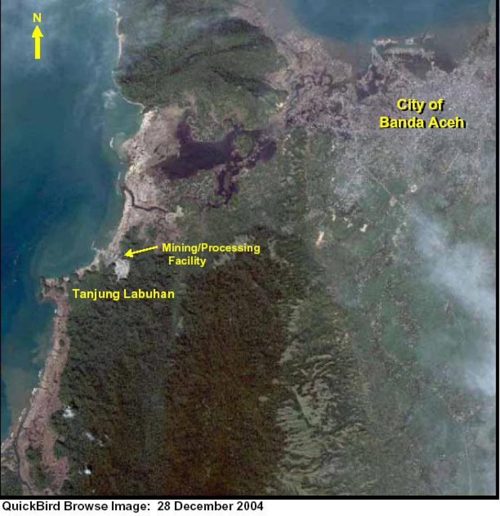
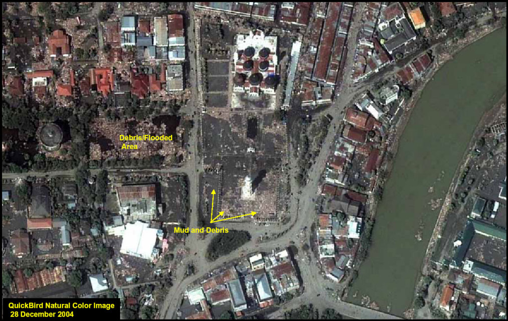
QuickBird Image, 28 December 2004
Source: --
Acquired: --
Copyright: --
Other info: --
QuickBird Image, 6 June 2004
Source: --
Acquired: --
Copyright: ---
Other info: --
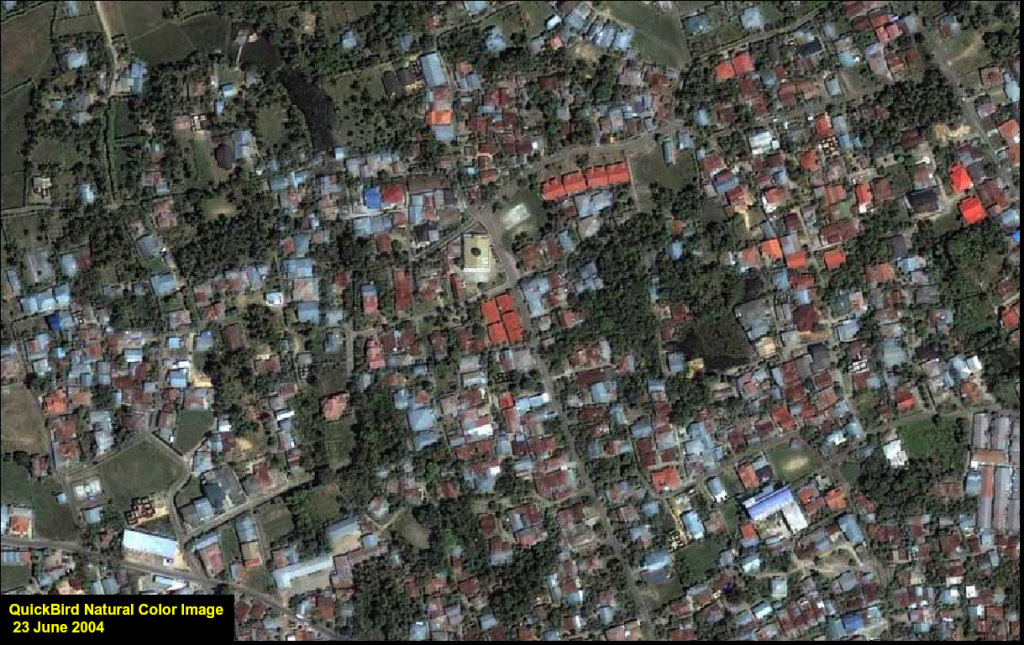
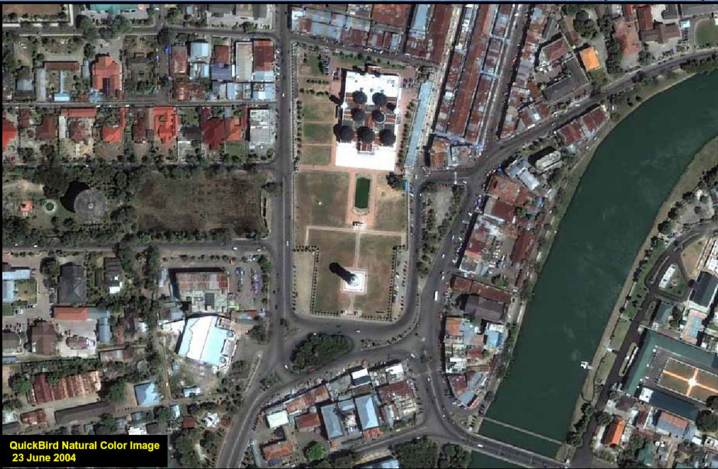
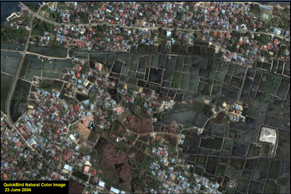
QuickBird Image, 23 June 2004
Source: --
Acquired: --
Copyright: --
Other info: --
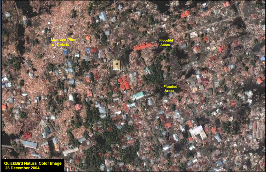
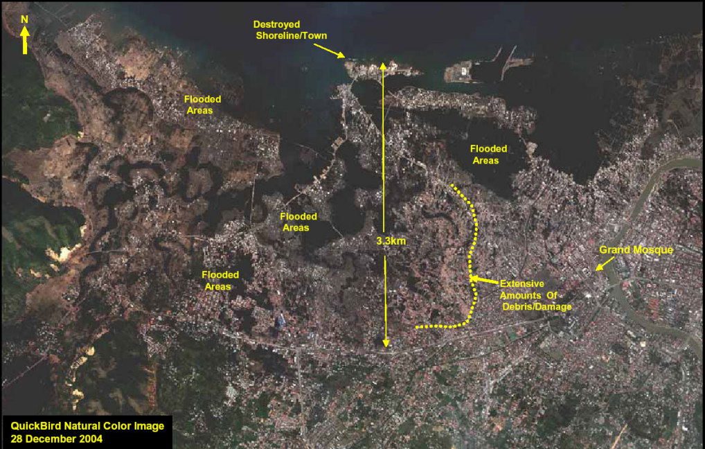
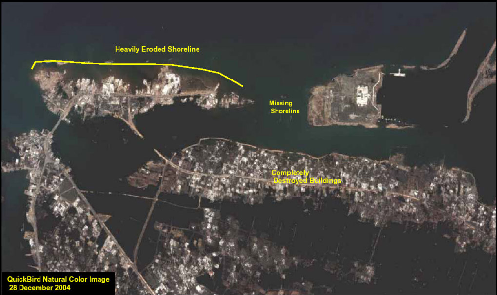
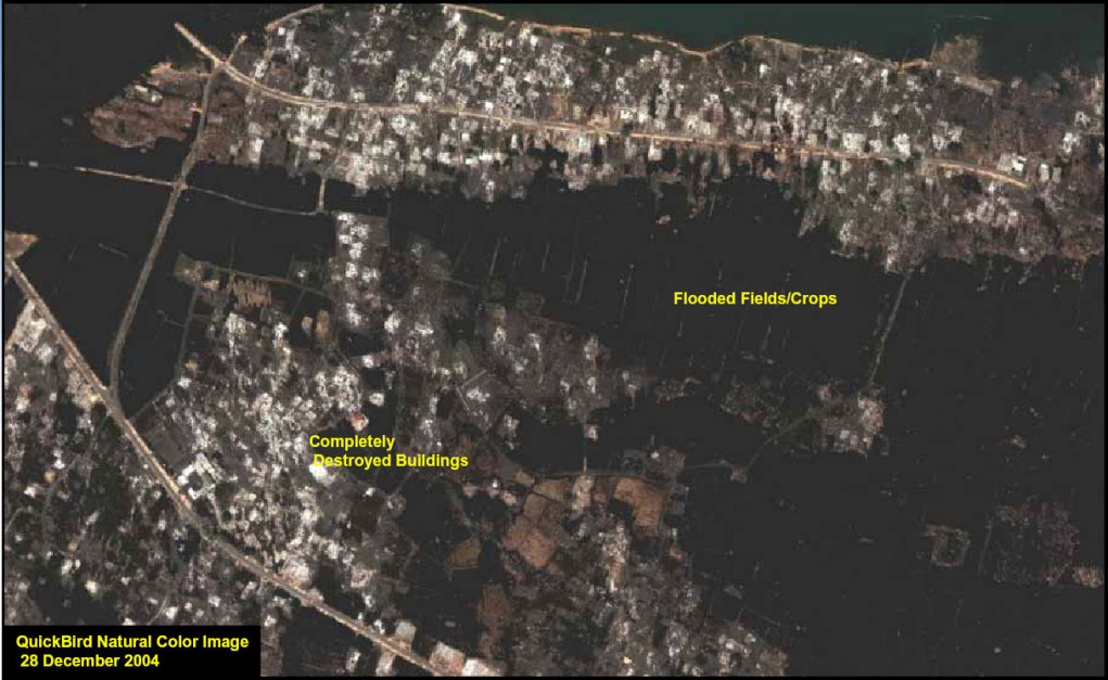
QuickBird Image, 28 December 2004
Source: --
Acquired: --
Copyright: --
Other info: --
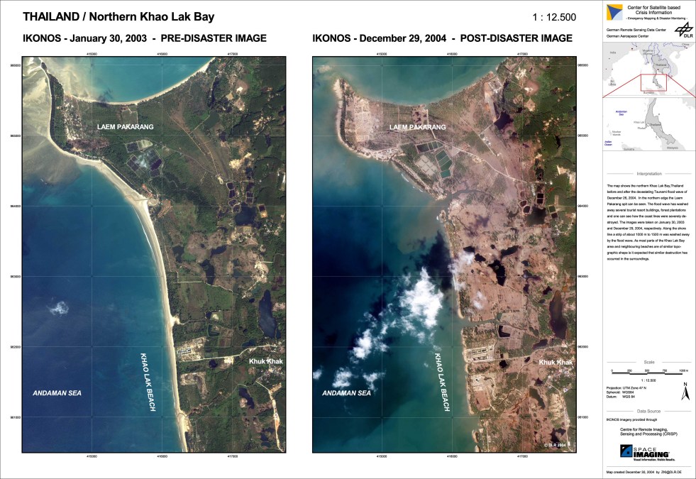
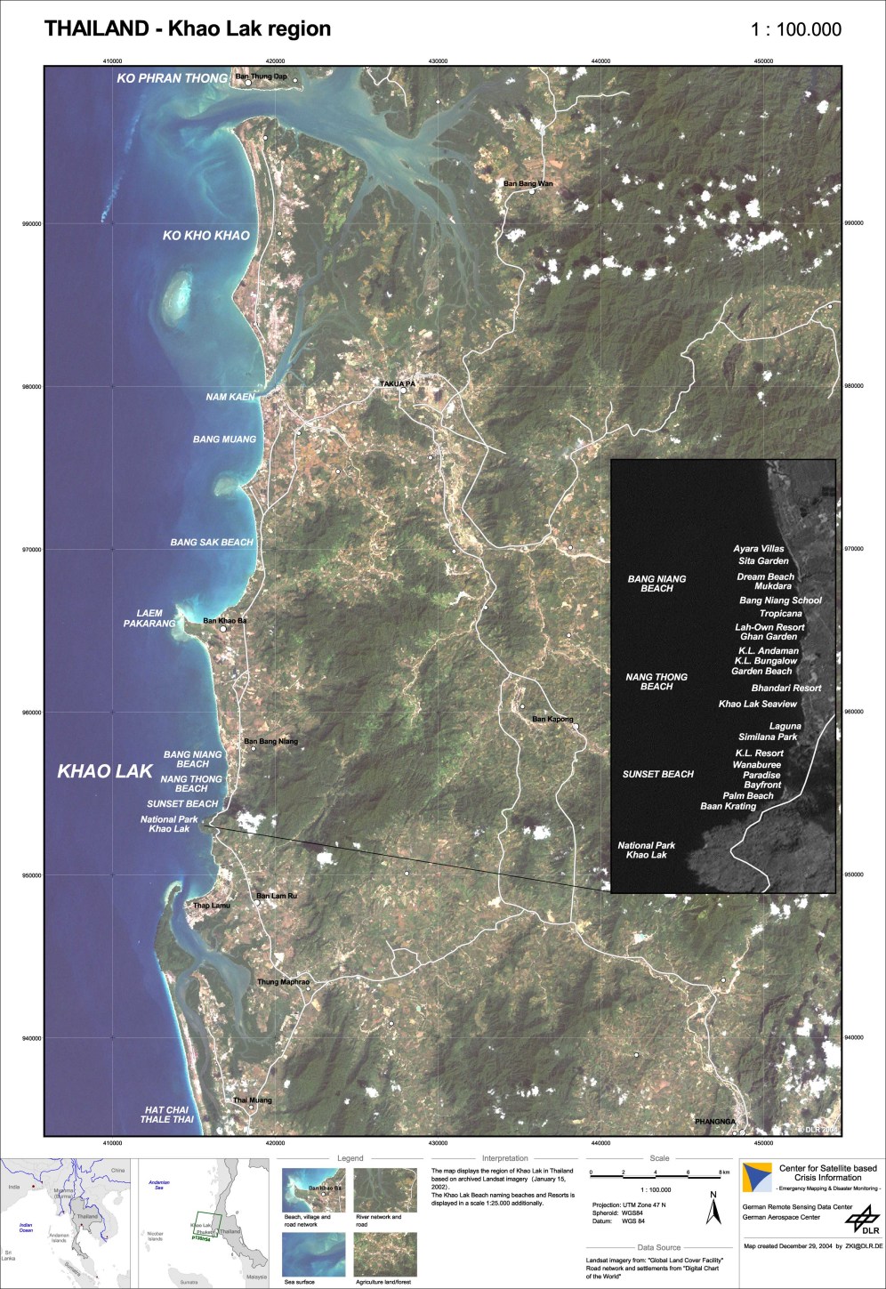
Thailand Khao Lak north
Source: Ikonos images, 30/01/2003 and 29/12/2004, before and after the devastating tsunami.
Acquired: 30/01/2003 and 29/12/2004
Copyright: Remote Sensing Data
Centre, DLR - German Aerospace Center Ikonos imagery provided through
Center for Remote Imaging, Sensing and Processing, Space Imaging.
Scale 1:12.500 Map created 30 December 2004 by zki@dlr.de
Scale 1:12.500 Map created 30 December 2004 by zki@dlr.de
Other info: --
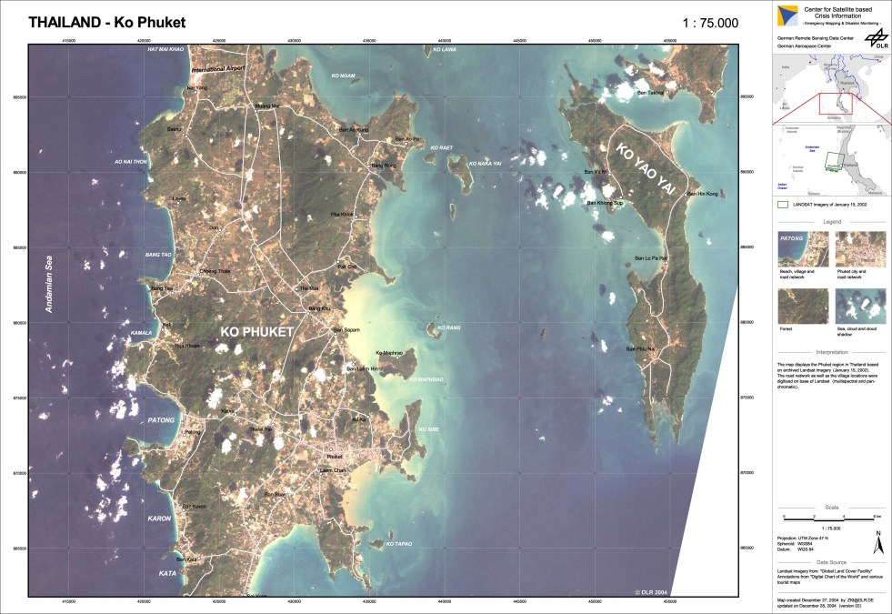
Thailand Phuket
Source: Scale 1:75,000 Landsat imagery, 15/01/2002.
Acquired: 15/01/2002.
Copyright: German Remote Sensing Data Centre, DLR - German Aerospace Center
Map created 30 December 2004 by zki@dlr.de
Map created 30 December 2004 by zki@dlr.de

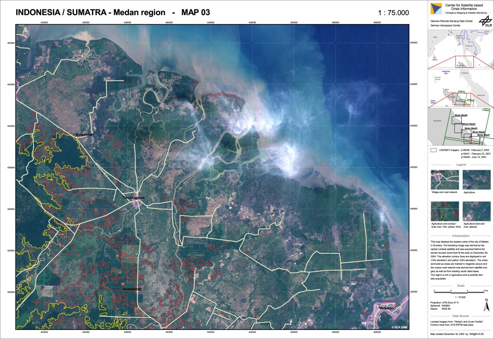
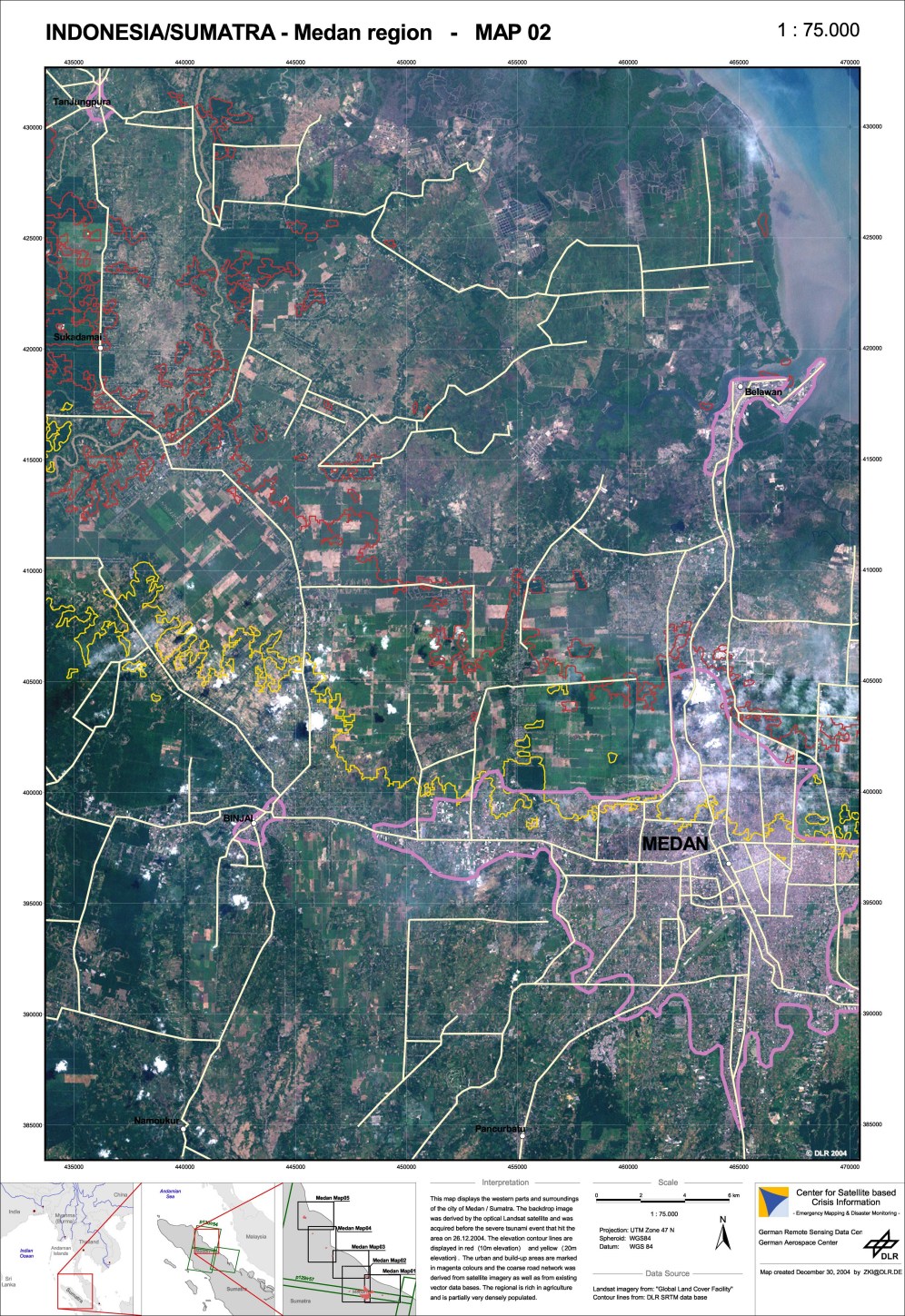
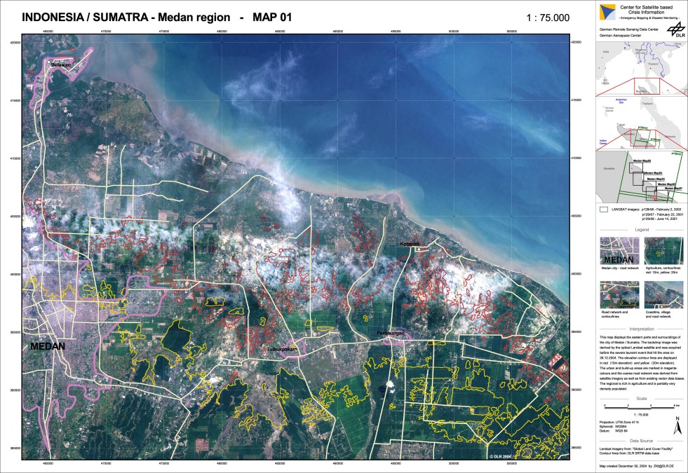
Indonesia, Medan, Scale 1:75,000
Source: Landsat images, 02/02/2002, 22/02/2001, and 14/05/2001.
Acquired: 02/02/2002, 22/02/2001, and 14/05/2001.
Copyright: German Remote Sensing Data Centre, DLR - German Aerospace Center
Map created 30 December 2004 by zki@dlr.de
Map created 30 December 2004 by zki@dlr.de
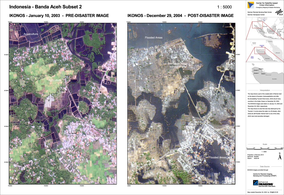
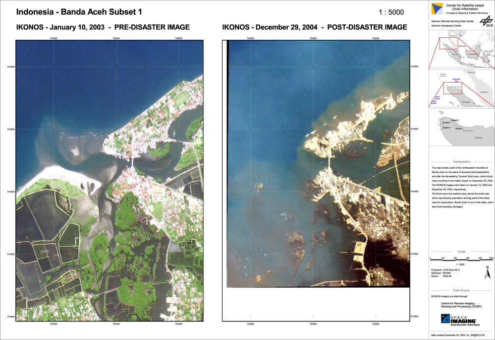
Indonesia Aceh, Scale 1:5000
Source: Ikonos images, 30/01/2003 and 29/12/2004, before and after the devastating tsunami.
Acquired: 30/01/2003 and 29/12/2004
Copyright: German Remote Sensing Data Centre, DLR - German Aerospace Center
Ikonos imagery provided through Center for Remote
Imaging, Sensing and Processing, Space Imaging.
Scale 1:12.500 Map created 30 December 2004 by zki@dlr.de
Scale 1:12.500 Map created 30 December 2004 by zki@dlr.de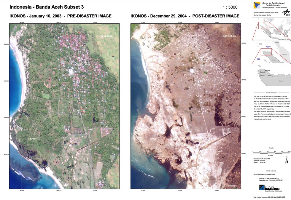
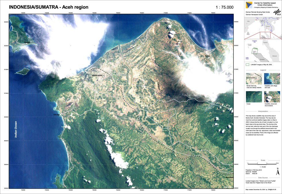
Indonesia aceh, Scale 1:75,000
Source: Landsat imagery, 08/05/2000
Acquired: 08/05/2000
Copyright: German Remote Sensing Data Centre, DLR - German Aerospace Center
Map created 30 December 2004 by zki@dlr.de
Map created 30 December 2004 by zki@dlr.de
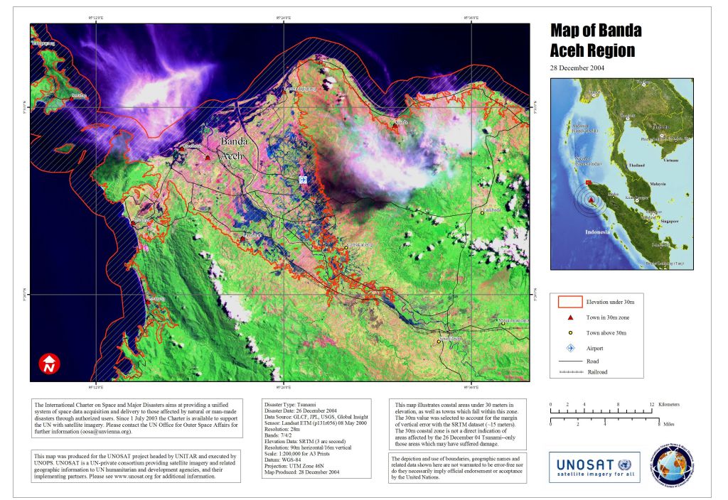
Satellite map of Banda Aceh region, scale: 1:200,000.
Source: GLCF, JPL, Global Insight.
Acquired: 8 Mai 2000
Copyright: Landsat ETM data acquired 8
May 2000, bands 7/4/2, 28 m resolution Elevation data: SRTM (3 arc
seconds). Shows coastal areas under 30 meters elevation.
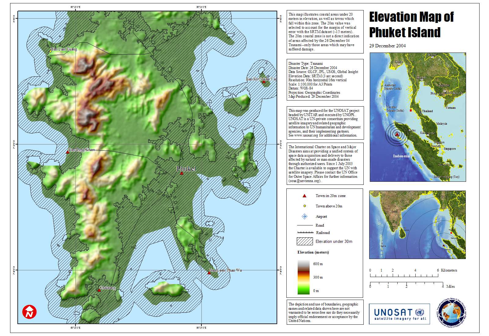
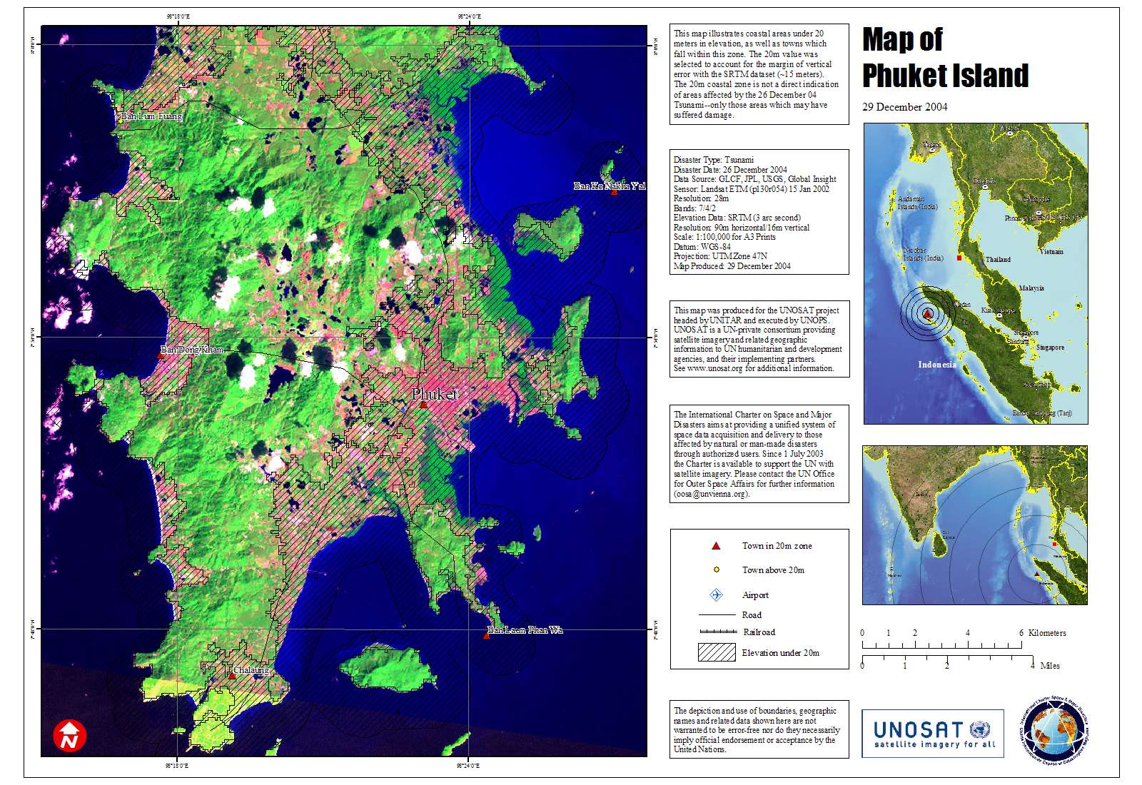
Elevation map of Phuket Island, scale: 1:100,000.
Source: GLCF, JPL, USGS, Global Insight. Elevation data: SRTM (3 arc seconds). Shows coastal areas under 20 meters elevation.
Acquired: --
Copyright: Map produced 29/12/2004 by UNOSAT.
Other info: --
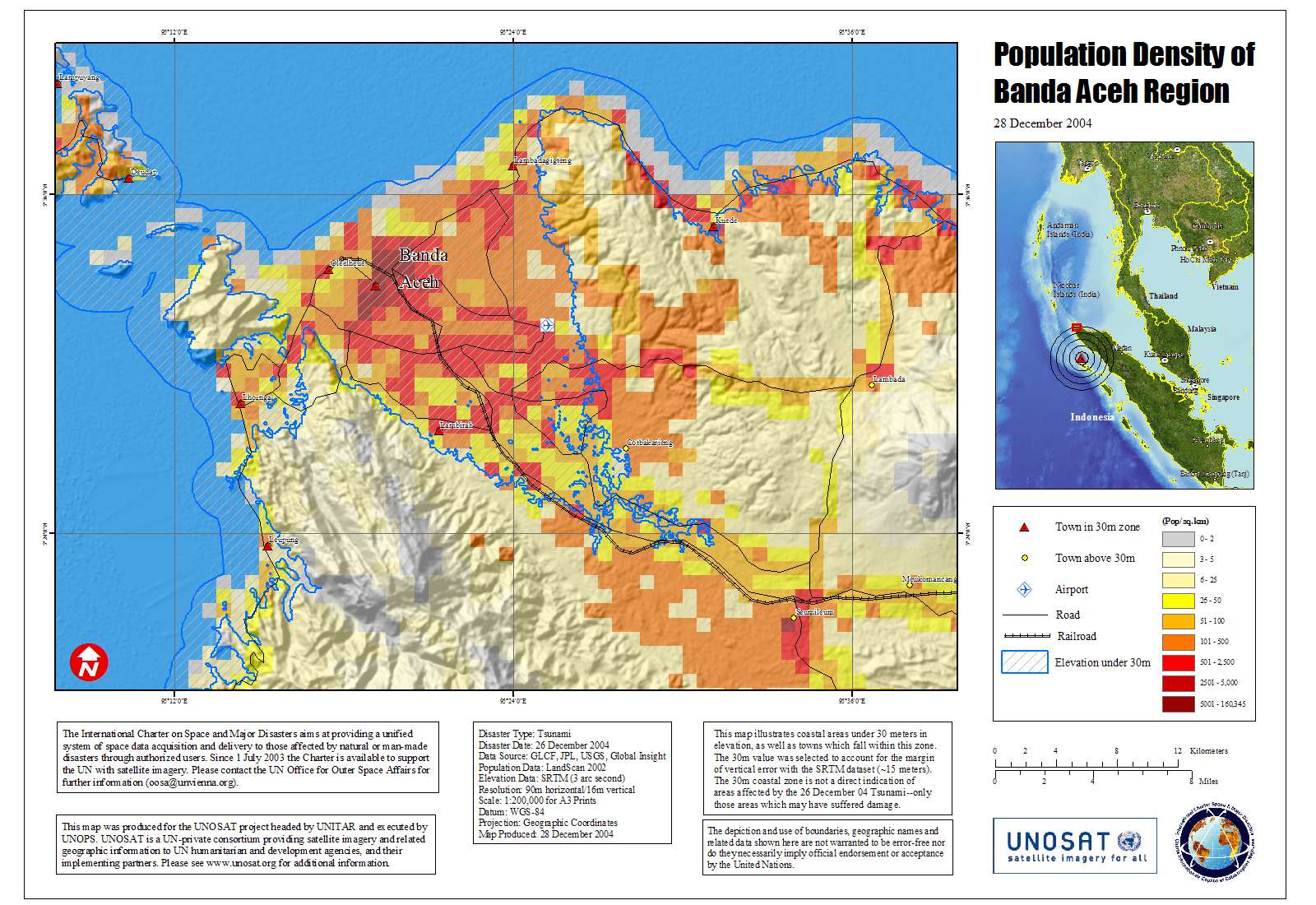
Population density map of Banda Aceh region, scale: 1:200,000.
Source: GLCF, JPL, Global Insight.
Elevation data: SRTM (3 arc seconds). Population data: LandScan 2002.
Shows coastal areas under 30 meters elevation.
Acquired: --
Copyright: Map produced 28/12/2004 by UNOSAT.
Other info: --
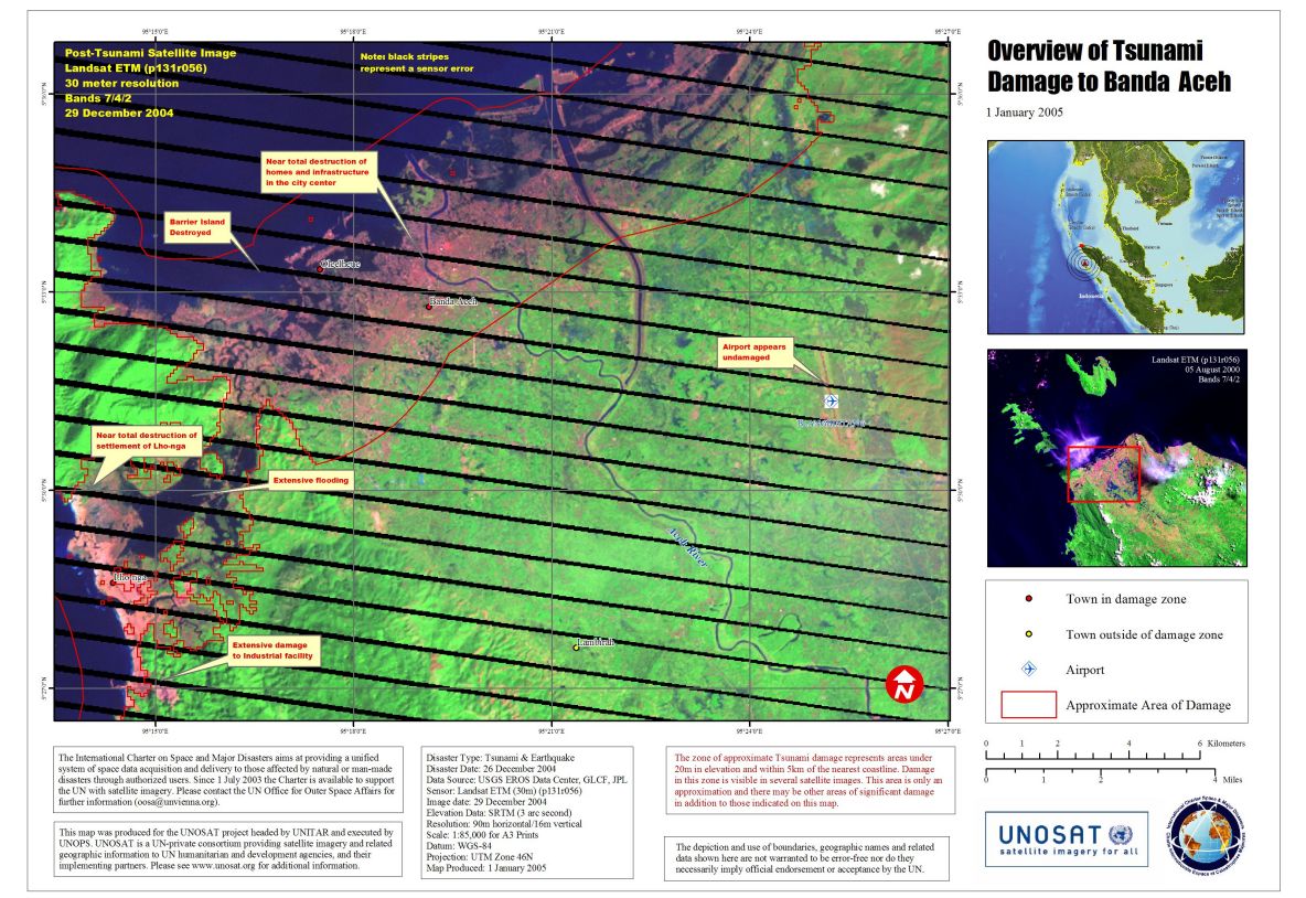
Satellite map of Aceh Etm.
Source: GLCF, JPL, Global Insight; Landsat.
Acquired: --
Copyright: Map produced 01/01/2005 by UNOSAT.
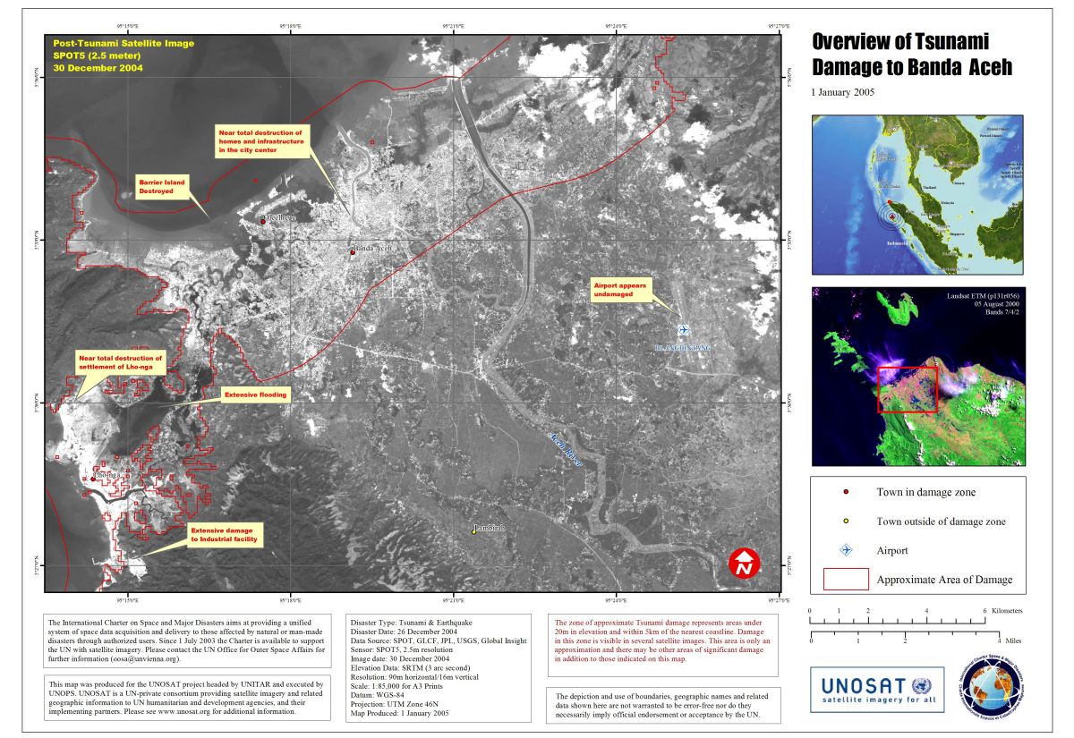
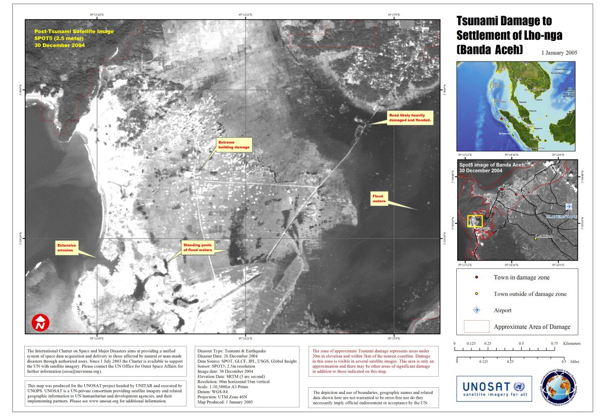
Satellite map of Banda Aceh Damage.
Source: GLCF, JPL, Global Insight; SPOT 5.
Acquired: --
Copyright: Map produced 01/01/2005 by UNOSAT.
Satellite map of Banda Aceh Damage.
Source: GLCF, JPL, Global Insight; SPOT 5.
Acquired: --
Copyright: Map produced 30/12/2004 by UNOSAT.
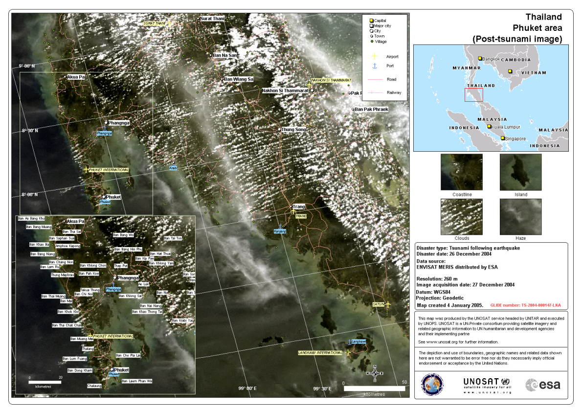
Satellite map of Phuket Envisat MERIS RGB Overview.
Source: ESA; Envisat MERIS.
Acquired: 27 December 2004
Copyright: Map produced 04/01/2005 by UNOSAT.
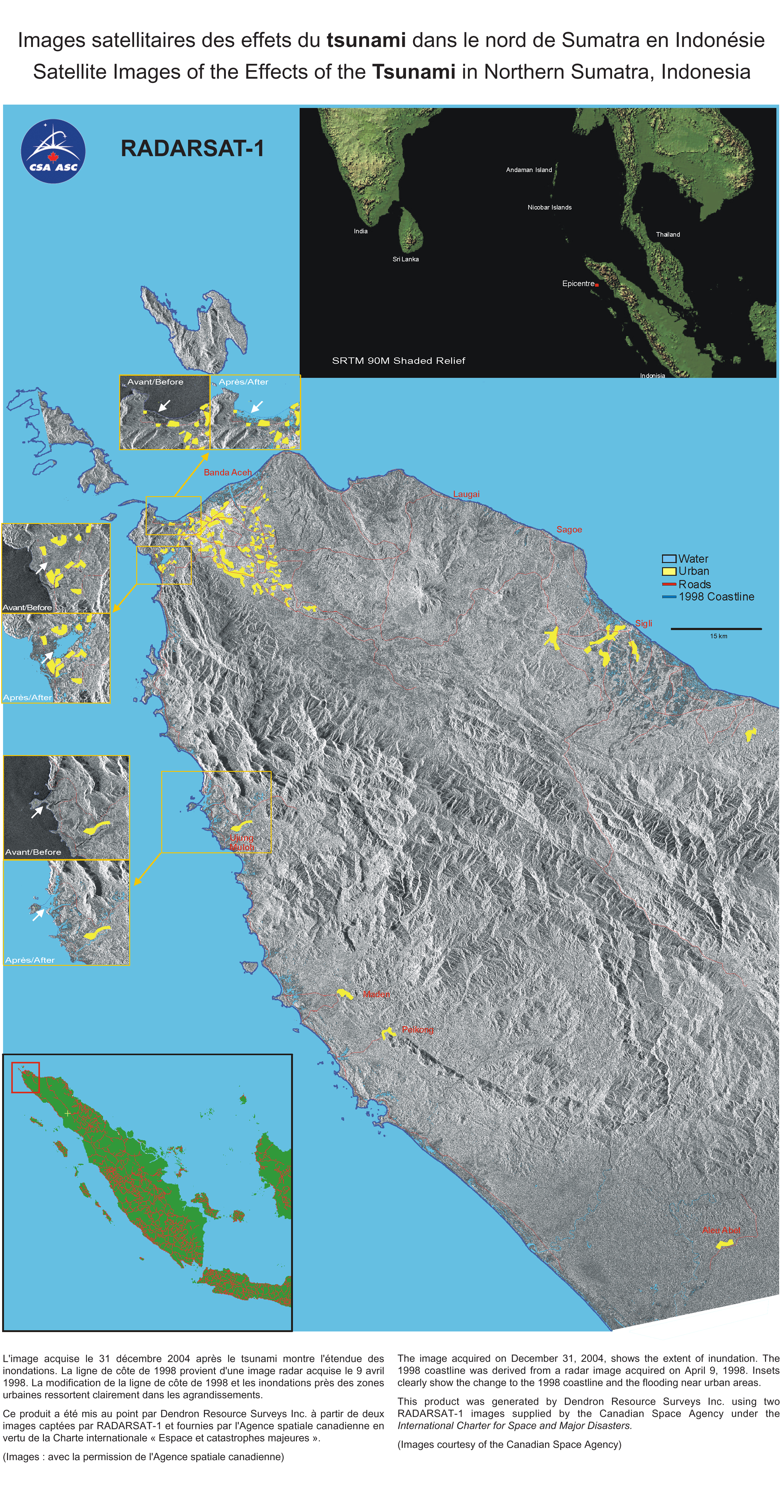
Dendron Poster: Sumatra.
Source: --
Acquired: --
Copyright: --
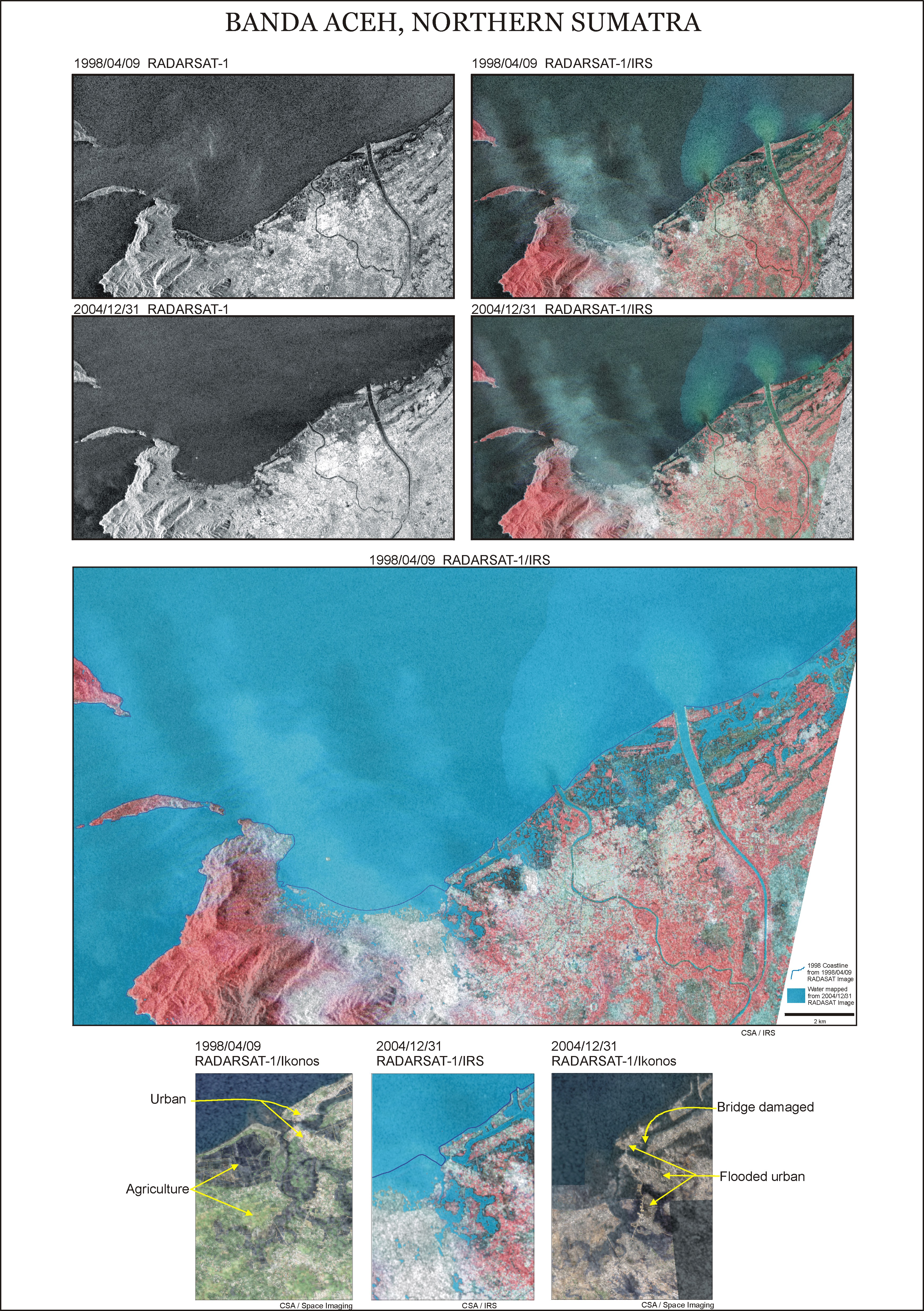
Dendron Poster: Banda Aceh.
Source: --
Acquired: --
Copyright: --
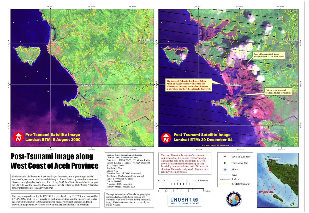
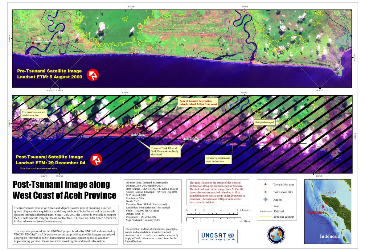
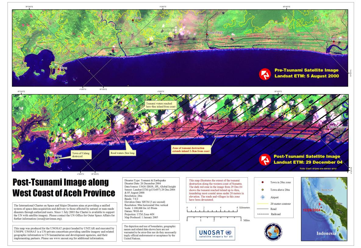
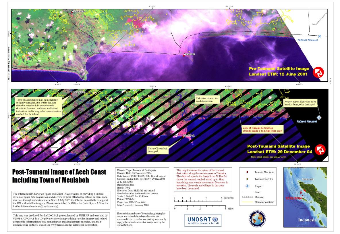
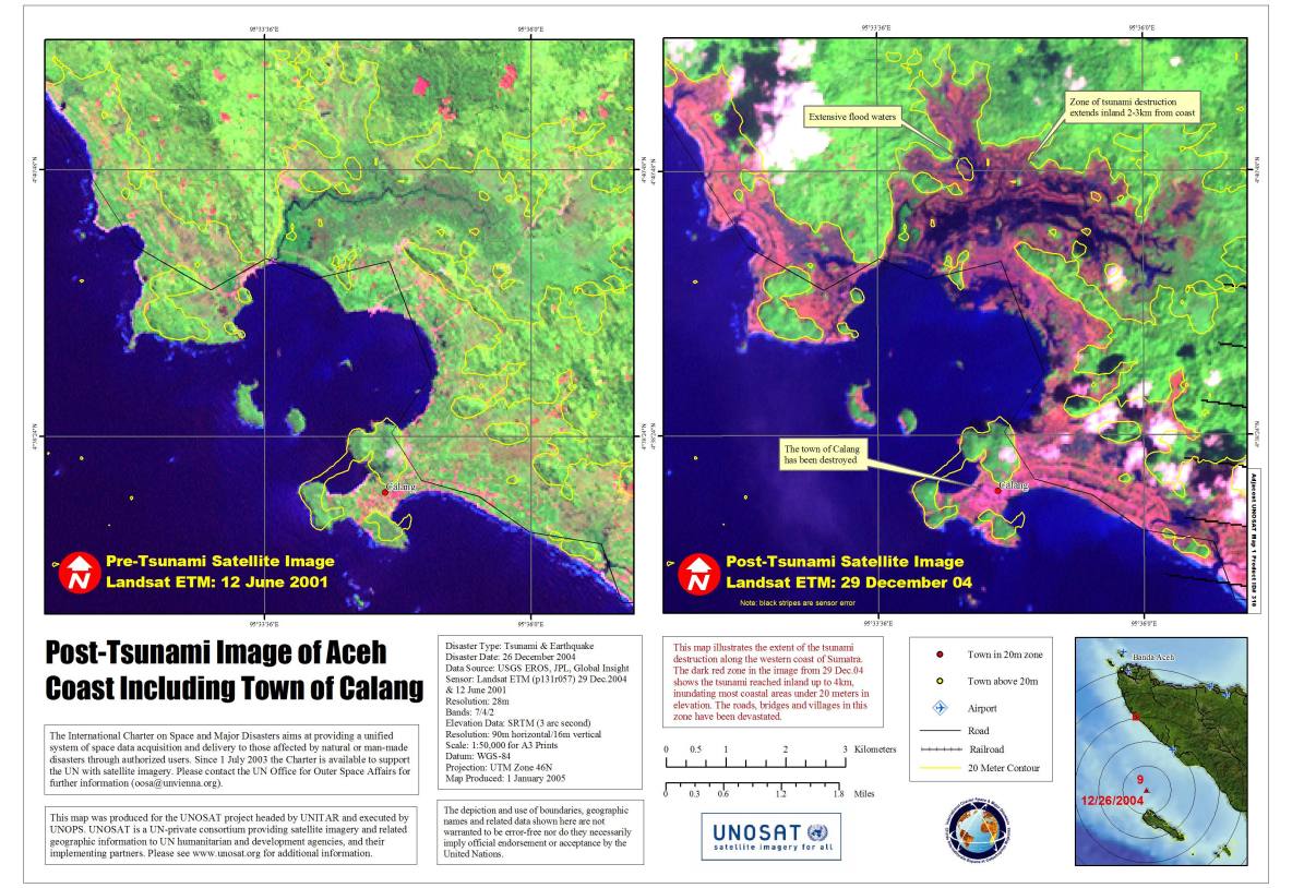
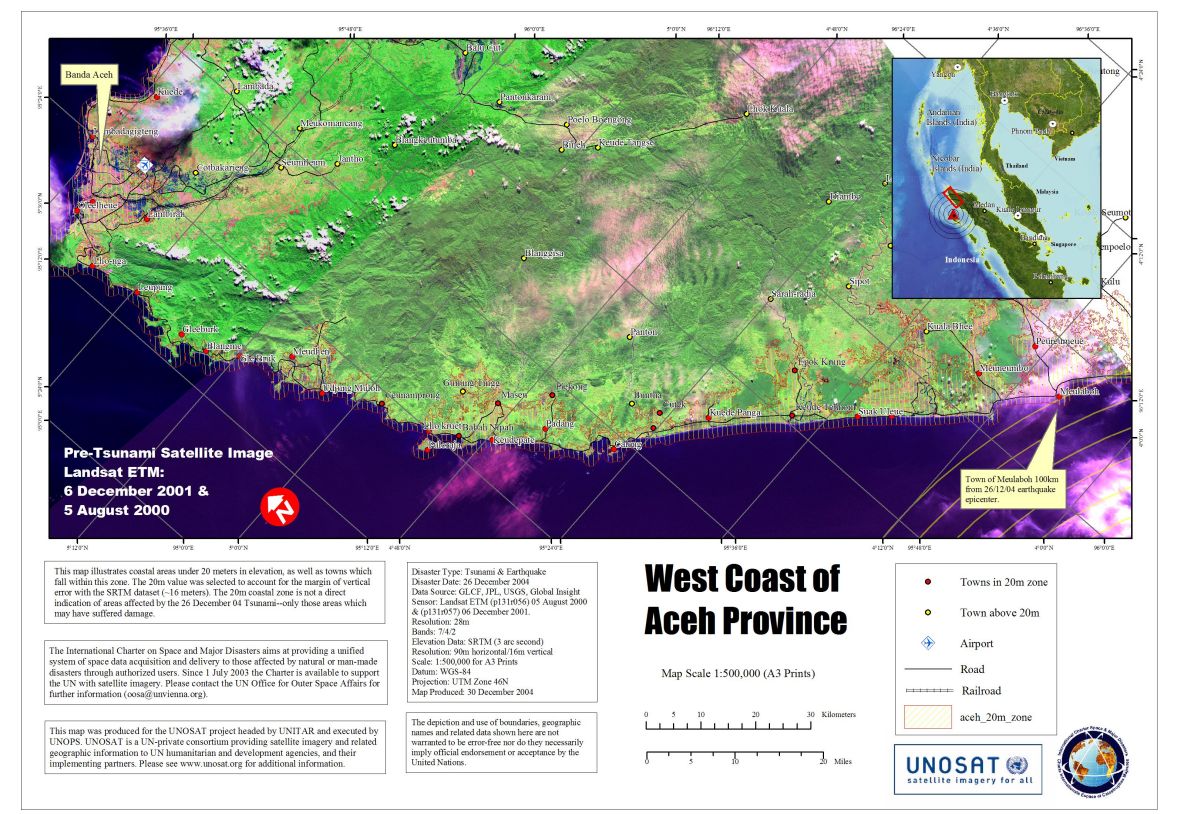
Satellite map of Aceh Coast Landsat ETM.
Source: GLCF, JPL, Global Insight; Landsat.
Acquired: --
Copyright: Map produced 01/01/2005 by UNOSAT
Satellite map of Aceh Coast Landsat ETM.
Source: GLCF, JPL, Global Insight; Landsat.
Acquired: --
Copyright: Map produced 01/01/2005 by UNOSAT.
Satellite map of Phuket Island, scale: 1:100,000.
Source: GLCF, JPL, Global Insight.
Landsat ETM data acquired 8 Jan 2002, bands 7/4/2, 28 m resolution
Elevation data: SRTM (3 arc seconds). Shows coastal areas under 20
meters elevation.
Acquired: 8 Jan 2002
Copyright: Map produced 29/12/2004 by UNOSAT.
Other info: --
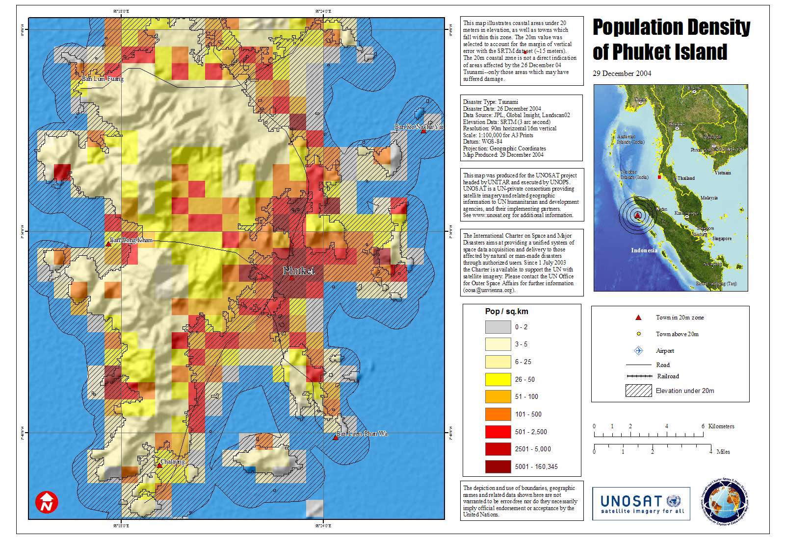
Population density map of Island, scale: 1:100,000.
Source: GLCF, JPL, Global Insight.
Elevation data: SRTM (3 arc seconds). Population data: LandScan 2002.
Shows coastal areas under 20 meters elevation.
Acquired: --
Copyright: Map produced 29/12/2004 by UNOSAT.
Other info: --
Satellite map of Aceh Coast Landsat ETM.
Source: GLCF, JPL, Global Insight; Landsat.
Acquired: --
Copyright: Map produced 01/01/2005 by UNOSAT
Other info: --
Satellite map of Banda-aceh ETM
Source: GLCF, JPL, Global Insight; Landsat.
Acquired: --
Copyright: Map produced 01/01/2005 by UNOSAT
Satellite map of Aceh Coast Landsat ETM.
Source: GLCF, JPL, Global Insight; Landsat.
Acquired: --
Copyright: Map produced 01/01/2005 by UNOSAT
Satellite map of Aceh Coast Landsat ETM
Source: GLCF, JPL, Global Insight; Landsat.
Acquired: --
Copyright: Map produced 01/01/2005 by UNOSAT.
Satellite map of Aceh Coast Landsat ETM.
Source: GLCF, JPL, Global Insight; Landsat.
Acquired: --
Copyright: Map produced 01/01/2005 by UNOSAT.
Satellite map of Aceh Coast.
Source: GLCF, JPL, Global Insight; Landsat.
Acquired: --
Copyright: Map produced 01/01/2005 by UNOSAT.
Satellite map of Aceh Elevation at 200 dpi.
Source: GLCF, JPL, Global Insight; Landsat.
Acquired: --
Copyright: Map produced 01/01/2005 by UNOSAT.
Indonesia Aceh
Source: Scale 1:5000 Ikonos images, 30/01/2003 and 29/12/2004, before and after the devastating tsunami. Scale 1:12.500
Acquired: 30/01/2003 and 29/12/2004
Copyright: German Remote Sensing Data
Centre, DLR - German Aerospace Center Ikonos imagery provided through
Center for Remote Imaging, Sensing and Processing, Space Imaging.
Map created 30 December 2004 by zki@dlr.de
Map created 30 December 2004 by zki@dlr.de
QuickBird Image, 28 December 2004
Source: --
Acquired: --
Copyright: --
Other info: --

Indonesia Aceh, Scale 1:5000, before and after the devastating tsunami.
Source: Ikonos
Acquired: 30/01/2003 and 29/12/2004
Copyright: Map created 30 December 2004 by zki@dlr.de
German Remote Sensing Data Centre, DLR - German Aerospace Center
Ikonos imagery provided through Center for Remote Imaging, Sensing and Processing, Space Imaging.
Medan, Scale 1:75,000
Source: Landsat imagery, archived data.
Copyright: German Remote Sensing Data Centre, DLR - German Aerospace Center
Map created 30 December 2004 by zki@dlr.de
Map created 30 December 2004 by zki@dlr.de
QuickBird Coverage, 28 December 2004
Source: --
Acquired: --
Copyright: --
Other info: --
QuickBird Image, 28 December 2004
Source: --
Acquired: --
Copyright: --
Other info: --
QuickBird Image, 28 December 2004
Source: --
Acquired: --
Copyright: --
Other info: --
Medan, Scale 1:75,000
Source: Ikonos images, 30/01/2003 and 29/12/2004, before and after the devastating tsunami.
Acquired: 30/01/2003 and 29/12/2004
Copyright: German Remote Sensing Data Centre, DLR - German Aerospace Center
Ikonos imagery provided through Center for Remote
Imaging, Sensing and Processing, Space Imaging.
Scale 1:12.500 Map created 30 December 2004 by zki@dlr.de
Scale 1:12.500 Map created 30 December 2004 by zki@dlr.de
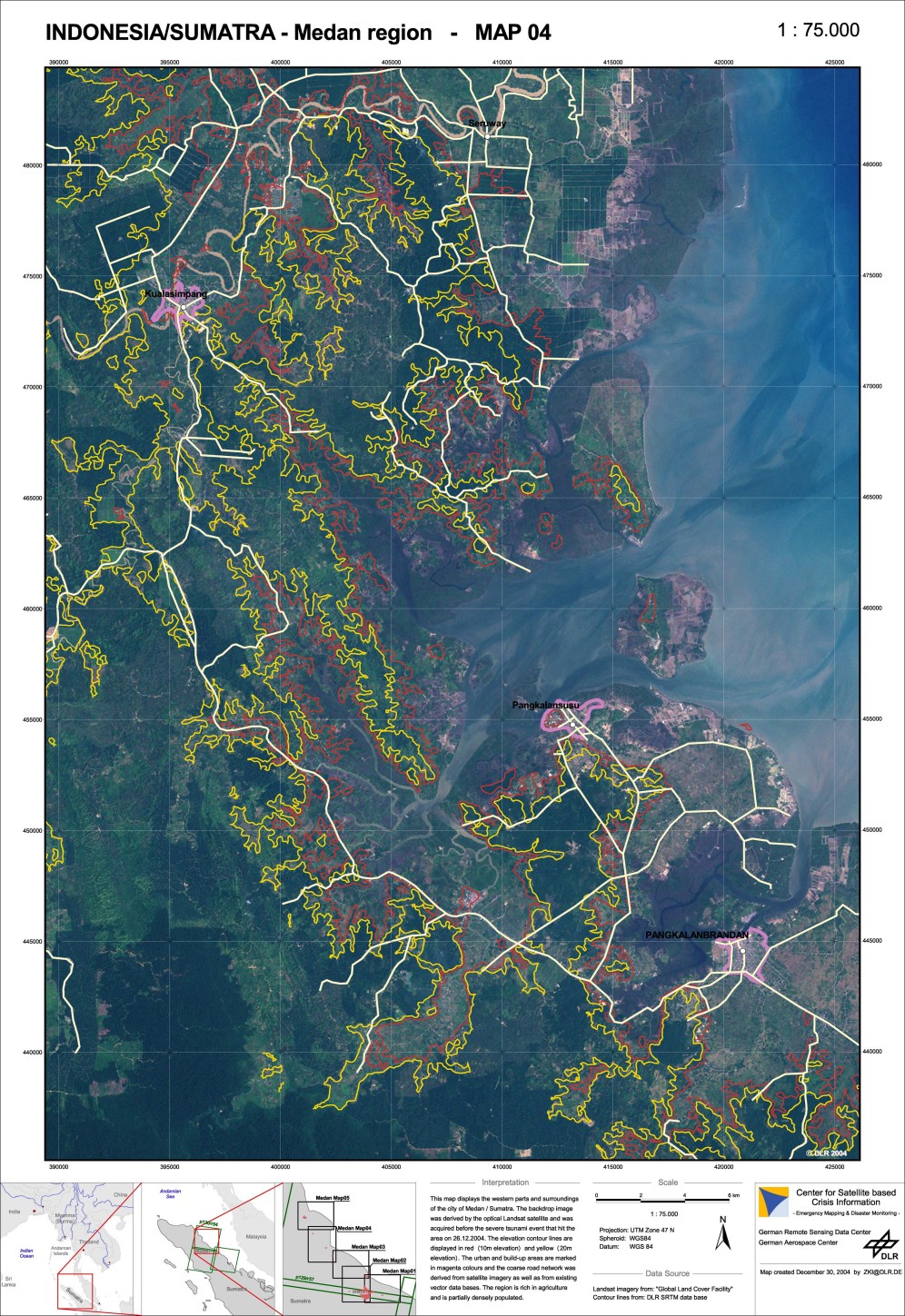
Medan Region, Scale 1:75,000
Source: Landsat imagery, DLR SRTM elevation data.
Copyright: German Remote Sensing Data Centre, DLR - German Aerospace Center
Map created 30 December 2004 by zki@dlr.de
Map created 30 December 2004 by zki@dlr.de
QuickBird Image, 28 December 2004
Source: --
Acquired: --
Copyright: --
Other info: --
QuickBird Image, 23 June 2004
Source: --
Acquired: --
Copyright: --
Other info: --
QuickBird Image, 28 December 2004
Source: --
Acquired: --
Copyright: --
Other info: --

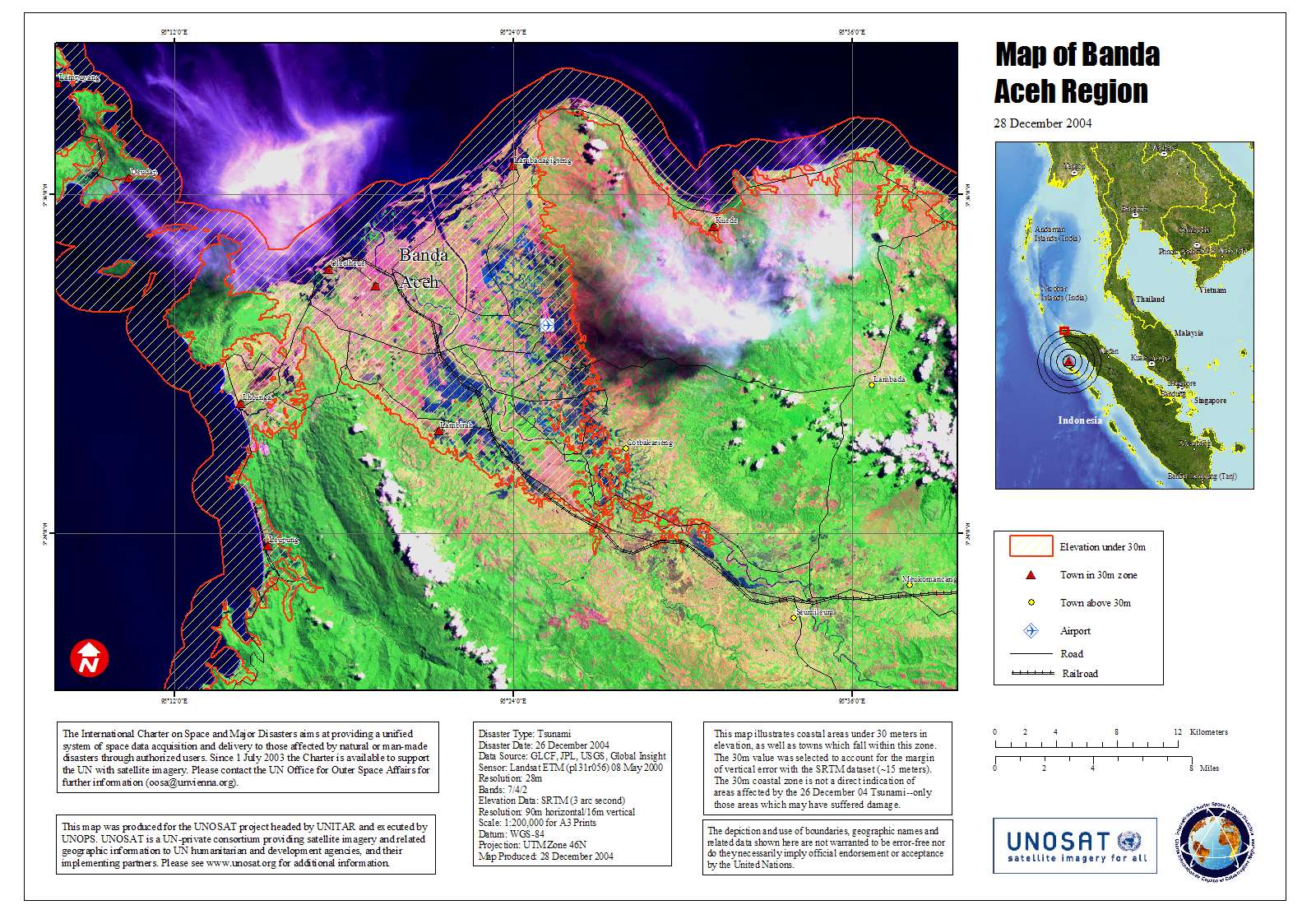
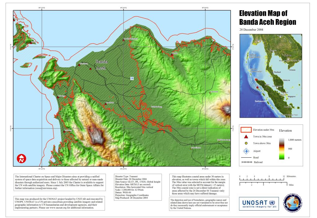
Elevation map of Banda Aceh region, scale: 1:200,000.
Source: GLCF, JPL, Global Insight. Elevation data: SRTM (3 arc seconds). Shows coastal areas under 30 meters elevation.
Acquired: --
Copyright: Map produced 28/12/2004 by UNOSAT.
Thailand Khao Lak
Source: Scale 1:100,000 Landsat imagery, 15/01/2002.
Acquired: 15/01/2002.
Copyright: German Remote Sensing Data Centre, DLR - German Aerospace Center
Map created 30 December 2004 by zki@dlr.de
Map created 30 December 2004 by zki@dlr.de
Medan, Scale 1:75,000
Source: Landsat
Acquired: 02/02/2002, 22/02/2001, 14/05/2001
Copyright: Map created 30 December 2004 by zki@dlr.de German Remote Sensing Data Centre, DLR - German Aerospace Center
- BandaAceh_2.avi - 40 MB
- Side-by-side: BandaAceh_Double_v3_Indeo5.avi - 143 MB
- BandaAceh_Simple_v3_Indeo5.avi - 107 MB
- BandaAceh_QI_2.avi - 98 MB
- Full flyby: BandaAceh_v5.avi - 28 MB
- Full flyby: banda-aceh_coast_sertit.avi - 60 MB
-
Powerpoint presentation with three embedded video sequences: movies-ppt_banda-aceh.zip - 41 MB
(Indeo codec not required)
##############
Earthquake, Tsunami in Southern Asia
https://www.disasterscharter.org/web/guest/-/earthquake-tsunami-in-southern-as-6
Sunday, 26 December 2004
Type of Event:
Earthquake, tsunami
Location of Event:
India; Sri Lanka, Thailand, Indonesia, Maldives, Malaysia, Myanmar (Burma)
Date of Charter Activation:
26/12/2004
Charter Requestor:
Project Management:
ISRO, NRSA; UNOOSA, CNES
Description of the event
A high-magnitude earthquake, 9.0 on the Richter scale, struck southern Asia at 00:58 UTC, 6:58 AM local time. The epicentre was 320 km west of Medan, just off the west coast of the Indonesian island of Sumatra. The earthquake was followed by tsunamis that killed nearly a quarter of a million people, mostly in Indonesia, Sri Lanka, and India. The coastal regions of India, Sri Lanka, Thailand, Indonesia, Maldives, Malaysia, and Myanmar were all severely affected. Bangladesh, the Seychelles, Somalia, Kenya, and Tanzania also suffered damage and loss of life.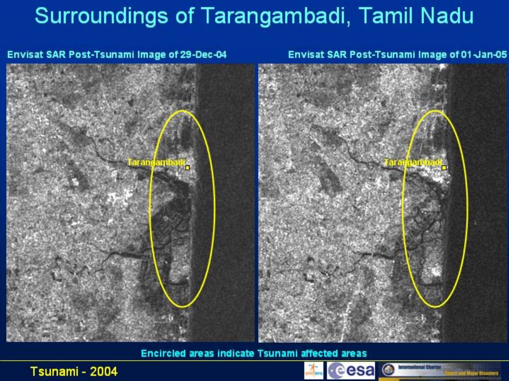
Before and after tsunami satellite images, Tarangambadi Surroundings Tamil Nadu
Source: Envisat SAR data, 29/12/04 and 01/01/05
Acquired: 01/01/05
Copyright: Courtesy National Remote Sensing Agency, Govt. of India
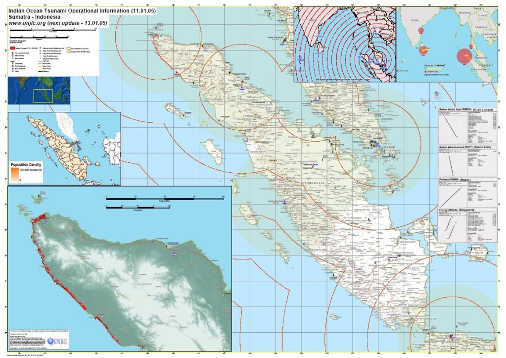
Regional Topographic map, with affected areas, population density and digital elevation model.
Source: UNJLC
Topographic map of Sumatra, with affected areas,
population density and digital elevation model.
Source: UNJLC.
Carte topographique régionale, montrant des zones touchées,
densité de la population et modèle numérique du terrain.
Source: Centre de logistique des Nations Unies.
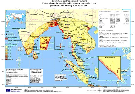
Potential population affected by Tsunami over the whole area.
Source: European Commission, Joint Research Institute.
Copyright: Population density data from Landscan 2002
Elevation data from SRTM (NASA)
Regional map of countries most affected by the Tsunami. Show zones under
30 meters elevation.
Source: UNOSAT, USGS, NASA
(SRTM30/ETOPO2/MODIS), Global Insight.
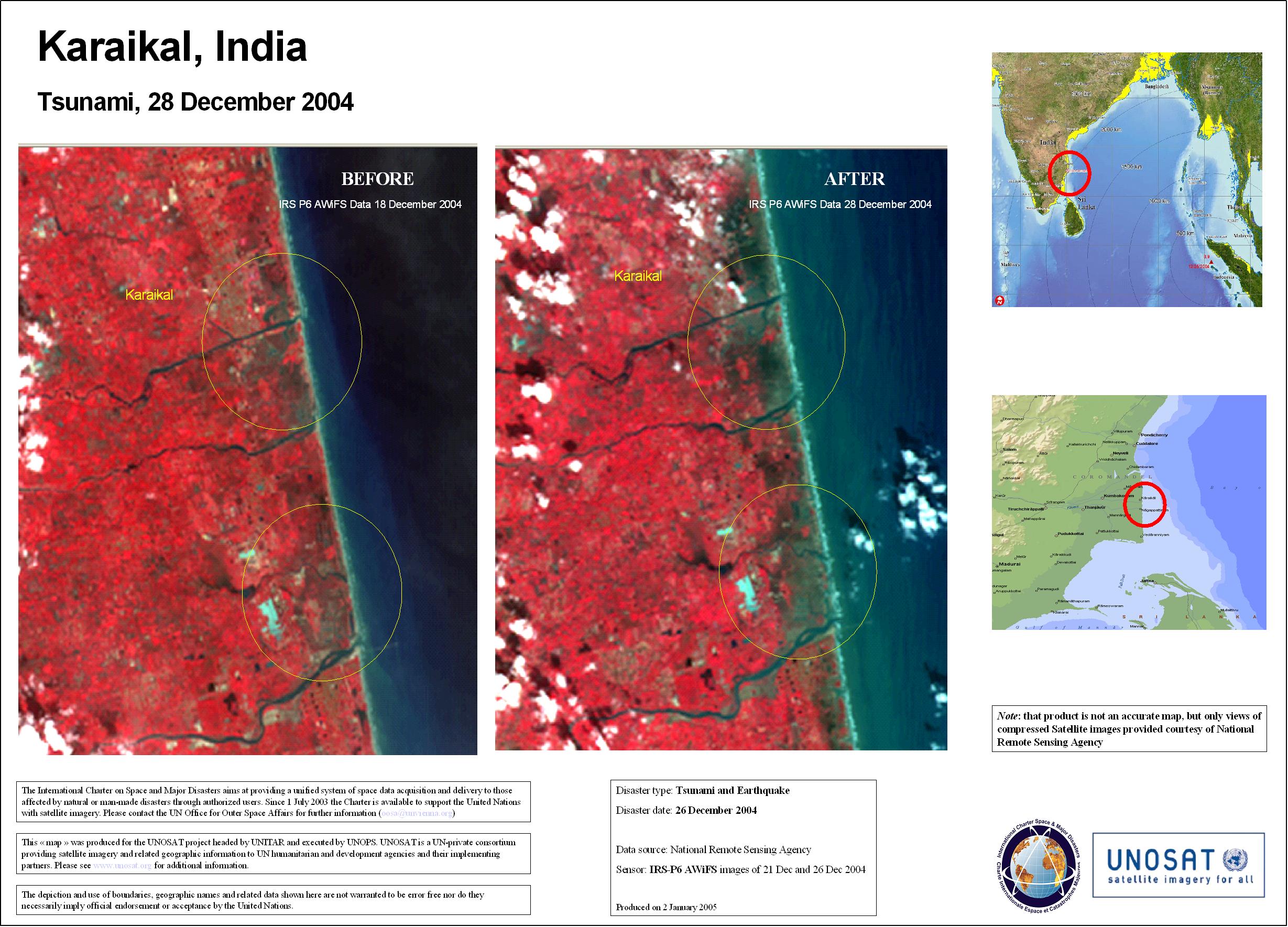
Post-tsunami satellite map, IRS Before After Tsunami Karaikal India
Source: IRS-P6 AWiFS data
Acquired: 02/01/2005
Copyright: Map produced 02/01/2005 by UNOSAT
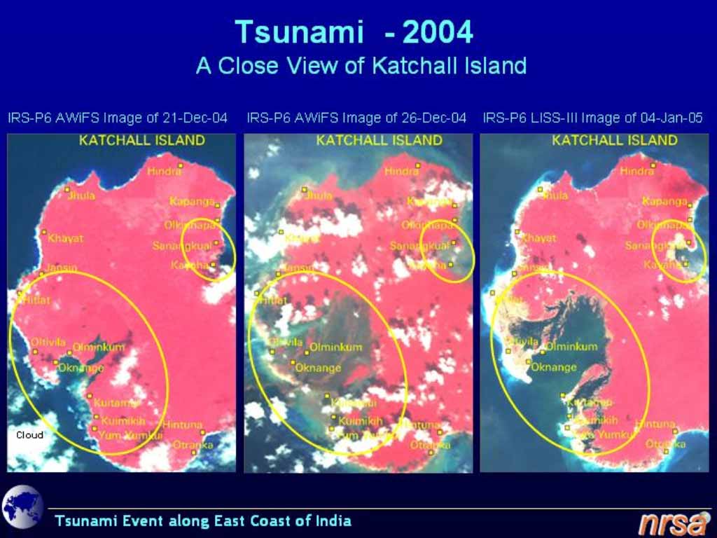
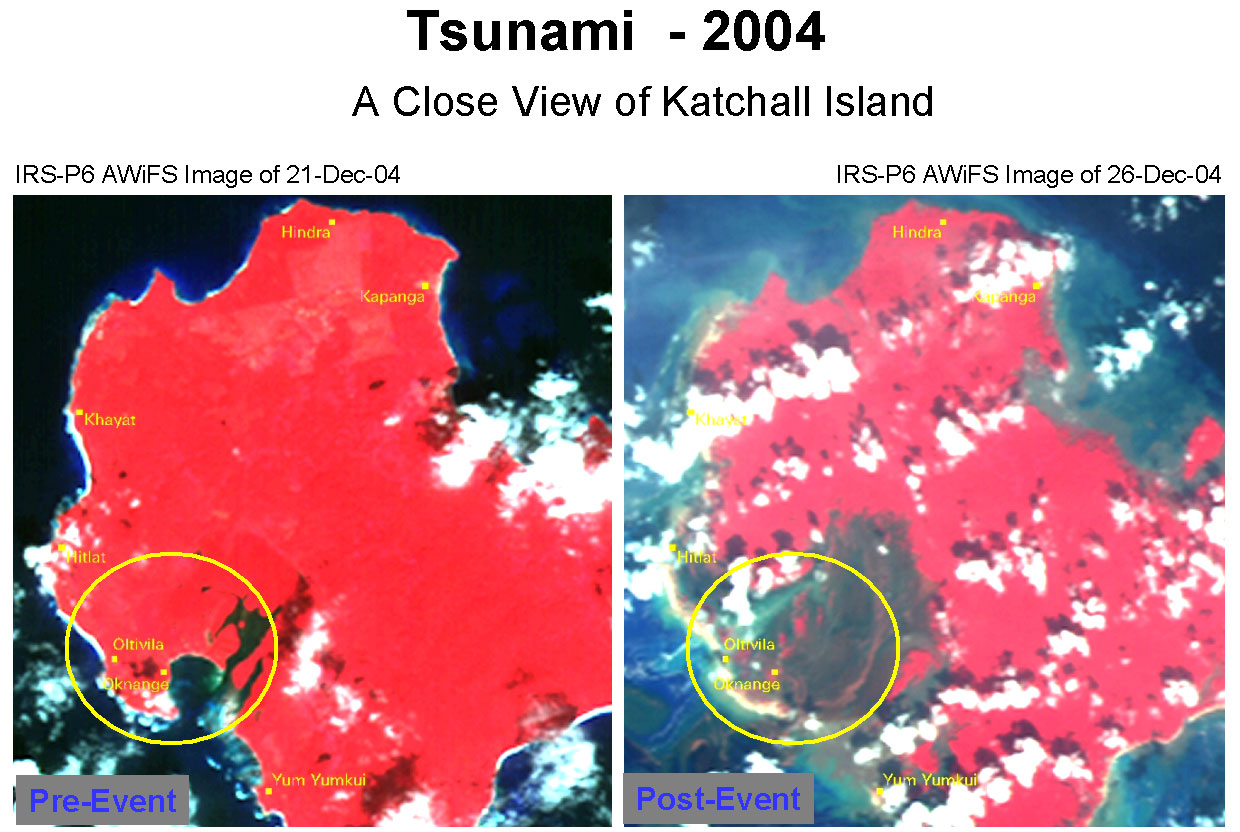
Before and after tsunami satellite images, Katchall
Source: IRS-P6 AWiFS data, 21/12/04, 26/12/04, and IRS-P6 LISS-III data, 04/01/05
Acquired: 21/12/04, 26/12/04, 04/01/05
Copyright: Courtesy National Remote Sensing Agency, Govt. of India
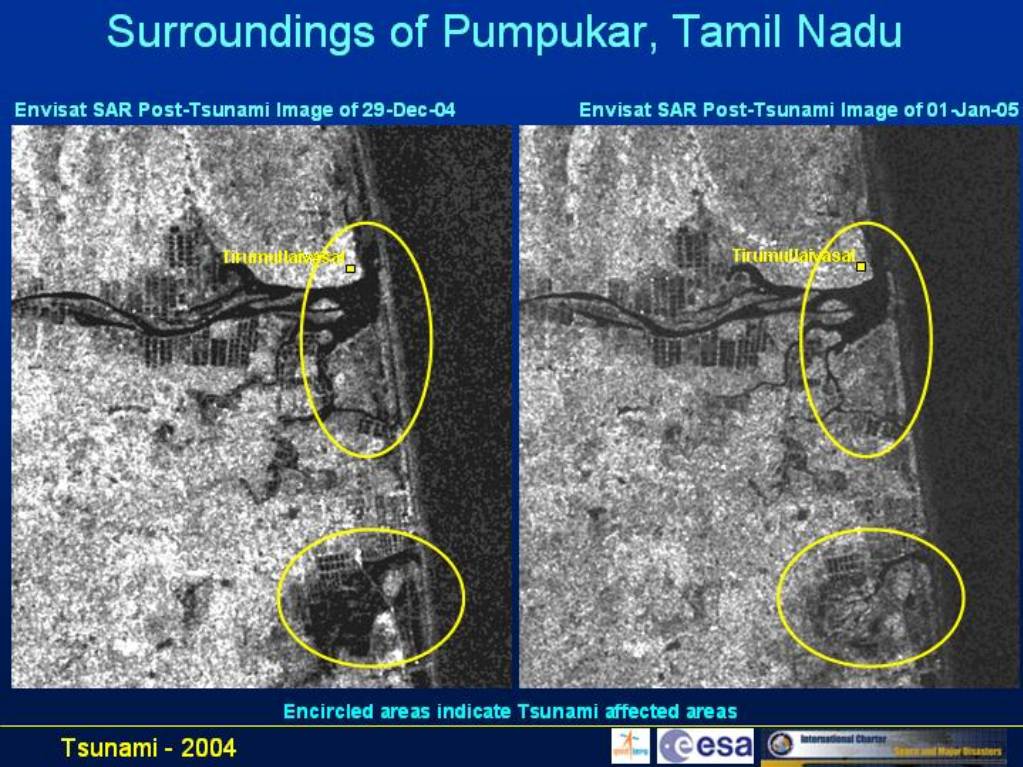
Before and after tsunami satellite images, Pumpukar Surroundings Tamil Nadu
Source: Envisat SAR data, 29/12/04 and 01/01/05
Acquired: 01/01/05
Copyright: Courtesy National Remote Sensing Agency, Govt. of India
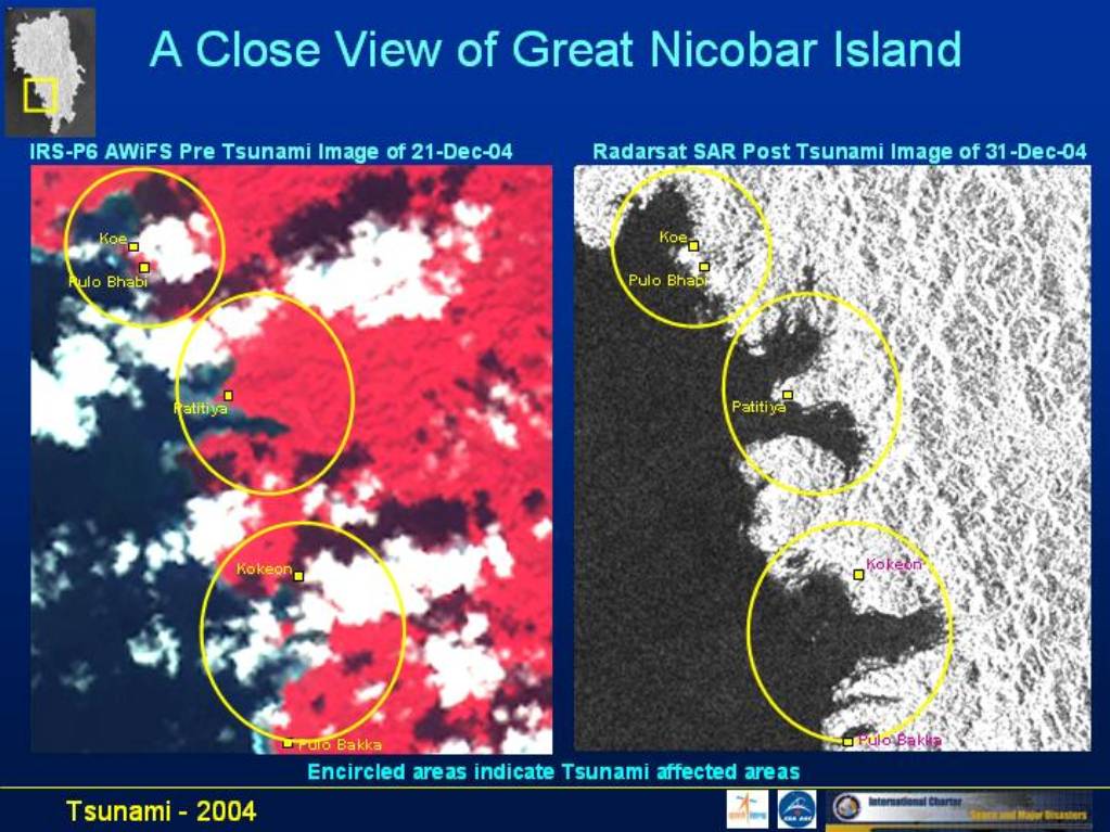
Before and after tsunami satellite images, Great Nicobar Patitiya Nicobar Islands
Source: IRS-P6 AWiFS data, 21/12/04, and Radarsat SAR data, 31/12/04
Acquired: 21/12/04, 31/12/04
Copyright: Courtesy National Remote Sensing Agency, Govt. of India
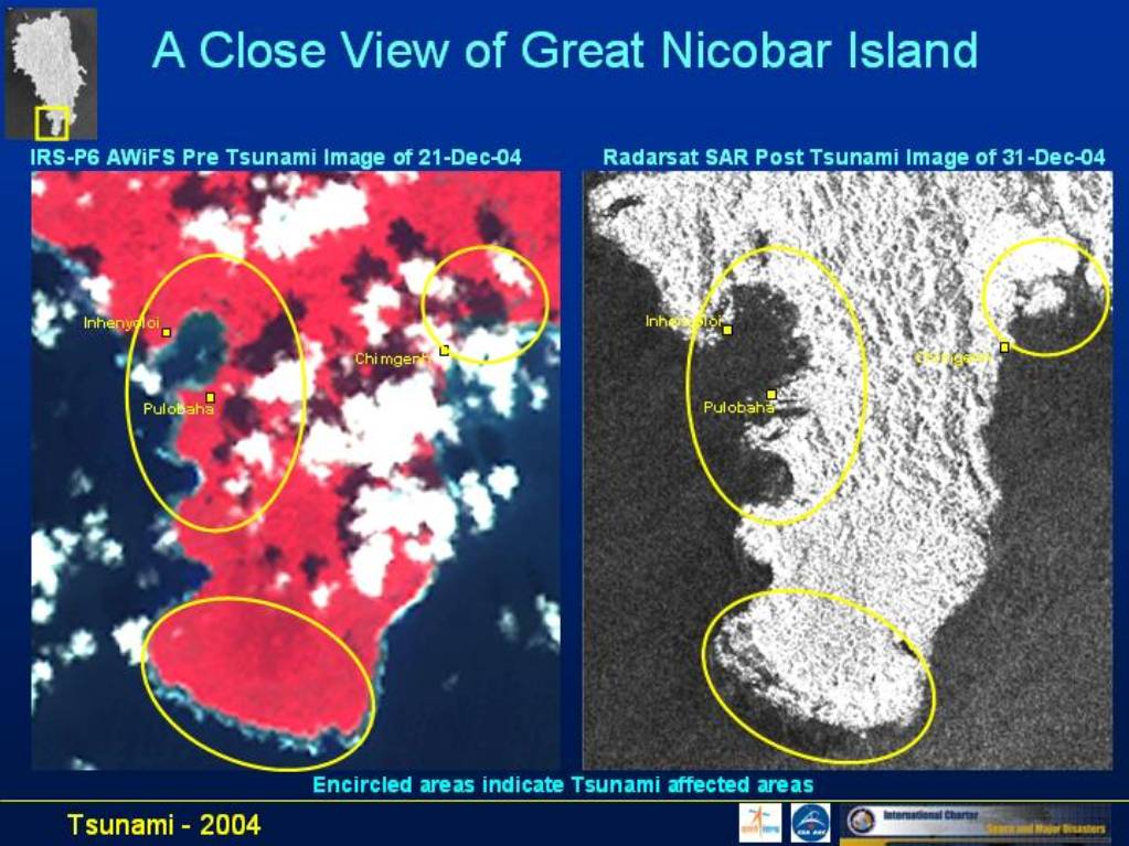
Before and after tsunami satellite images, Great Nicobar Pulobaha Nicobar Islands
Source: IRS-P6 AWiFS data, 21/12/04, and Radarsat SAR data, 31/12/04
Acquired: 21/12/04, 31/12/04
Copyright: Courtesy National Remote Sensing Agency, Govt. of India
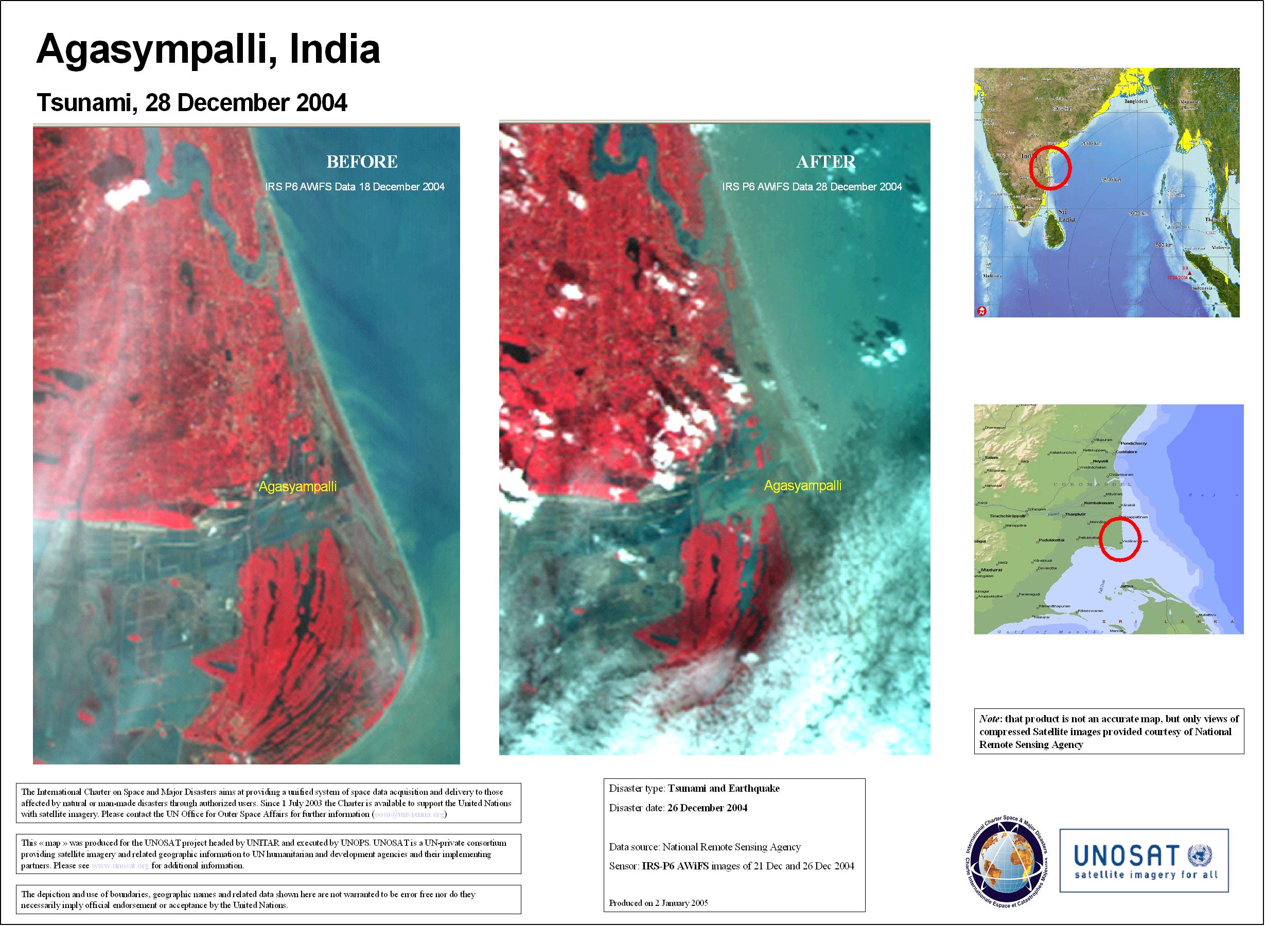
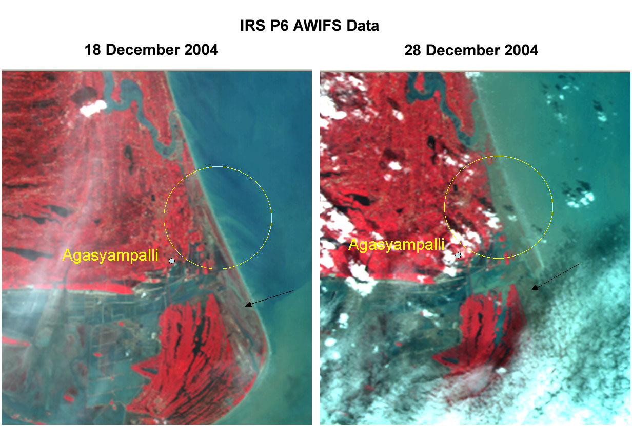
Post-tsunami satellite map, IRS Before After Tsunami Agasympalli India
Source: IRS-P6 AWiFS data
Acquired: 02/01/2005
Copyright: Map produced 02/01/2005 by UNOSAT
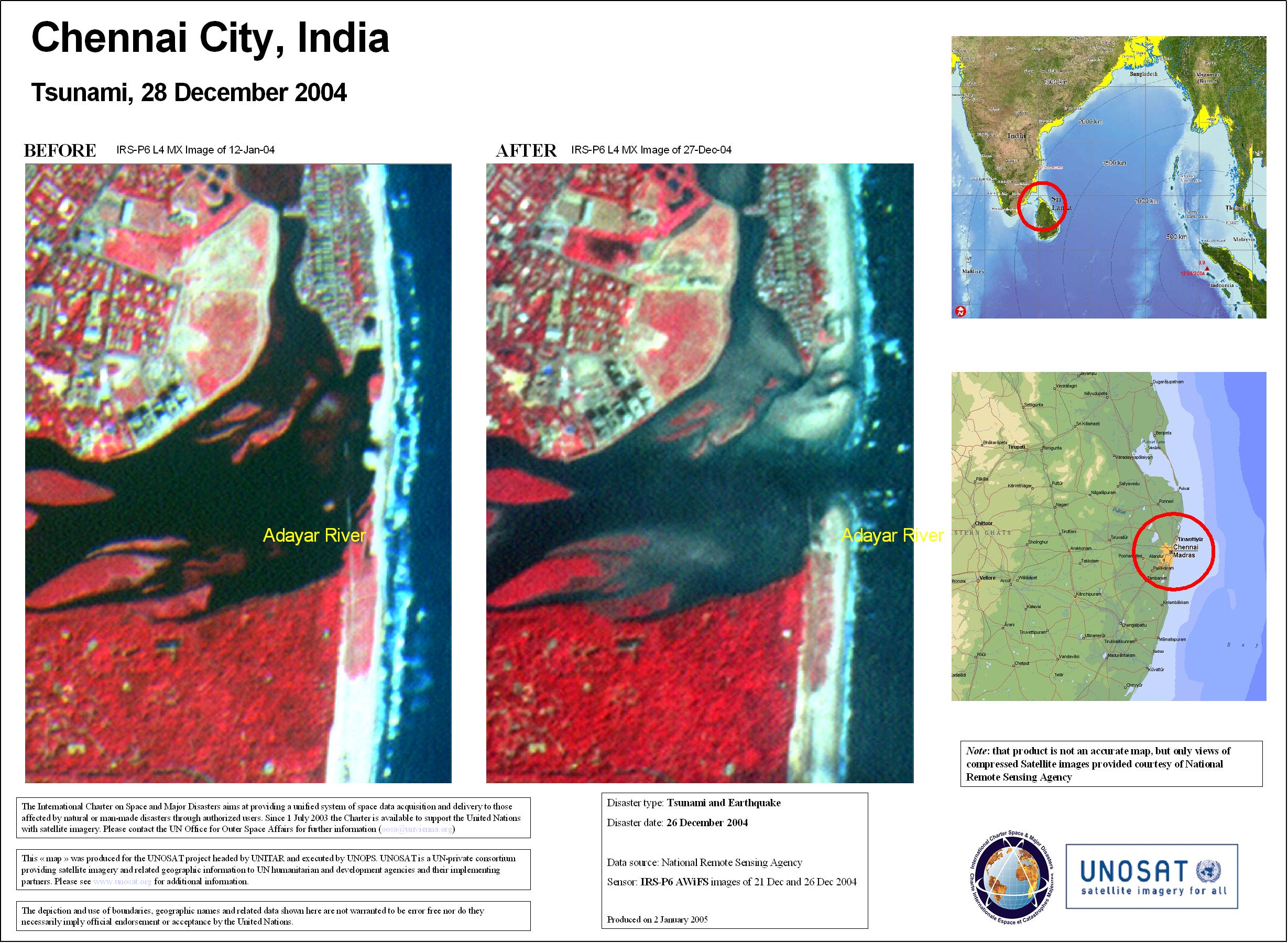
Post-tsunami satellite map, IRS Before After Tsunami Chennai Indiar
Source: IRS-P6 AWiFS data
Acquired: 02/01/2005
Copyright: Map produced 02/01/2005 by UNOSAT
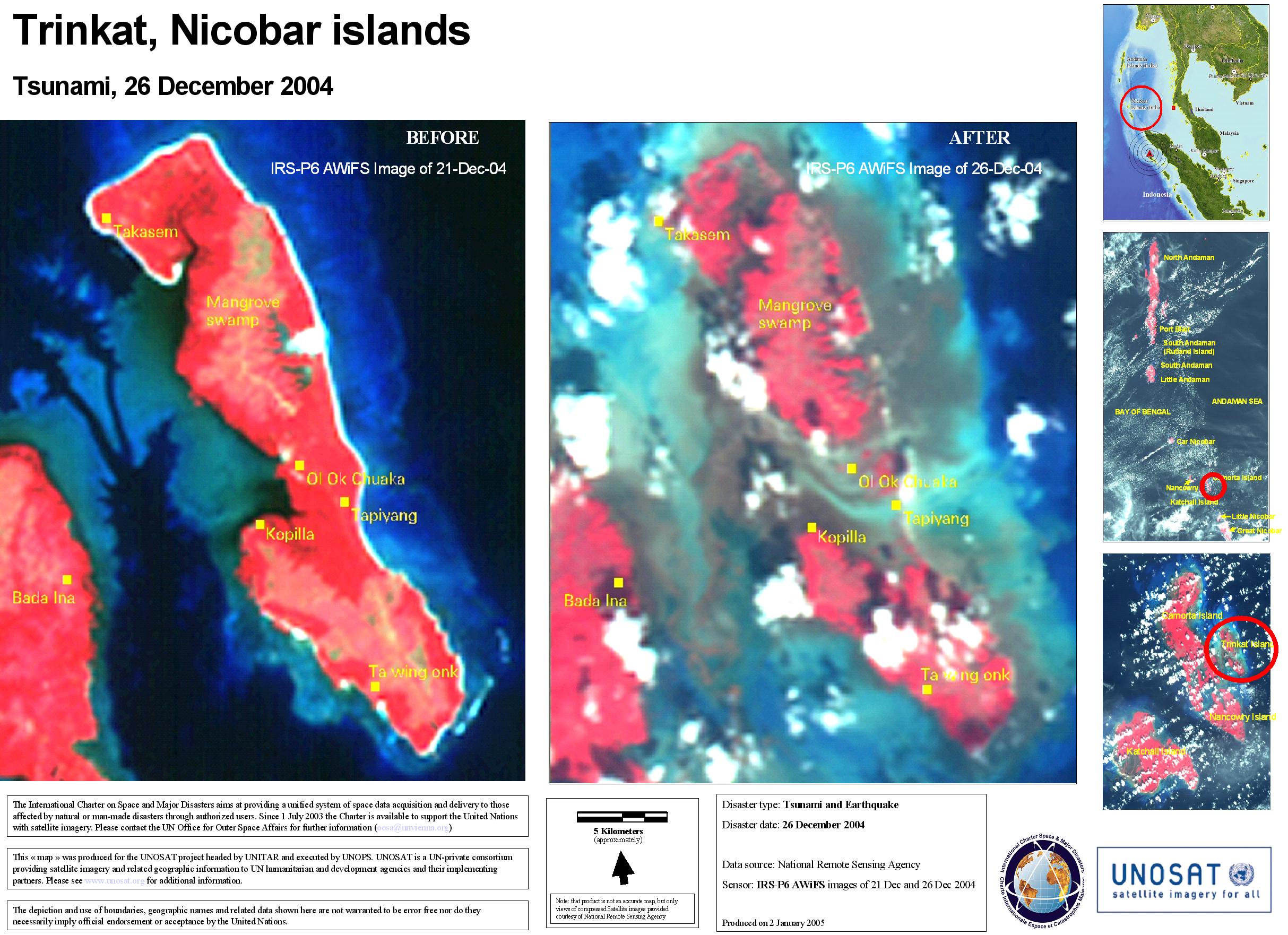
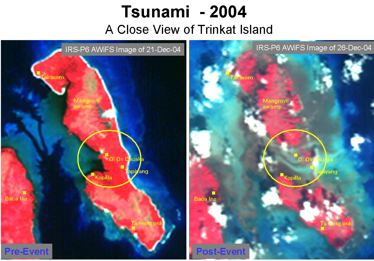
Post-tsunami satellite map, IRS Before After Tsunami Trinkat Nicobar
Source: IRS-P6 AWiFS data
Acquired: 02/01/2005
Copyright: Map produced 02/01/2005 by UNOSAT
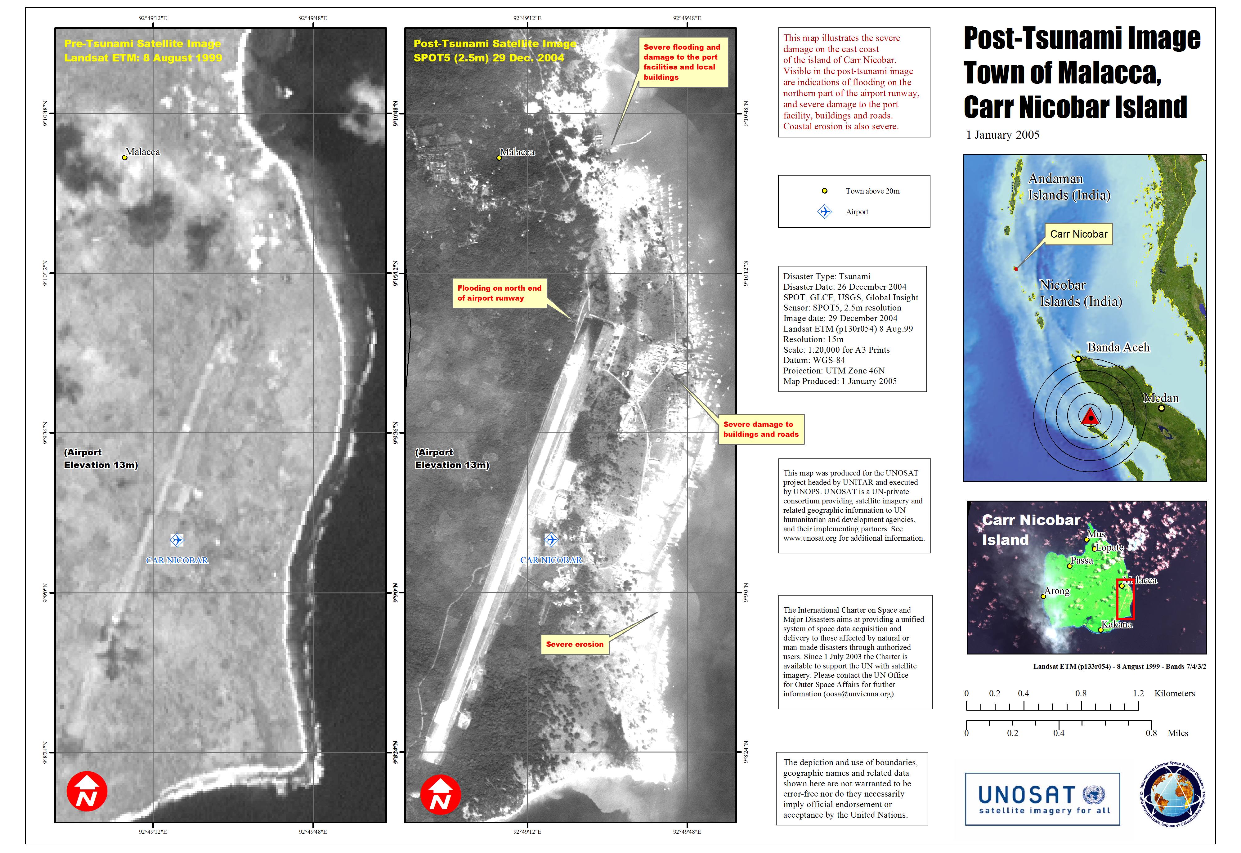
Post-tsunami satellite map, Malacca Nicobar
Source: Landsat ETM, 08/08/1999 and SPOT 5 data, 2.5 m resolution, 29/12/2004
Acquired: 01/01/2005
Copyright: Map produced 01/01/2005 by UNOSAT
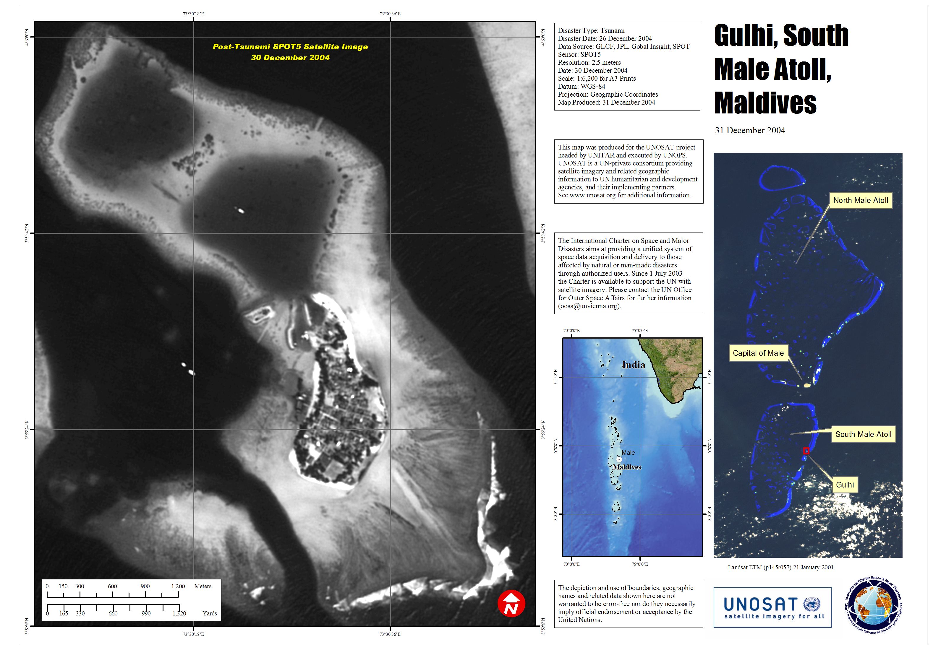
Post-tsunami satellite map, Maldives Gulhi
Source: SPOT 5 data, 2.5 m resolution.
Acquired: 31/12/2004
Copyright: Map produced 31/12/2004 by UNOSAT
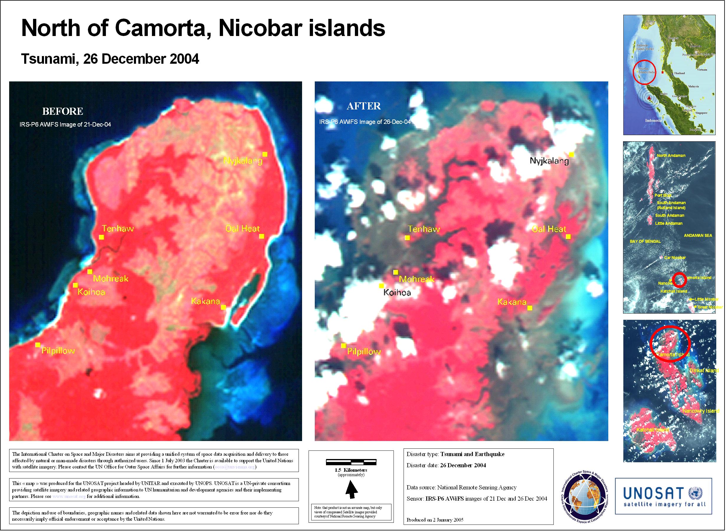
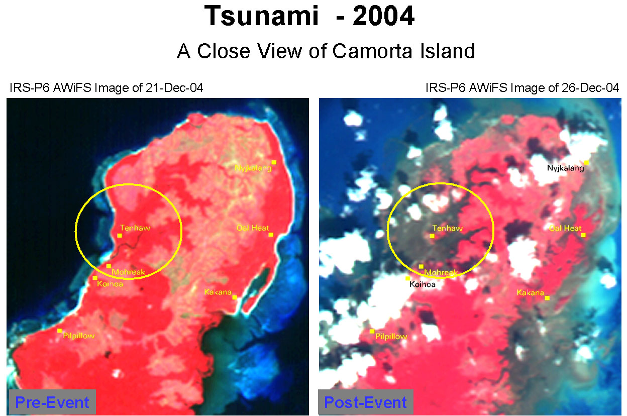
Post-tsunami satellite map, IRS Before After Tsunami North Camorta Nicobar
Source: IRS-P6 AWiFS data
Acquired: 02/01/2005
Copyright: Map produced 02/01/2005 by UNOSAT
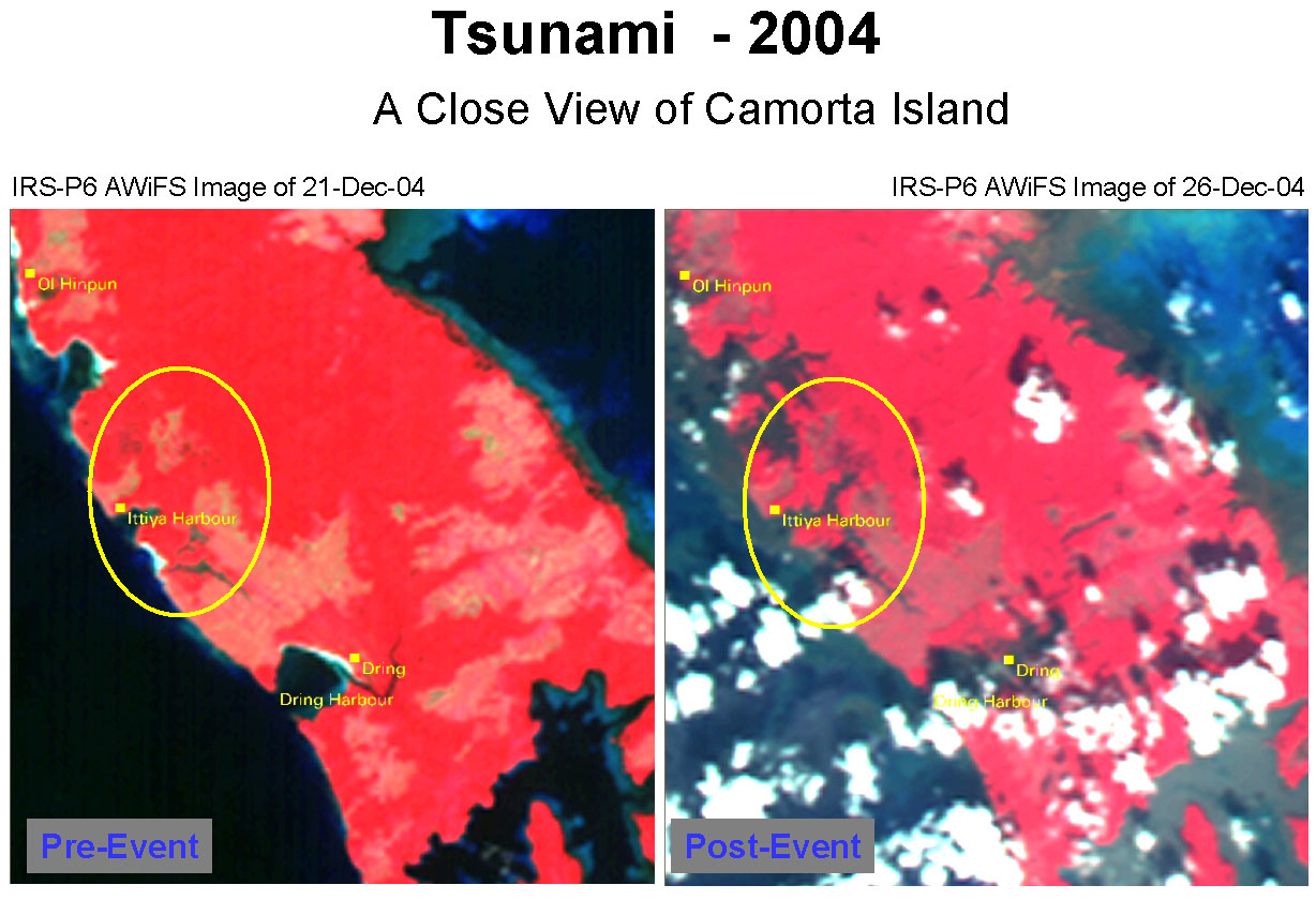
Post-tsunami satellite map, IRS Before After Tsunami North Center Nicobar
Source: IRS-P6 AWiFS data
Acquired: 02/01/2005
Copyright: Map produced 02/01/2005 by UNOSAT
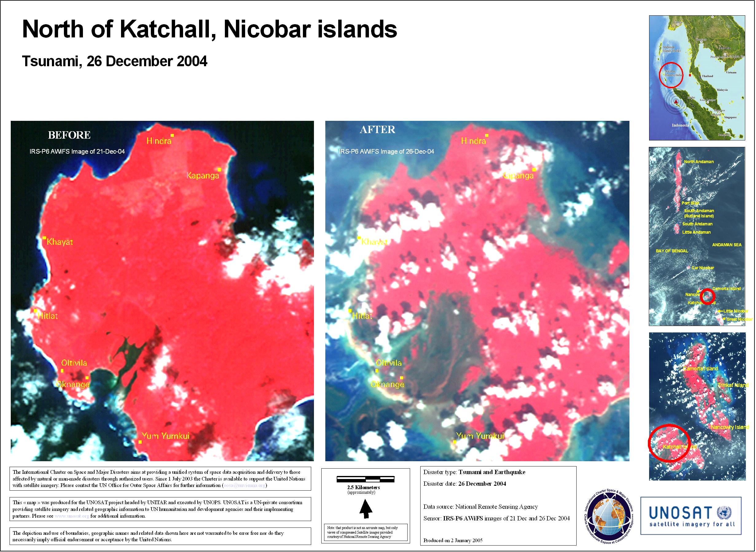
Post-tsunami satellite map, IRS Before After Tsunami North Katchall Nicobar
Source: IRS-P6 AWiFS data
Acquired: 02/01/2005
Copyright: Map produced 02/01/2005 by UNOSAT
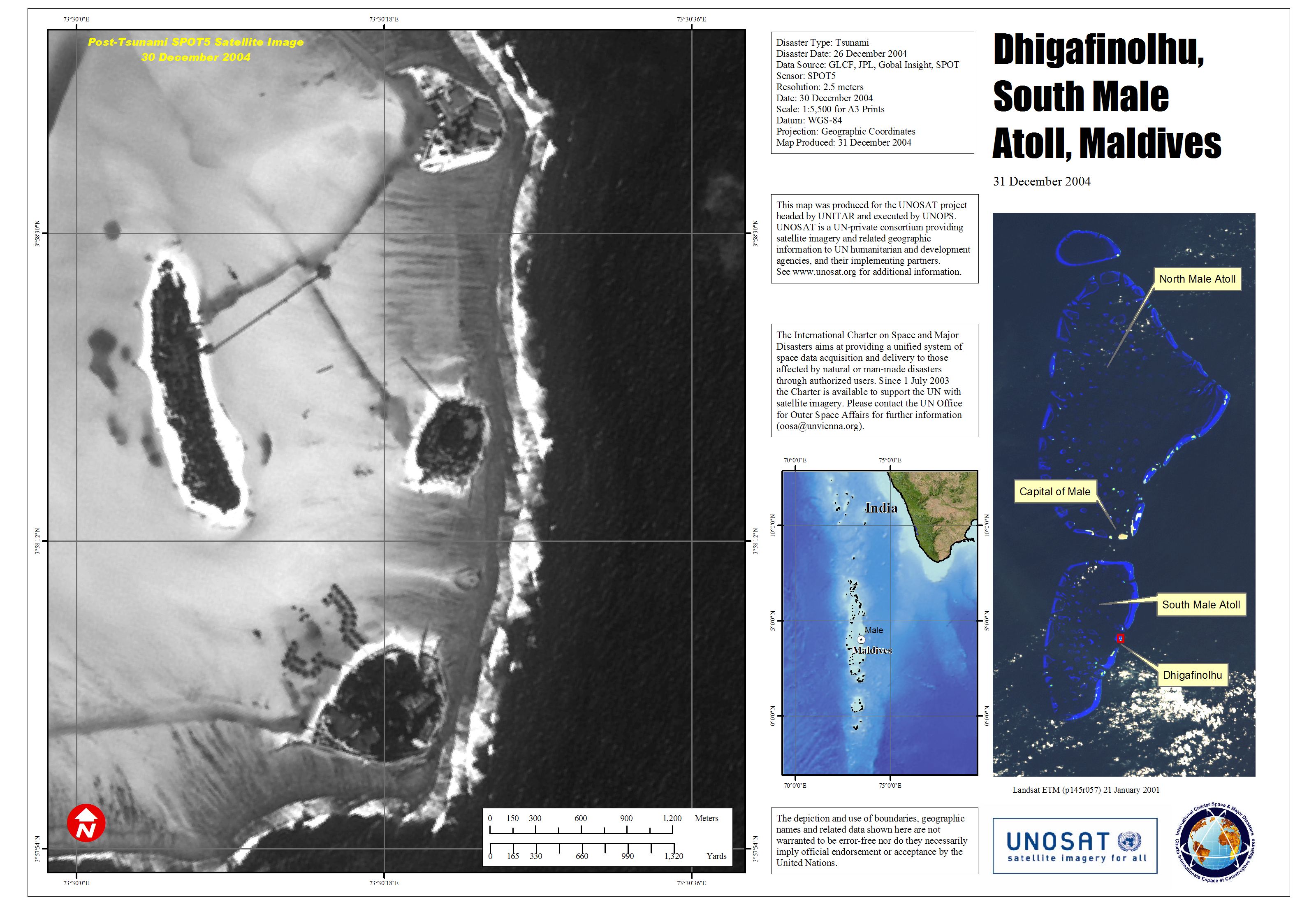
Post-tsunami satellite map, Maldives Dhigafinolhu
Source: SPOT 5 data, 2.5 m resolution.
Acquired: 31/12/2004
Copyright: Map produced 31/12/2004 by UNOSAT
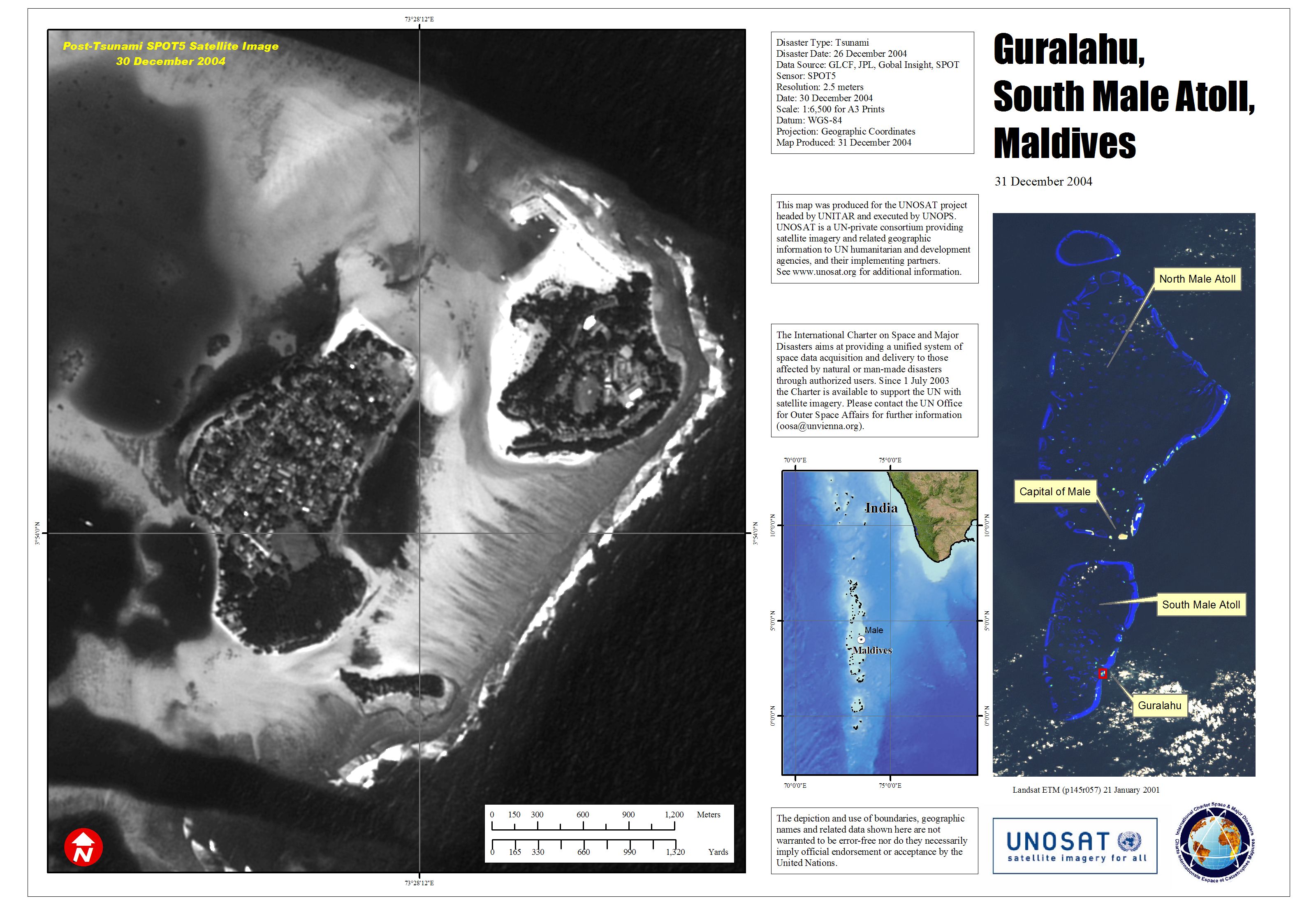
Post-tsunami satellite map, Maldives Guralahu
Source: SPOT 5 data, 2.5 m resolution.
Acquired: 31/12/2004
Copyright: Map produced 31/12/2004 by UNOSAT
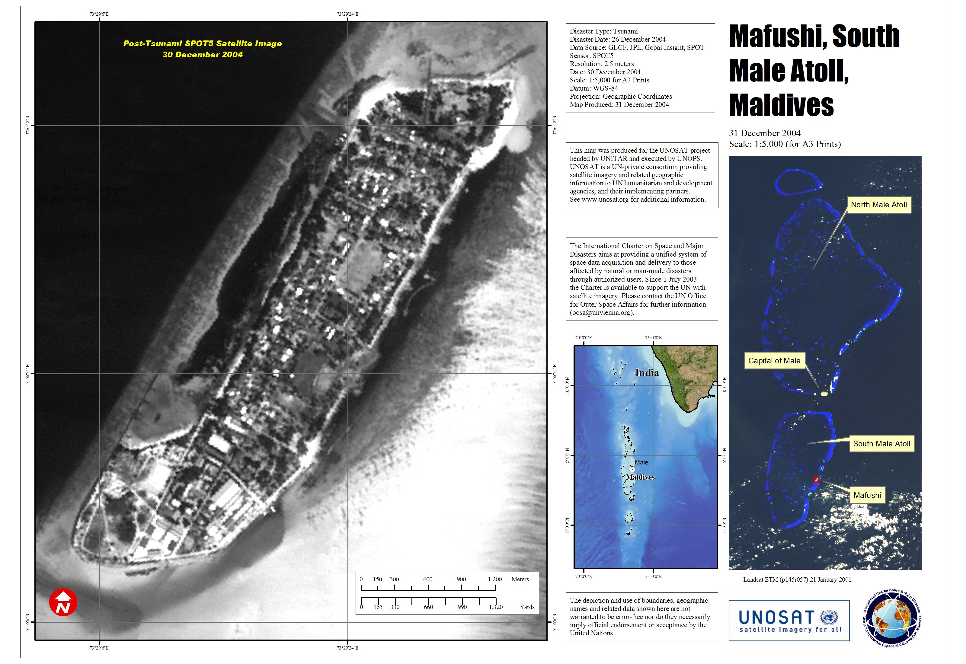
Post-tsunami satellite map, Maldives Mafushi
Source: SPOT 5 data, 2.5 m resolution.
Acquired: 31/12/2004
Copyright: Map produced 31/12/2004 by UNOSAT
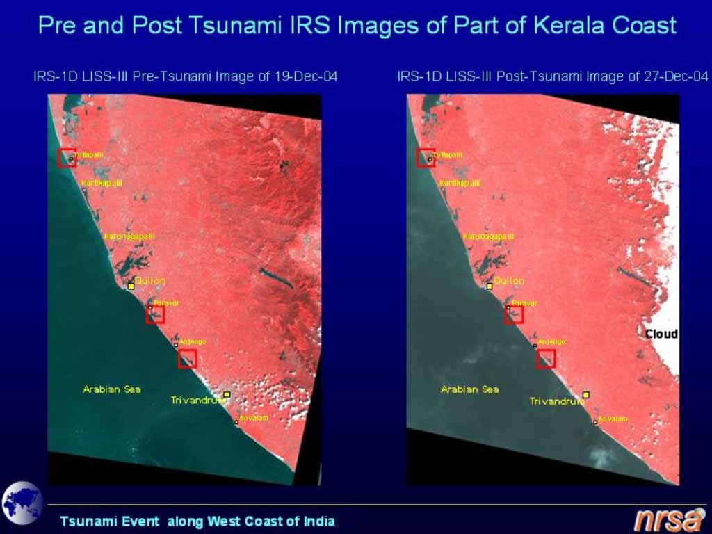
Before and after tsunami satellite images, Kerala
Source: IRS-1D LISS data, 19/12/04 and 27/12/04
Acquired: 27/12/04
Copyright: Courtesy National Remote Sensing Agency, Govt. of India
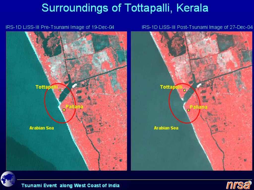
Before and after tsunami satellite images, Tottapalli, Kerala
Source: IRS-1D LISS data, 19/12/04 and 27/12/04
Acquired: 27/12/04
Copyright: Courtesy National Remote Sensing Agency, Govt. of India
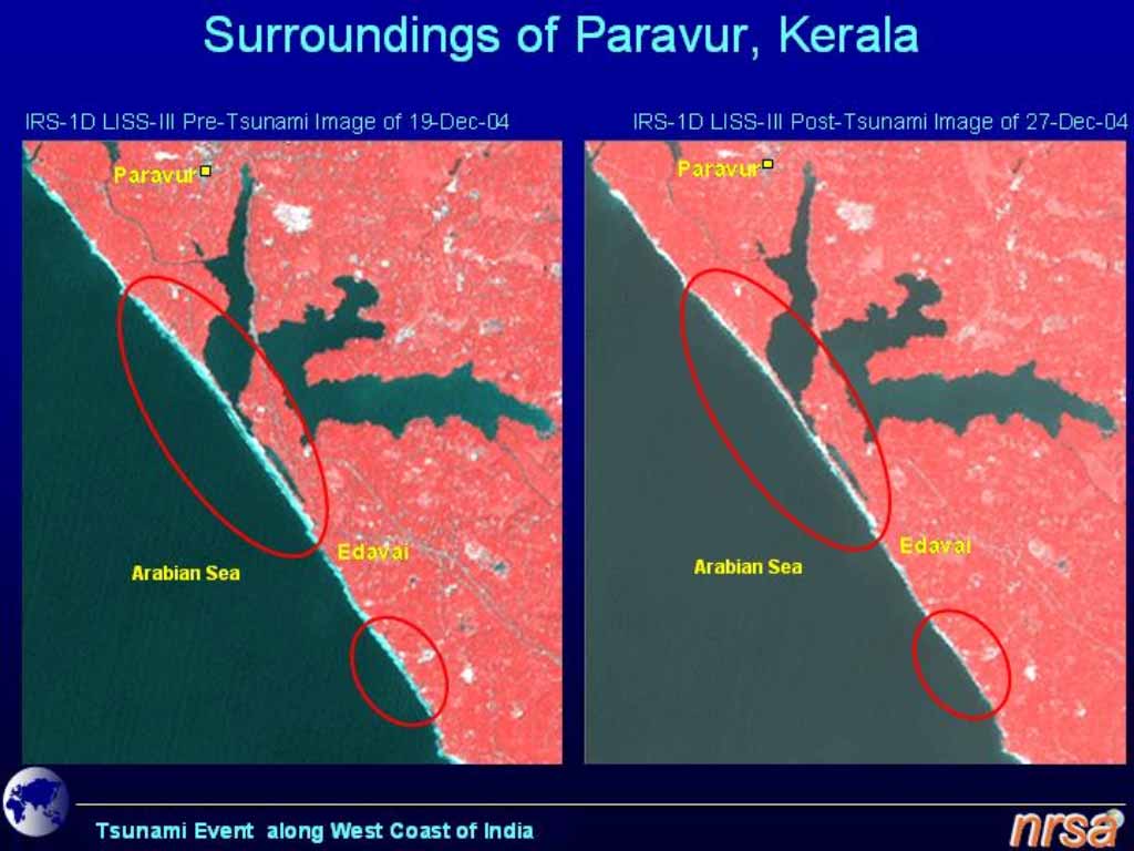
Before and after tsunami satellite images, Paravur, Kerala
Source: IRS-1D LISS data, 19/12/04 and 27/12/04
Acquired: 27/12/04
Copyright: Courtesy National Remote Sensing Agency, Govt. of India
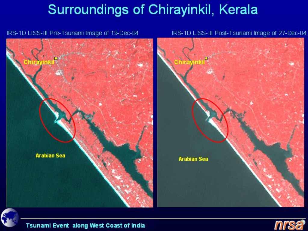
Before and after tsunami satellite images, Chirayinkil, Kerala
Source: IRS-1D LISS data, 19/12/04 and 27/12/04
Acquired: 27/12/04
Copyright: Courtesy National Remote Sensing Agency, Govt. of India
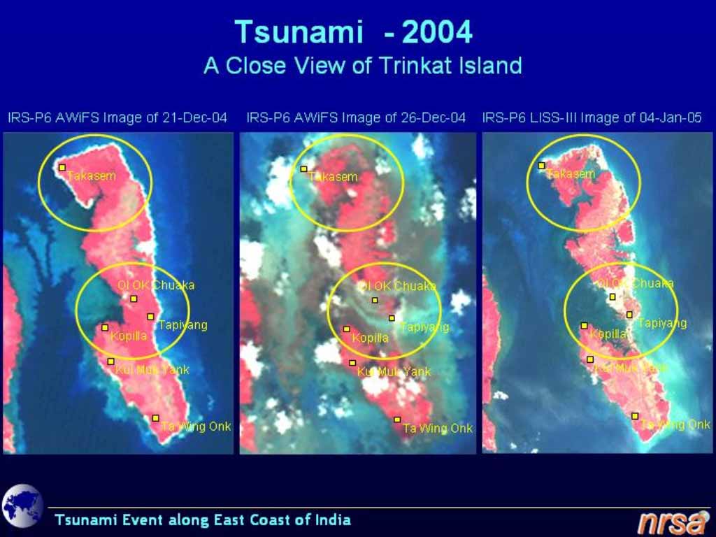
Before and after tsunami satellite images, Trinkat
Source: IRS-P6 AWiFS data, 21/12/04, 26/12/04, and IRS-P6 LISS-III data, 04/01/05
Acquired: 21/12/04, 26/12/04, 04/01/05
Copyright: Courtesy National Remote Sensing Agency, Govt. of India
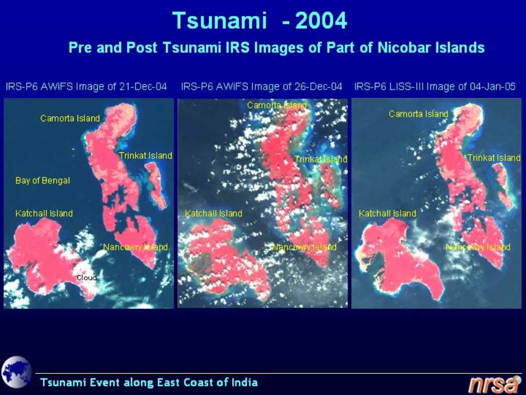
Before and after tsunami satellite images, Nicobar
Source: IRS-P6 AWiFS data, 21/12/04, 26/12/04, and IRS-P6 LISS-III data, 04/01/05
Acquired: 21/12/04, 26/12/04, 04/01/05
Copyright: Courtesy National Remote Sensing Agency, Govt. of India
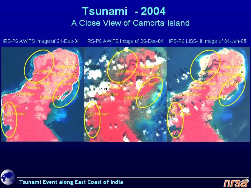
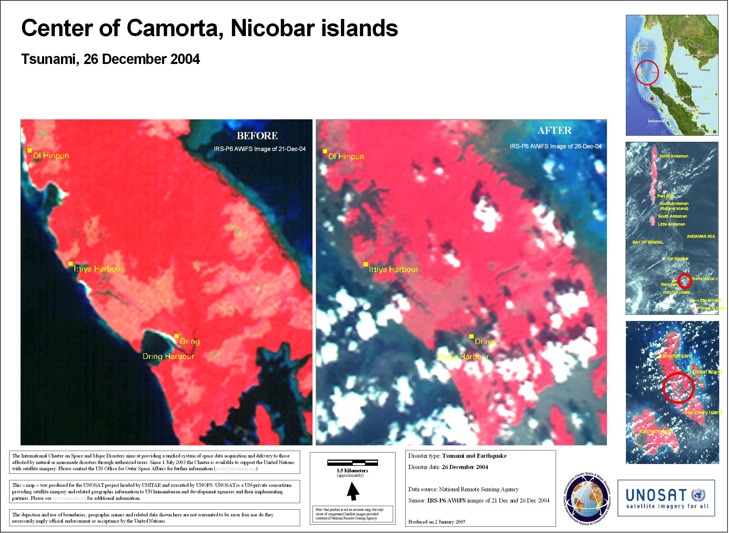
Before and after tsunami satellite images, Camorta
Source: IRS-P6 AWiFS data, 21/12/04, 26/12/04, and IRS-P6 LISS-III data, 04/01/05
Acquired: 21/12/04, 26/12/04, 04/01/05
Copyright: Courtesy National Remote Sensing Agency, Govt. of India
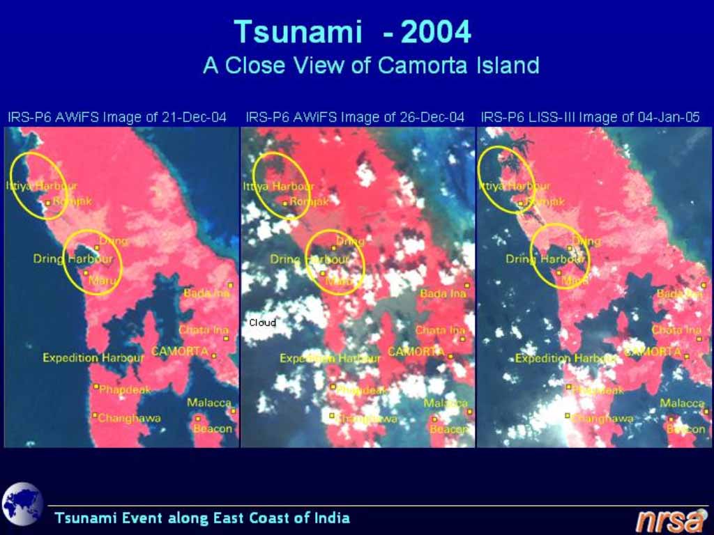
Before and after tsunami satellite images, Camorta
Source: IRS-P6 AWiFS data, 21/12/04, 26/12/04, and IRS-P6 LISS-III data, 04/01/05
Acquired: 21/12/04, 26/12/04, 04/01/05
Copyright: Courtesy National Remote Sensing Agency, Govt. of India
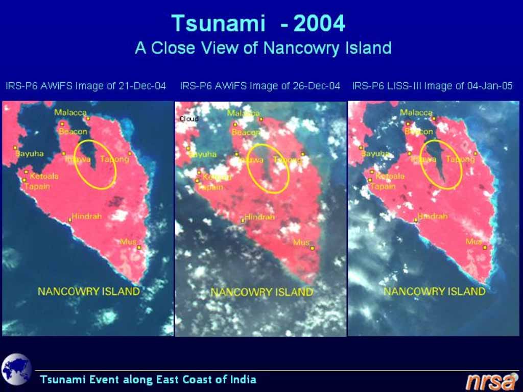
Before and after tsunami satellite images, Nancowry
Source: IRS-P6 AWiFS data, 21/12/04, 26/12/04, and IRS-P6 LISS-III data, 04/01/05
Acquired: 21/12/04, 26/12/04, 04/01/05
Copyright: Courtesy National Remote Sensing Agency, Govt. of India
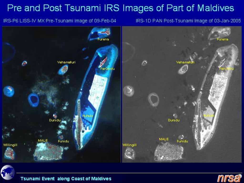
Before and after tsunami satellite images, Male, Maldives
Source: IRS-P6 LISS-IV MX data, 09/02/04, IRS 1D PAN, 03/01/05
Acquired: 03/01/05
Copyright: Courtesy National Remote Sensing Agency, Govt. of India
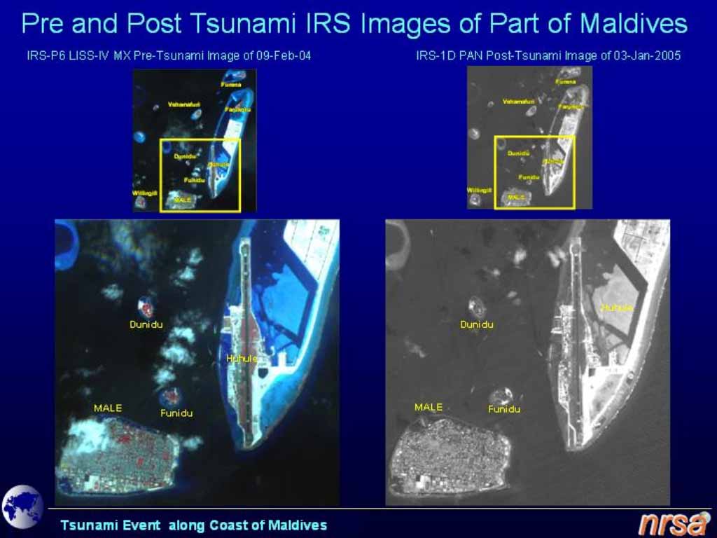
Before and after tsunami satellite images, Huhule, Maldives
Source: IRS-P6 LISS-IV MX data, 09/02/04, IRS 1D PAN, 03/01/05
Acquired: 03/01/05
Copyright: Courtesy National Remote Sensing Agency, Govt. of India
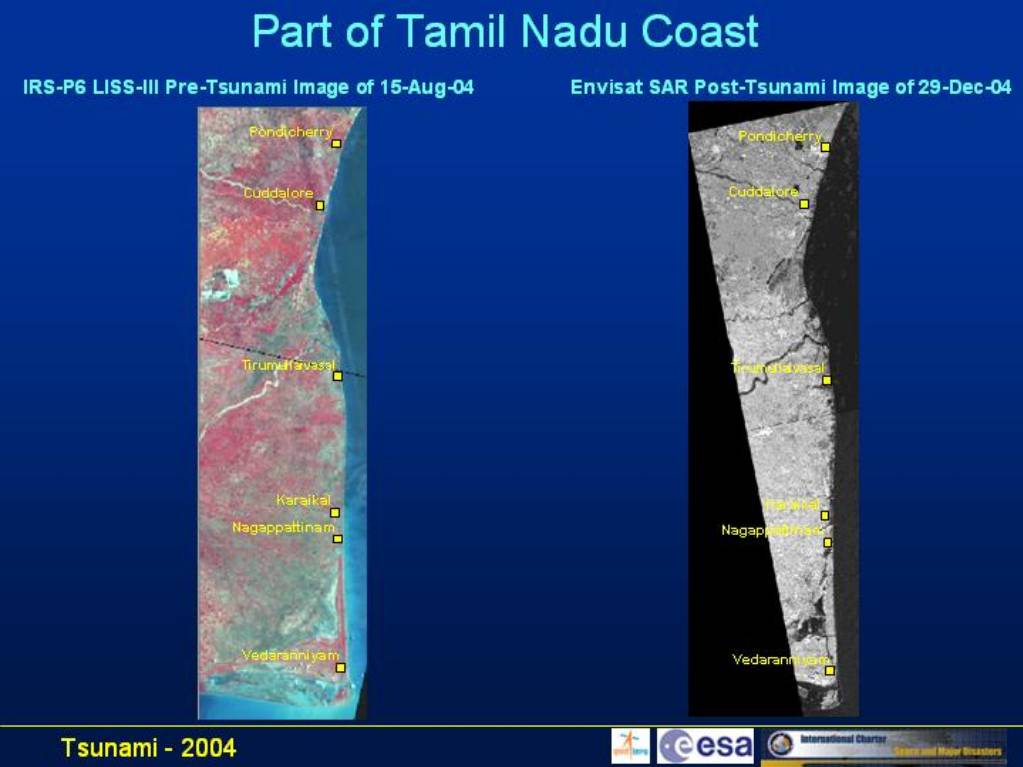
Before and after tsunami satellite images, Tamil Nadu Coast Tamil Nadu
Source: IRS-P6 LISS-III data, 15/08/04 and Envisat SAR data, 29/12/04
Acquired: 29/12/04
Copyright: Courtesy National Remote Sensing Agency, Govt. of India
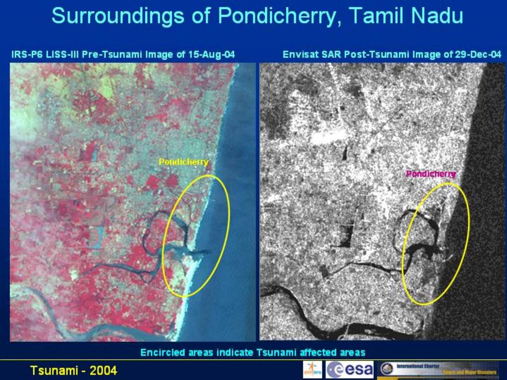
Before and after tsunami satellite images, Pondicherry Tamil Nadu
Source: IRS-P6 LISS-III data, 15/08/04 and Envisat SAR data, 29/12/04
Acquired: 29/12/04
Copyright: Courtesy National Remote Sensing Agency, Govt. of India
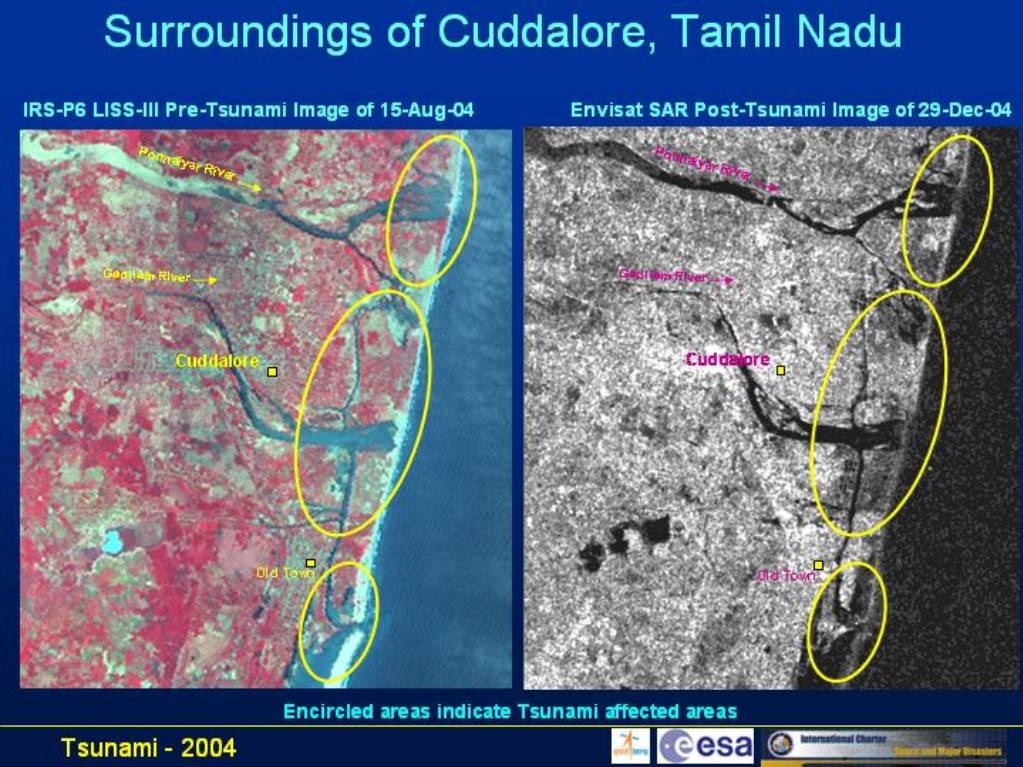
Before and after tsunami satellite images, Cuddalore Tamil Nadu
Source: IRS-P6 LISS-III data, 15/08/04 and Envisat SAR data, 29/12/04
Acquired: 29/12/04
Copyright: Courtesy National Remote Sensing Agency, Govt. of India
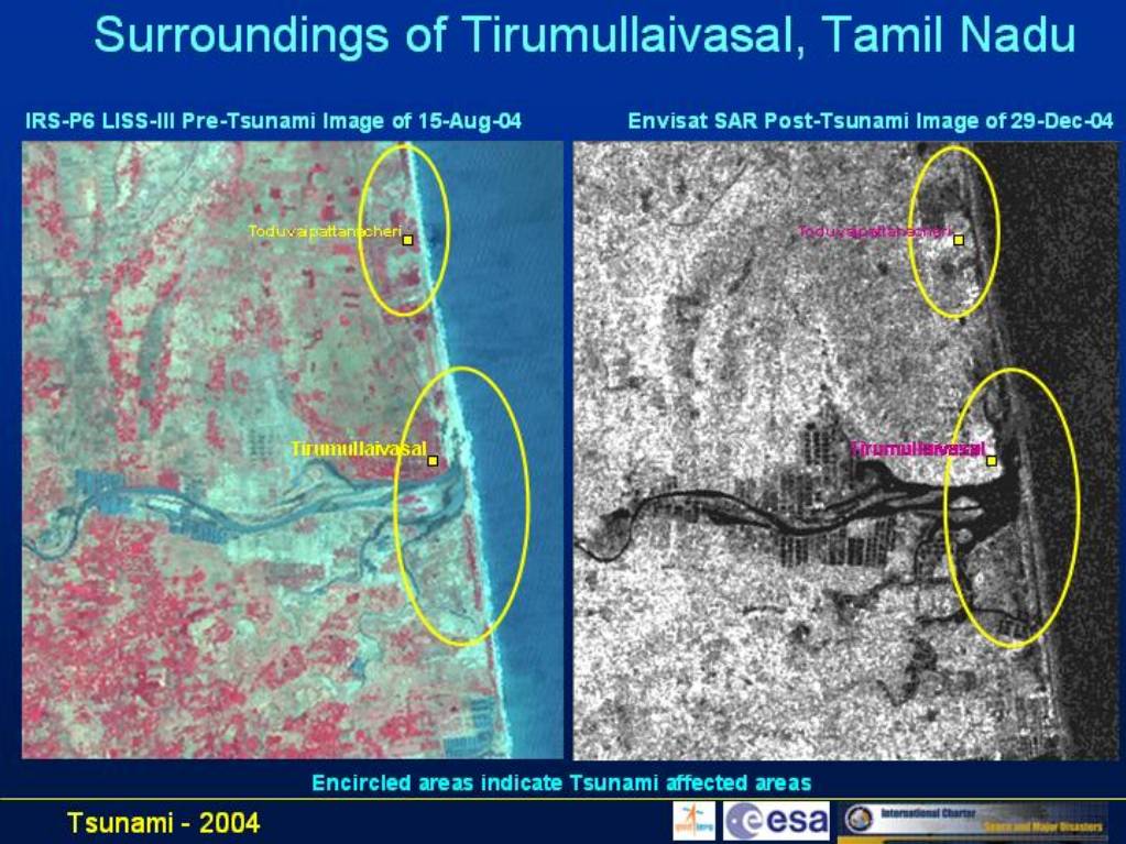
Before and after tsunami satellite images, Tirumullaivasal Tamil Nadu
Source: IRS-P6 LISS-III data, 15/08/04 and Envisat SAR data, 29/12/04
Acquired: 29/12/04
Copyright: Courtesy National Remote Sensing Agency, Govt. of India
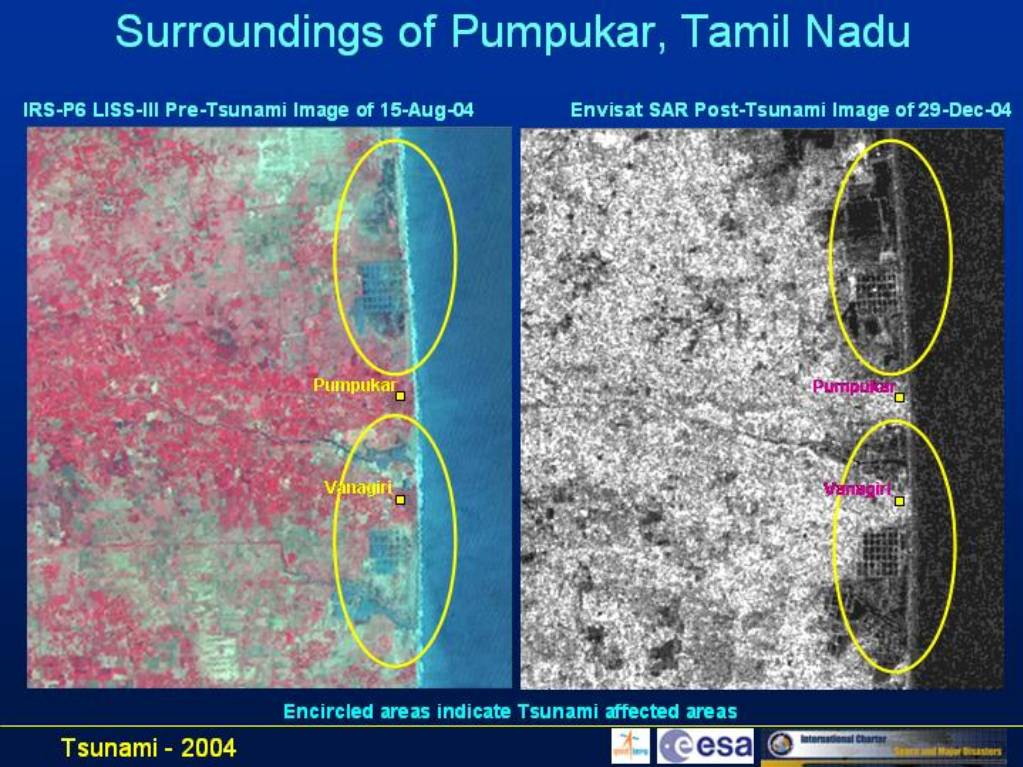
Before and after tsunami satellite images, Pumpukar Tamil Nadu
Source: IRS-P6 LISS-III data, 15/08/04 and Envisat SAR data, 29/12/04
Acquired: 29/12/04
Copyright: Courtesy National Remote Sensing Agency, Govt. of India
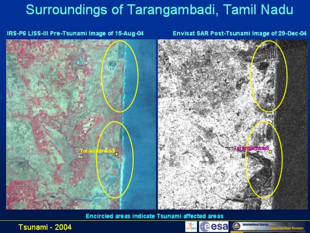
Before and after tsunami satellite images, Tarangambadi Tamil Nadu
Source: IRS-P6 LISS-III data, 15/08/04 and Envisat SAR data, 29/12/04
Acquired: 29/12/04
Copyright: Courtesy National Remote Sensing Agency, Govt. of India
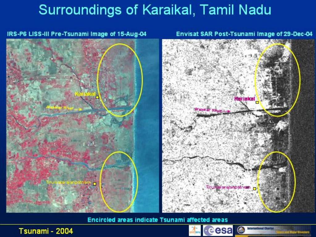
Before and after tsunami satellite images, Karaikal Tamil Nadu
Source: IRS-P6 LISS-III data, 15/08/04 and Envisat SAR data, 29/12/04
Acquired: 29/12/04
Copyright: Courtesy National Remote Sensing Agency, Govt. of India
Before and after tsunami satellite images, Nagappattinam Tamil Nadu
Source: IRS-P6 LISS-III data, 15/08/04 and Envisat SAR data, 29/12/04
Acquired: 29/12/04
Copyright: Courtesy National Remote Sensing Agency, Govt. of India
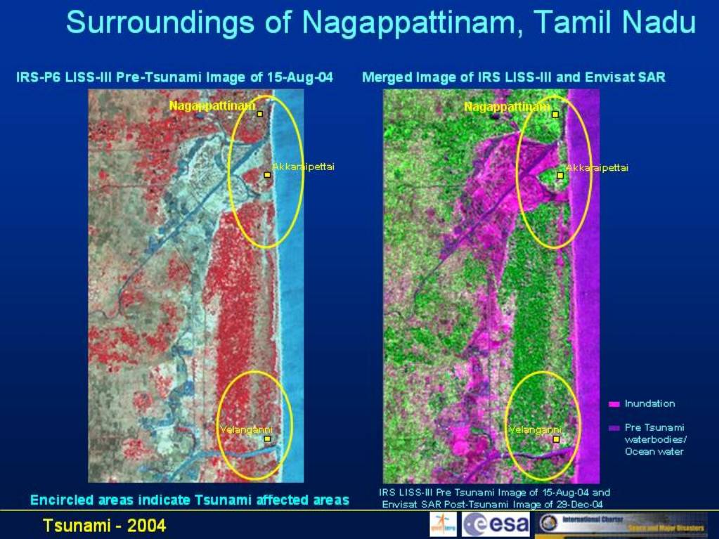
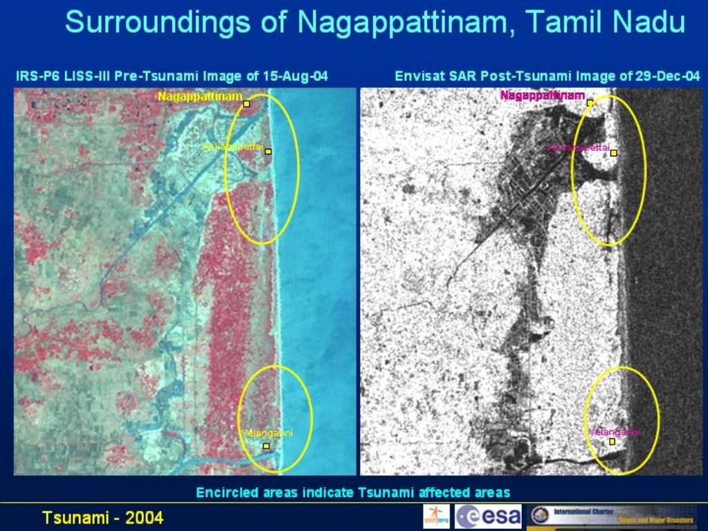
Before and after tsunami satellite images, Nagappattinam Surroundings Tamil Nadu
Source: IRS-P6 LISS-III data, 15/08/04 and merged image
IRS LISS-III, 15/08/04 and Envisat SAR data, 29/12/04
Acquired: 29/12/04
Copyright: Courtesy National Remote Sensing Agency, Govt. of India
Before and after tsunami satellite images, Vedaranniyam Tamil Nadu
Source: IRS-P6 LISS-III data, 15/08/04 and Envisat SAR data, 29/12/04
Acquired: 29/12/04
Copyright: Courtesy National Remote Sensing Agency, Govt. of India
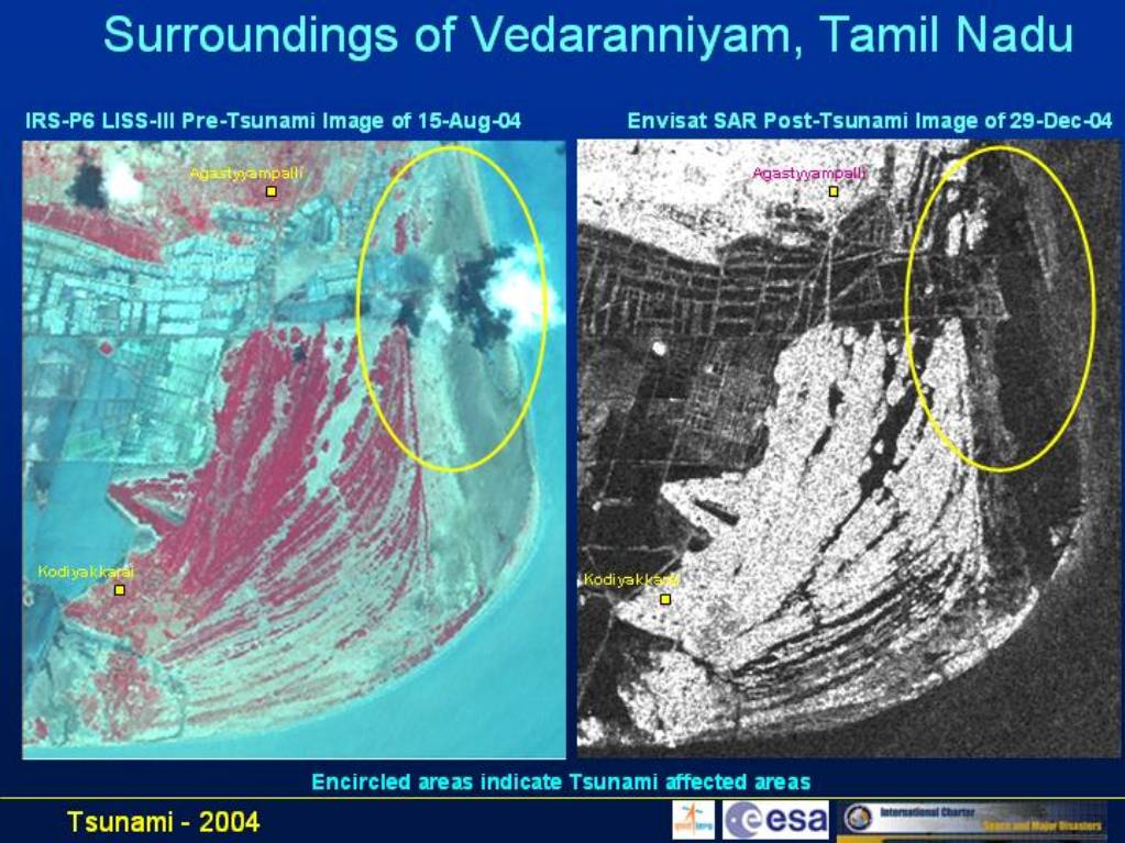
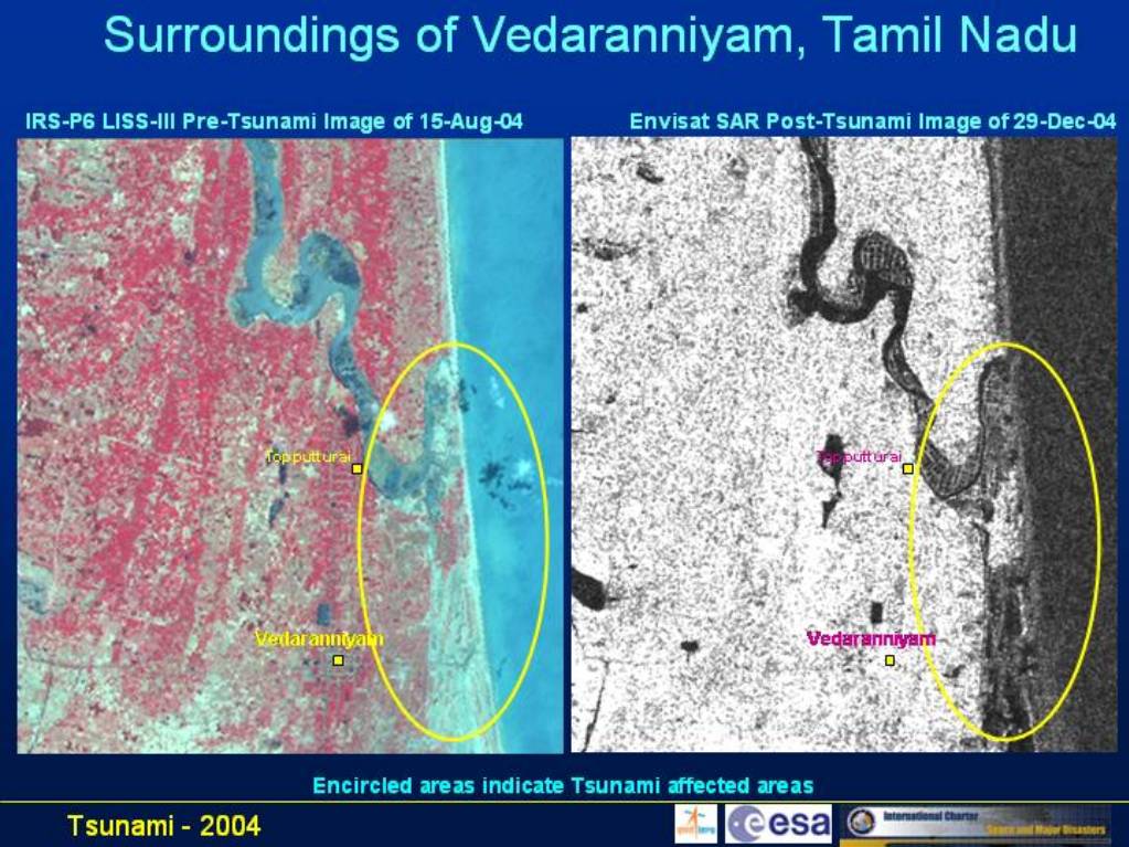
Before and after tsunami satellite images, Vedaranniyam Surroundings Tamil Nadu
Source: IRS-P6 LISS-III data, 15/08/04 and Envisat SAR data, 29/12/04
Acquired: 29/12/04
Copyright: Courtesy National Remote Sensing Agency, Govt. of India
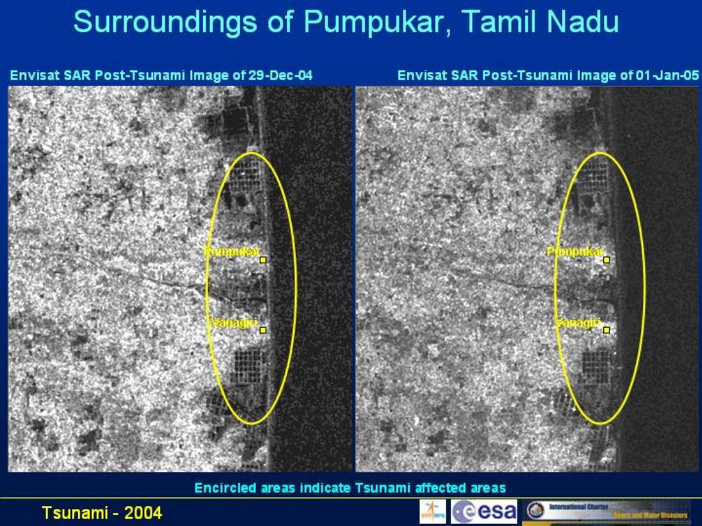
Before and after tsunami satellite images, Pumpukar Surroundings Tamil Nadu
Source: Envisat SAR data, 29/12/04 and 01/01/05
Acquired: 01/01/05
Copyright: Courtesy National Remote Sensing Agency, Govt. of India
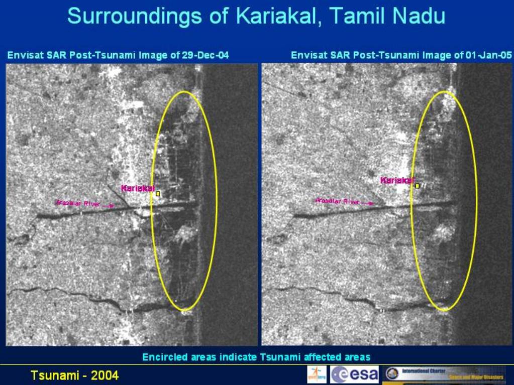
Before and after tsunami satellite images, Karaikal Surroundings Tamil Nadu
Source: Envisat SAR data, 29/12/04 and 01/01/05
Acquired: 01/01/05
Copyright: Courtesy National Remote Sensing Agency, Govt. of India
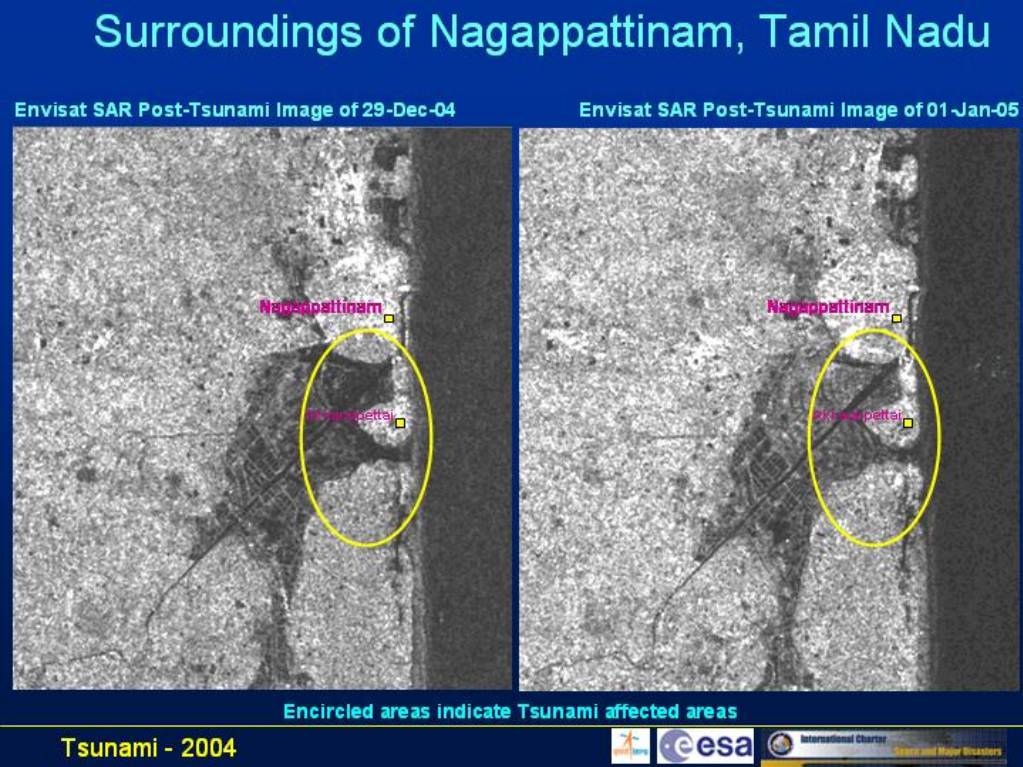
Before and after tsunami satellite images, Nagappattinam Surroundings Tamil Nadu
Source: Envisat SAR data, 29/12/04 and 01/01/05
Acquired: 01/01/05
Copyright: Courtesy National Remote Sensing Agency, Govt. of India
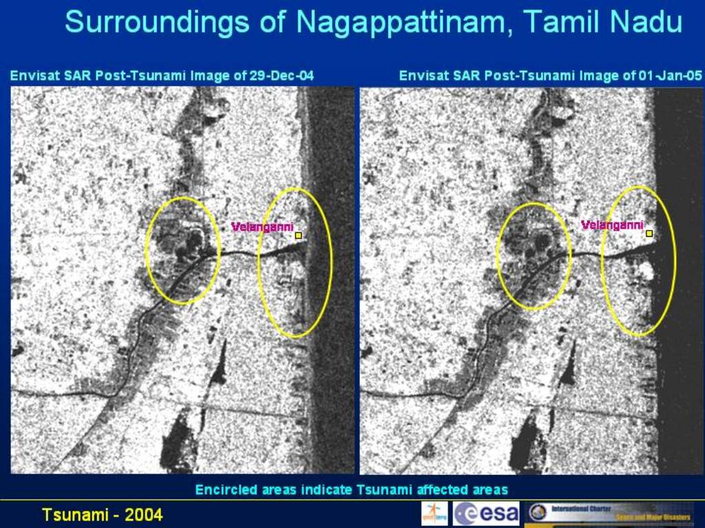
Before and after tsunami satellite images, Nagappattinam Surroundings Tamil Nadu
Source: Envisat SAR data, 29/12/04 and 01/01/05
Acquired: 01/01/05
Copyright: Courtesy National Remote Sensing Agency, Govt. of India
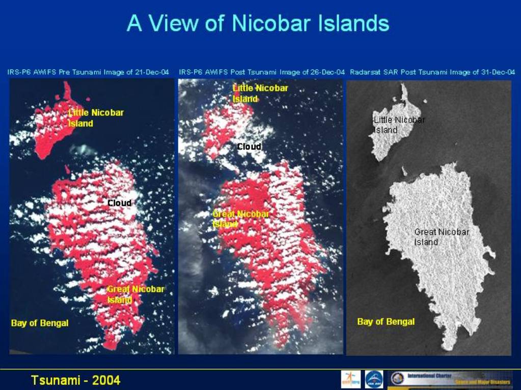
Before and after tsunami satellite images, View Of Nicobar Islands
Source: IRS-P6 AWiFS data, 21/12/04, 26/12/04, and Radarsat SAR data, 31/12/04
Acquired: 21/12/04, 26/12/04, 31/12/04
Copyright: Courtesy National Remote Sensing Agency, Govt. of India
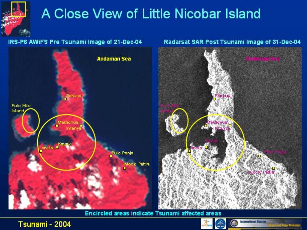
Before and after tsunami satellite images, Little Nicobar Pulo Milo Nicobar Islands
Source: IRS-P6 AWiFS data, 21/12/04, and Radarsat SAR data, 31/12/04
Acquired: 21/12/04, 31/12/04
Copyright: Courtesy National Remote Sensing Agency, Govt. of India
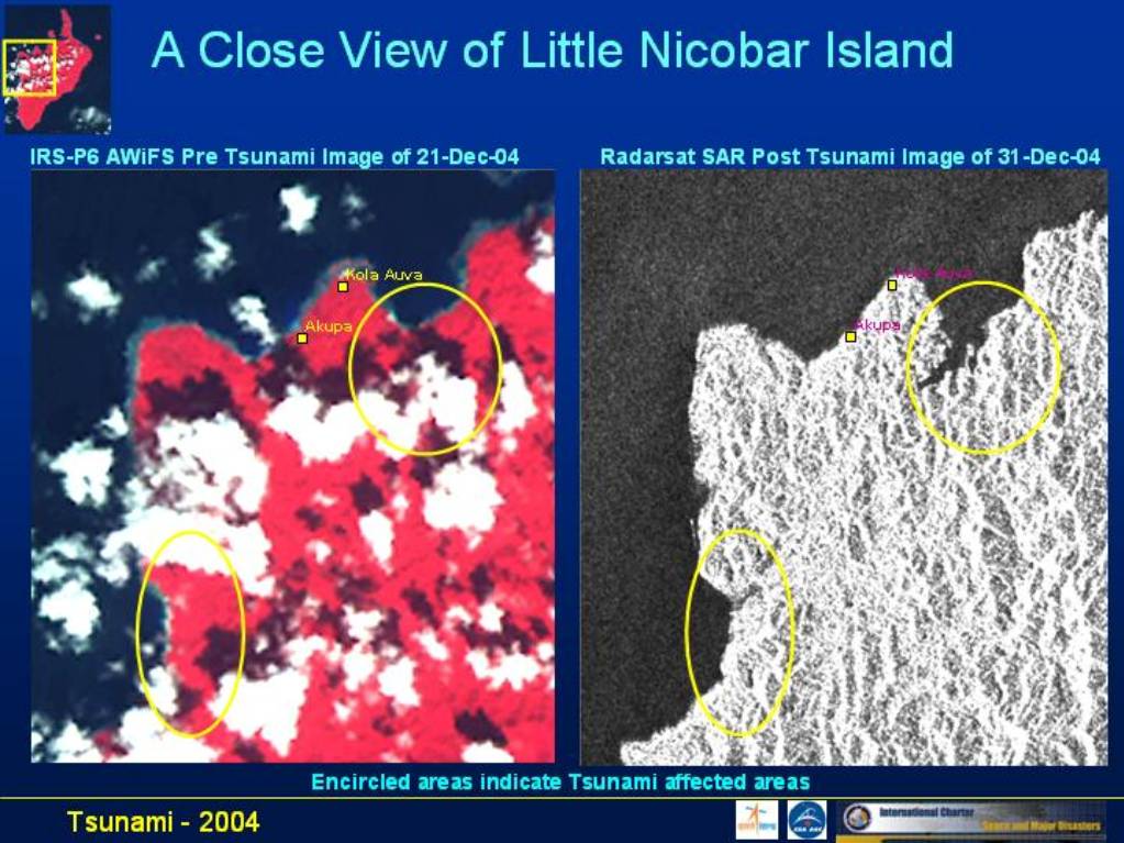
Before and after tsunami satellite images, Little Nicobar Kola Auva Nicobar Islands
Source: IRS-P6 AWiFS data, 21/12/04, and Radarsat SAR data, 31/12/04
Acquired: 21/12/04, 31/12/04
Copyright: Courtesy National Remote Sensing Agency, Govt. of India
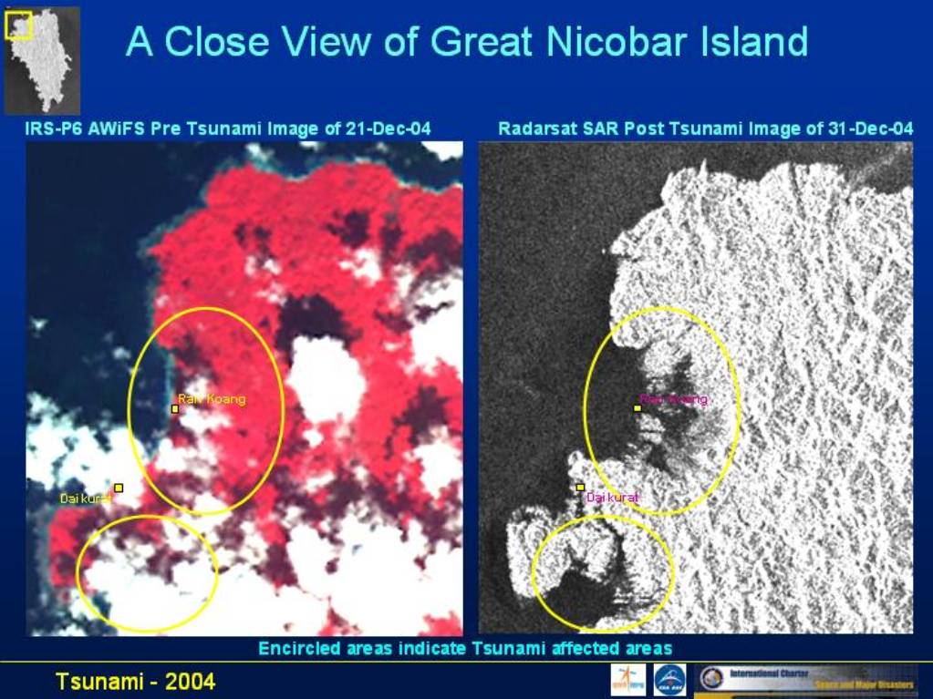
Before and after tsunami satellite images, Great Nicobar Nicobar Islands
Source: IRS-P6 AWiFS data, 21/12/04, and Radarsat SAR data, 31/12/04
Acquired: 21/12/04, 31/12/04
Copyright: Courtesy National Remote Sensing Agency, Govt. of India
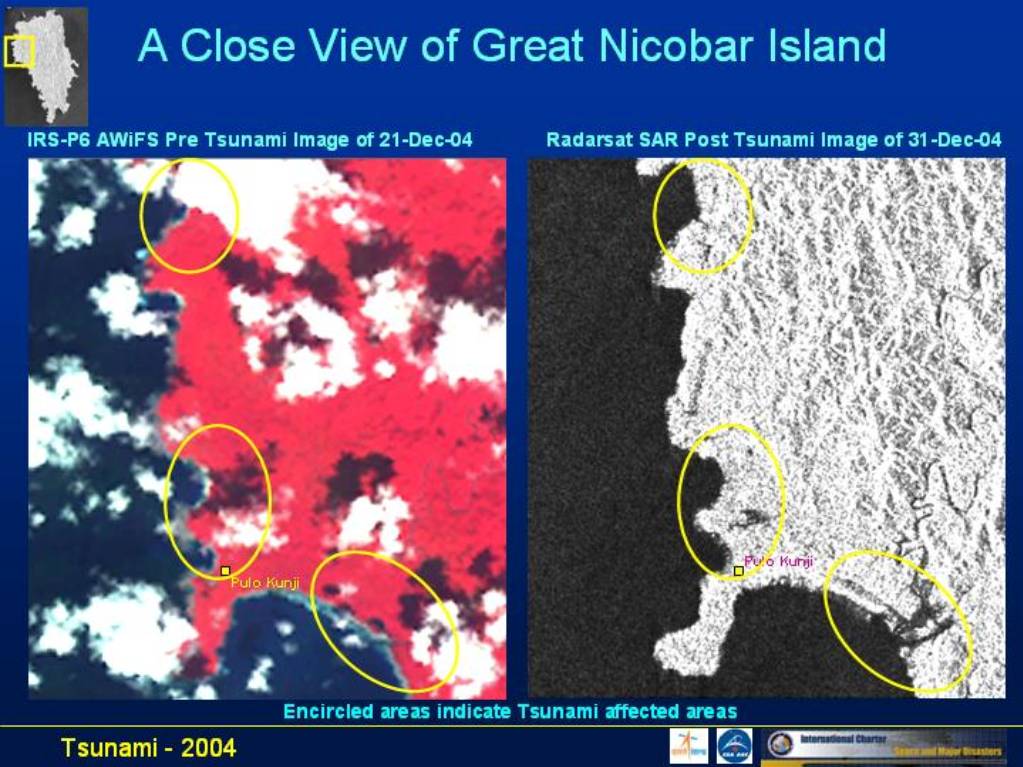
Before and after tsunami satellite images, Great Nicobar Pulo Kunji Nicobar Islands
Source: IRS-P6 AWiFS data, 21/12/04, and Radarsat SAR data, 31/12/04
Acquired: 21/12/04, 31/12/04
Copyright: Courtesy National Remote Sensing Agency, Govt. of India
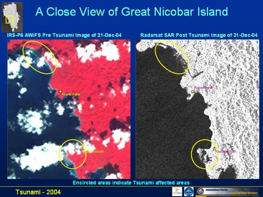
Before and after tsunami satellite images, Great Nicobar Kopenheat Nicobar Islands
Source: IRS-P6 AWiFS data, 21/12/04, and Radarsat SAR data, 31/12/04
Acquired: 21/12/04, 31/12/04
Copyright: Courtesy National Remote Sensing Agency, Govt. of India

Regional Topographic map, with affected areas,
population density and digital elevation model
Source: UNJLC
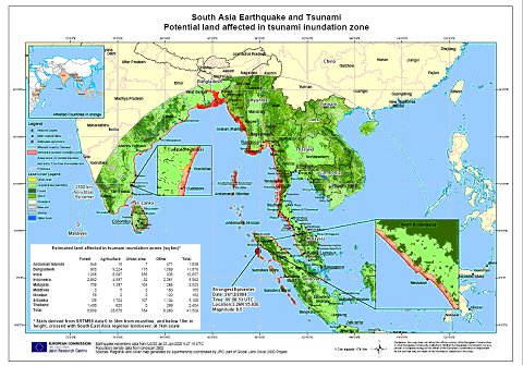
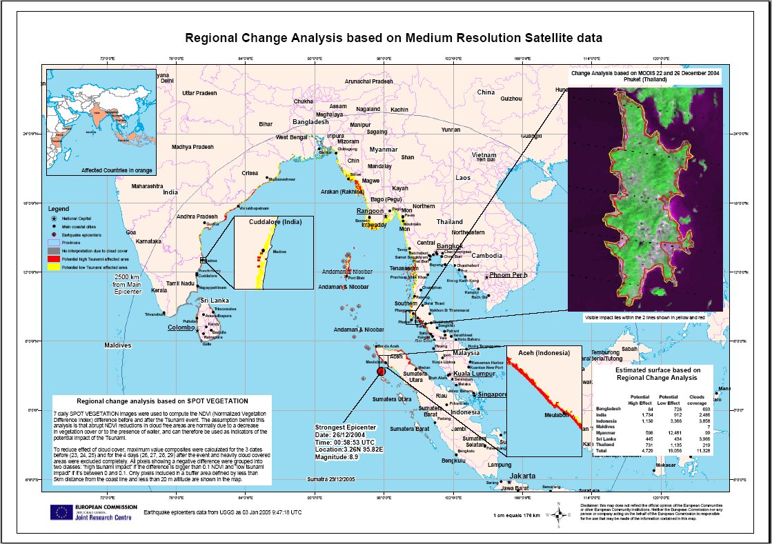
Potential land affected by Tsunami over the whole area.
Copyright: European Commission,
Joint Research Institute. Regional land cover map generated by a
partnership coordinated by JRC, part of Global Land Cover 2000 project.
Source: IRS-P6 AWiFs imagery
21/12/2004-26/12/2004, before and after tsunami
Copyright: Courtesy National Remote Sensing Agency, Govt. of India
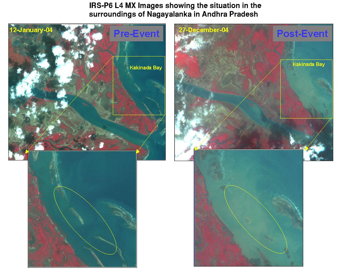
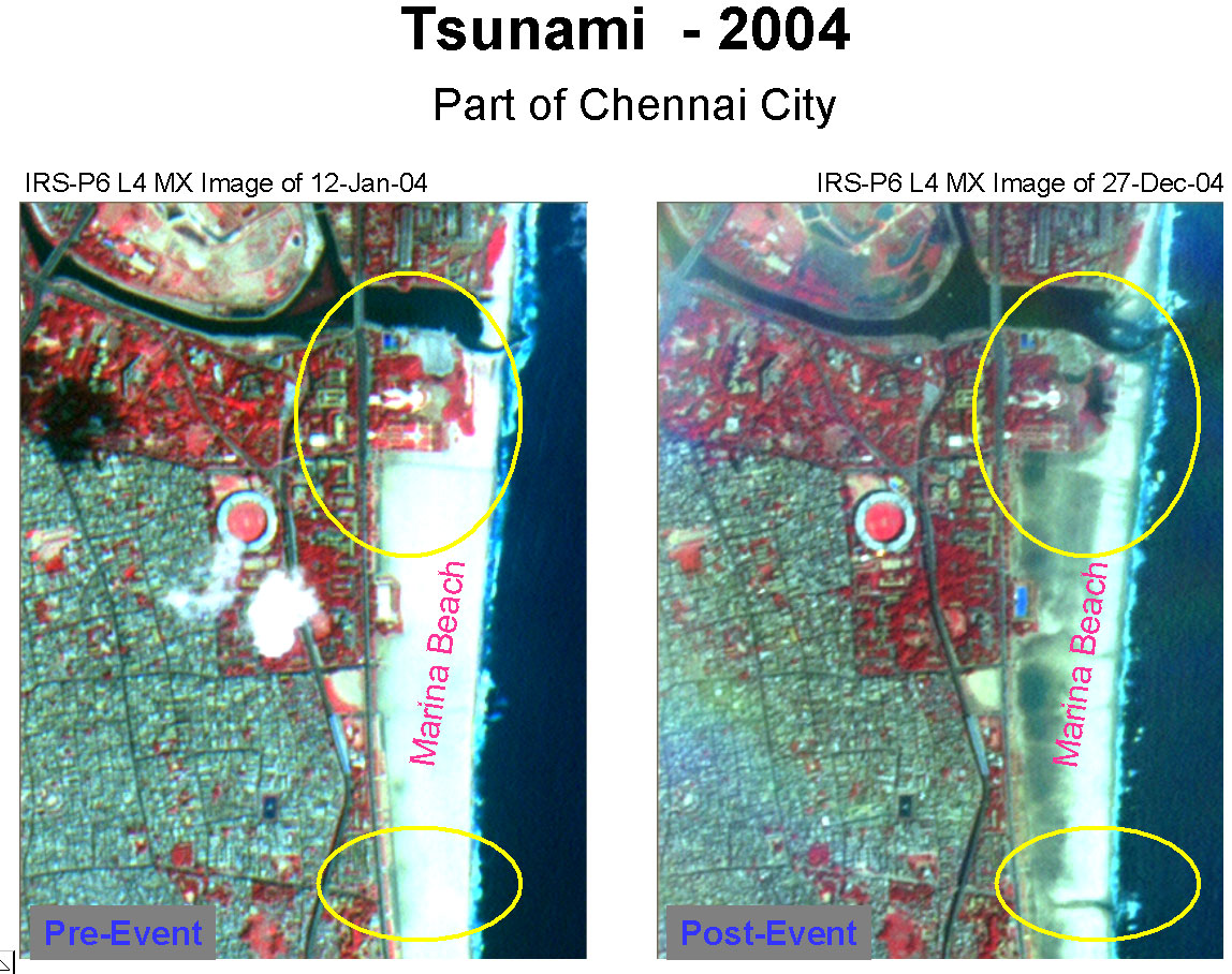
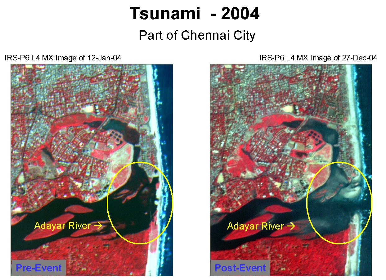
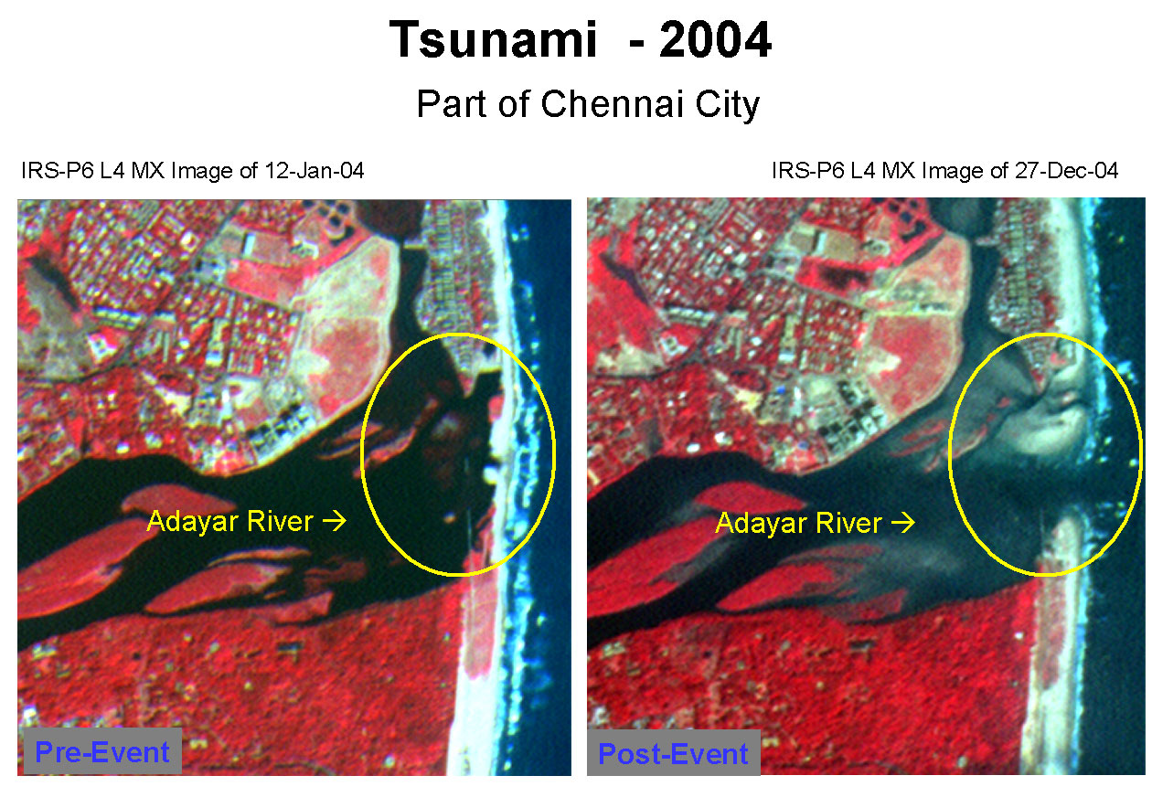
Source: IRS-P6 L4 MX imagery
12/01/2004-27/12/2004, before and after tsunami
Copyright: Courtesy National Remote Sensing Agency, Govt. of India
Source: IRS-P6 L4 MX imagery
12/01/2004-27/12/2004, before and after tsunami
Copyright: Courtesy National Remote Sensing Agency, Govt. of India
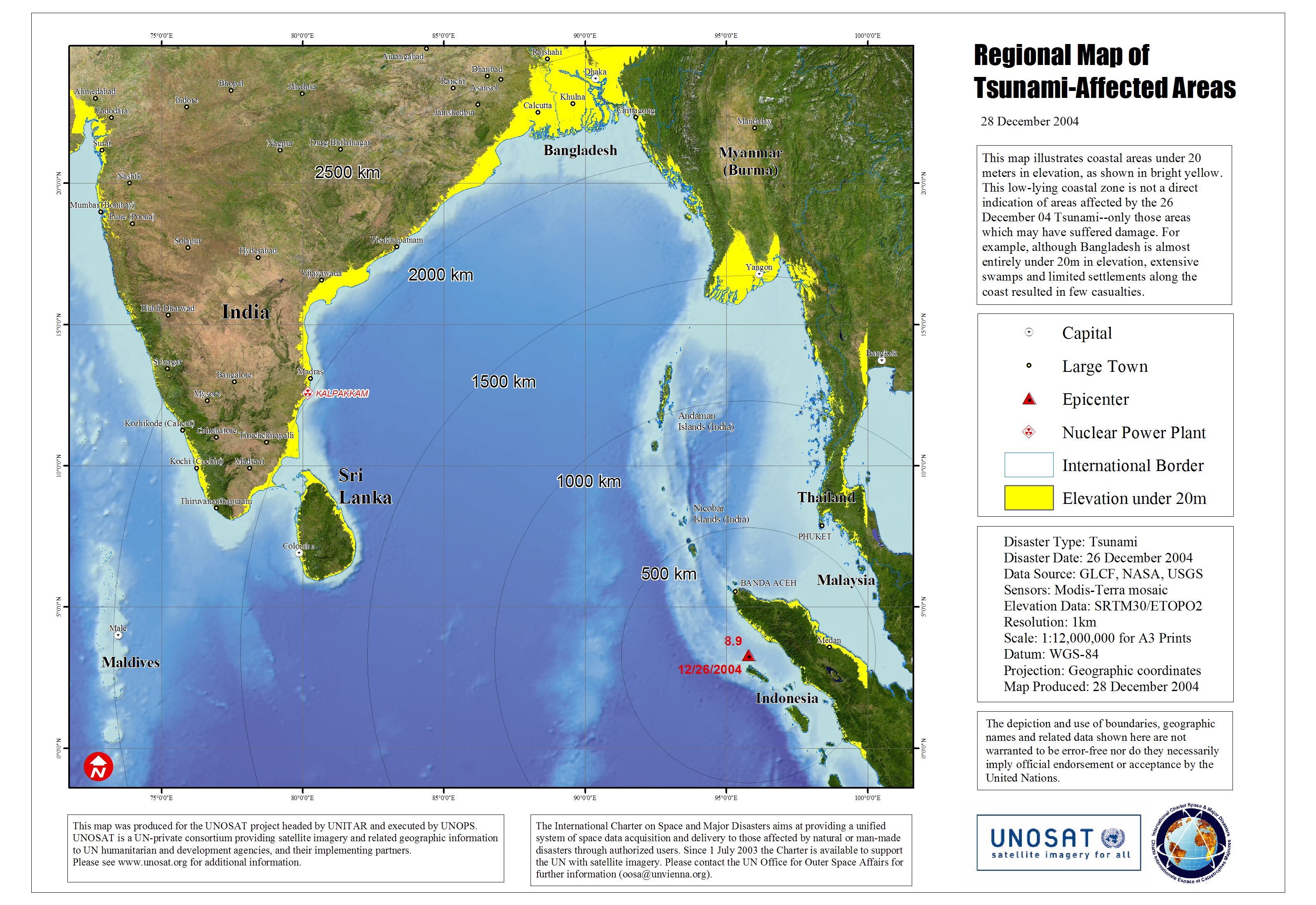
Regional map of tsunami-affected areas, scale: 1:12,000,000
Source: GLCF, NASA, USGS.
MODIS-Terra Mosaic
SRTM (3 arc seconds).
Shows coastal areas under 20 meters elevation.
Map produced 28/12/2004 by UNOSAT.
Other info: Elevation data: SRTM (3 arc seconds).
Shows coastal areas under 20 meters elevation.
Map produced 28/12/2004 by UNOSAT.
Source: IRS-P6 L4 MX imagery
12/01/2004-27/12/2004, before and after tsunami
Copyright: Courtesy National Remote Sensing Agency, Govt. of India
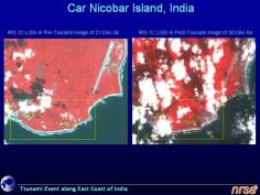
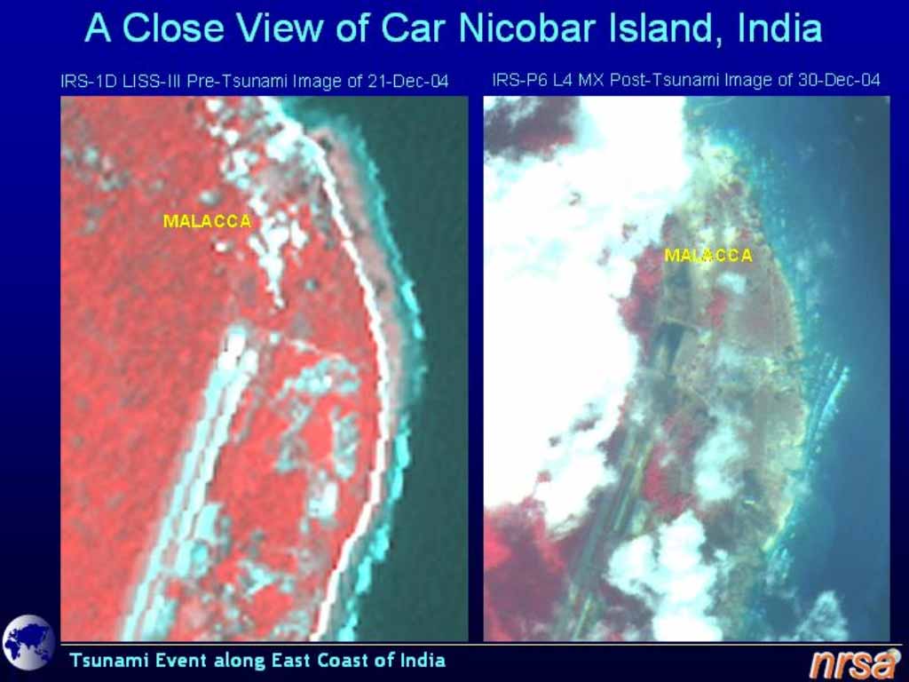
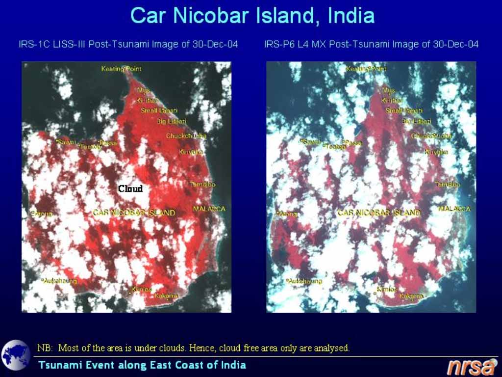
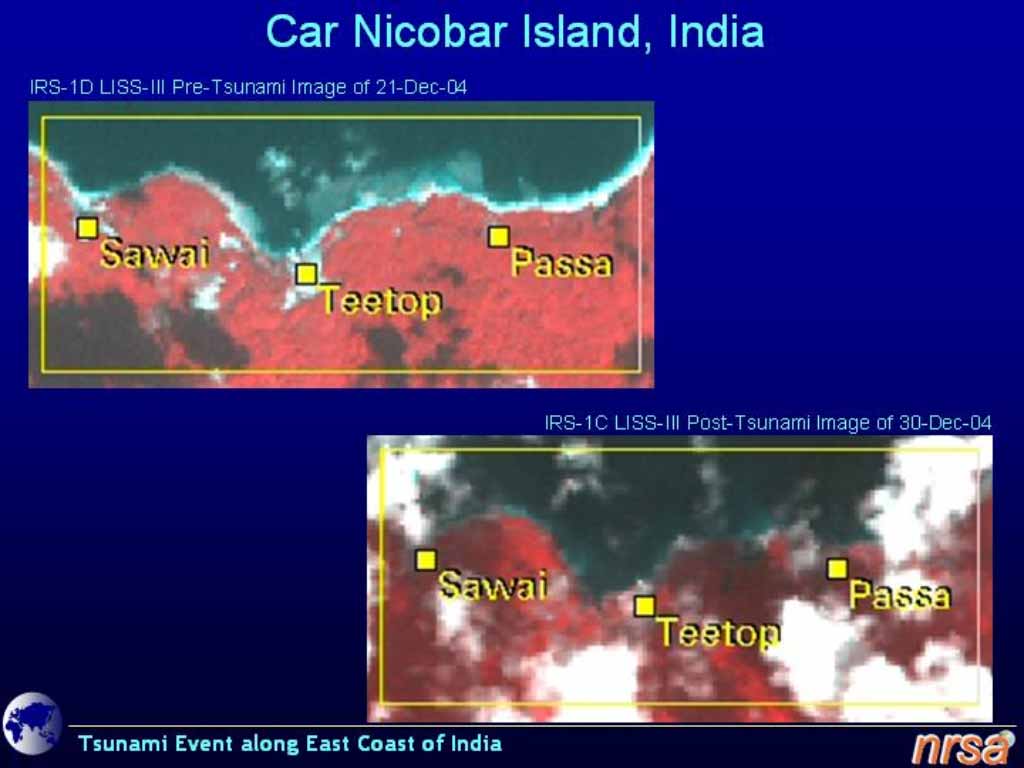
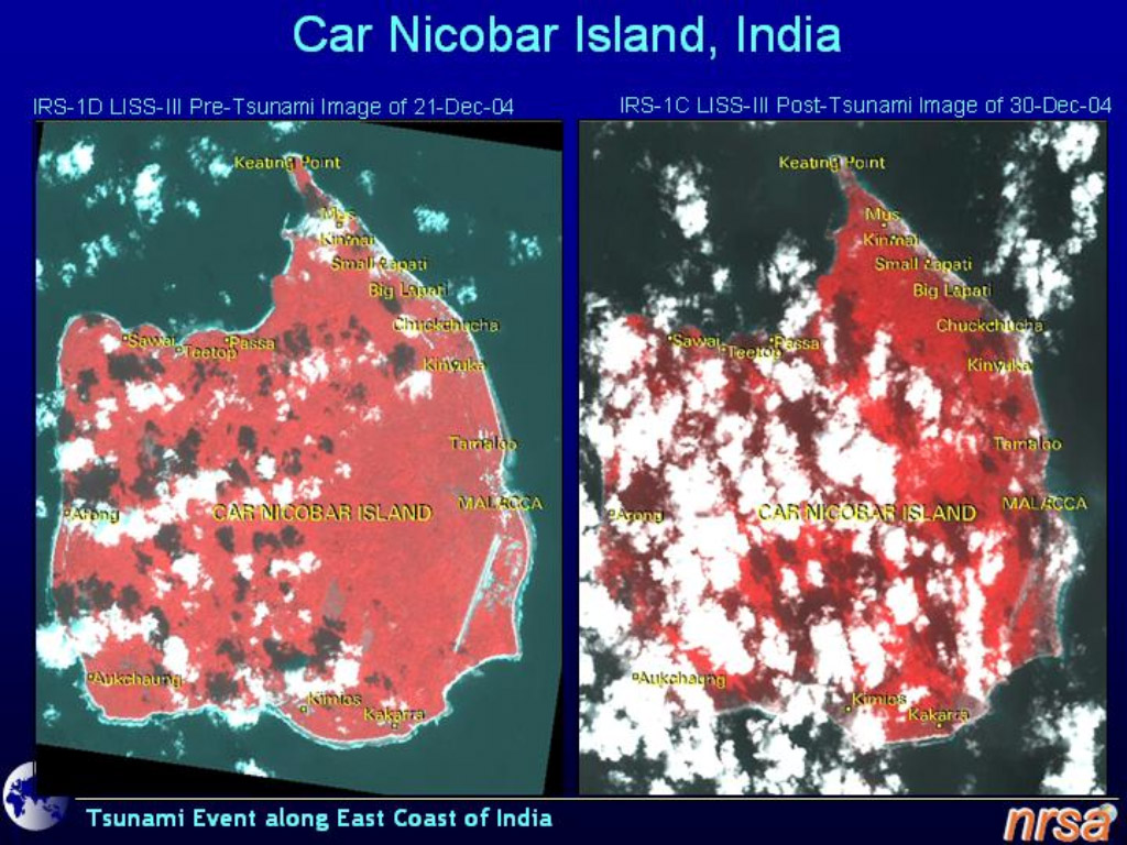
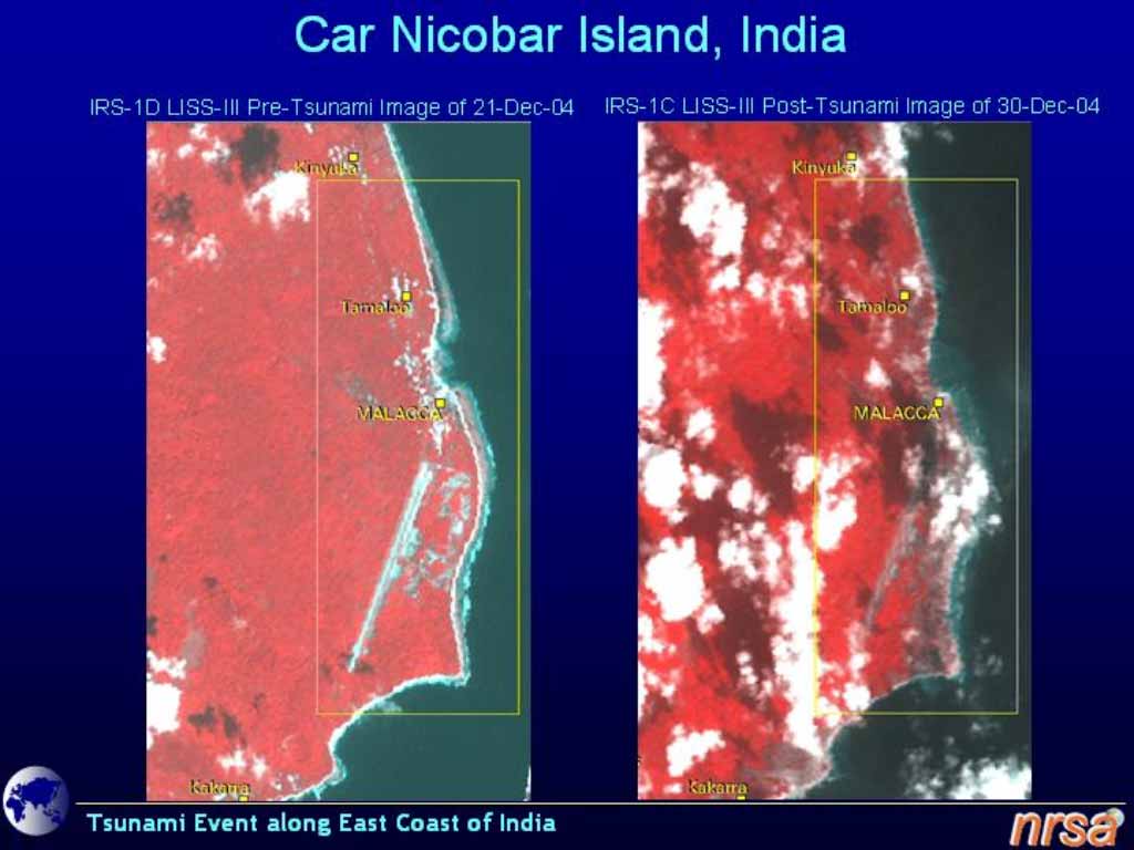
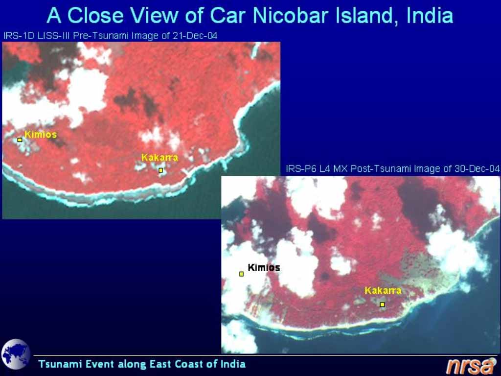
Source: IRS-1D LISS-III imagery, 21/12/2004,
IRS-1C LISS-III imagery, 30/12/2004,
Car Nicobar Island
Copyright: Courtesy National Remote Sensing Agency, Govt. of India.
Source: IRS-1D LISS-III imagery, 21/12/2004,
IRS-1C LISS-III imagery, 30/12/2004,
Car Nicobar Island
Copyright: Courtesy National Remote Sensing Agency, Govt. of India.
Source: IRS-P6 L4 MX imagery
12/01/2004-27/12/2004, before and after tsunami
Copyright: Courtesy National Remote Sensing Agency, Govt. of India
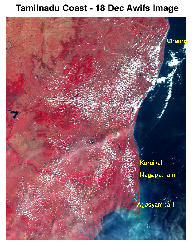
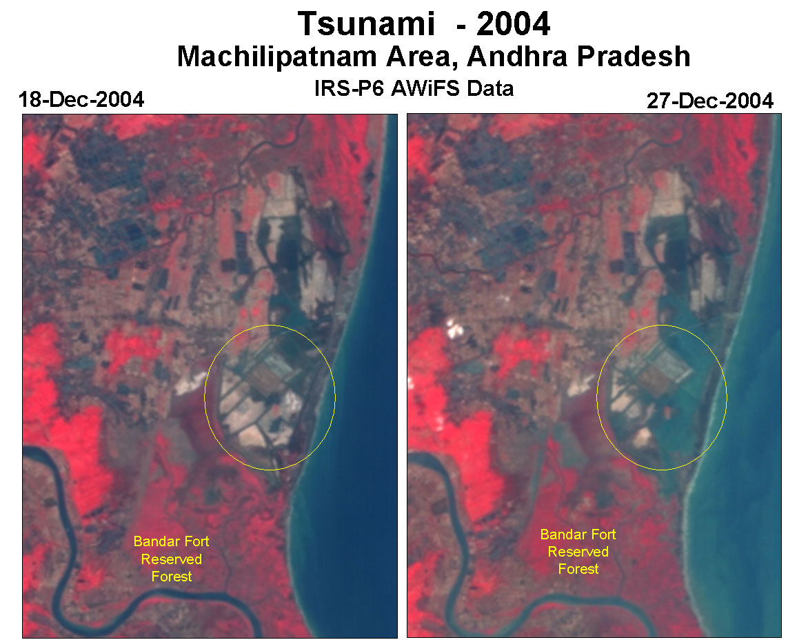
Source: IRS-P6 AWiFs imagery
18/12/2004
Copyright: Courtesy National Remote Sensing Agency, Govt. of India
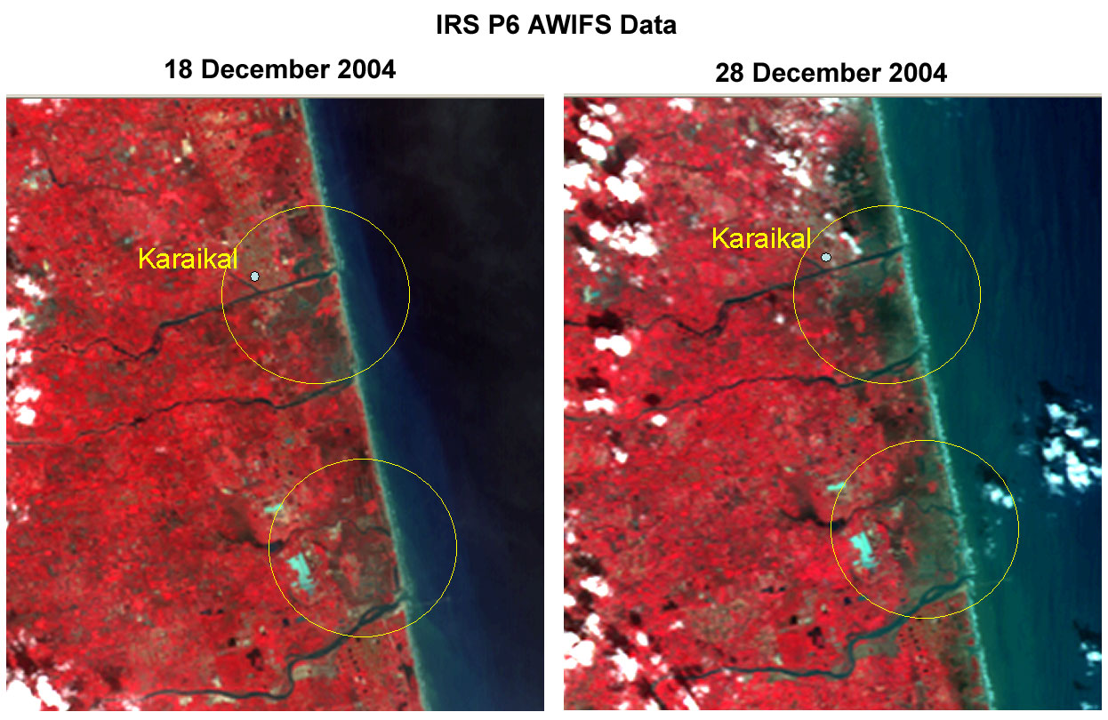
Source: IRS-P6 AWiFs imagery
18/12/2004-28/12/2004, before and after
Copyright: Courtesy National Remote Sensing Agency, Govt. of India
Source: IRS-1D LISS-III imagery, 21/12/2004,
IRS-1C LISS-III imagery, 30/12/2004,
Car Nicobar Island
Copyright: Courtesy National Remote Sensing Agency, Govt. of India.
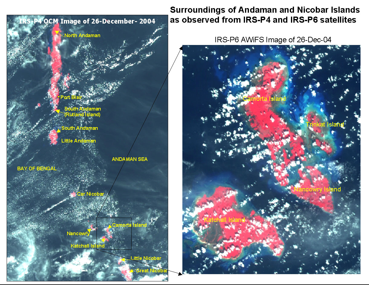
Source: IRS-P4 OCM, IRS-P6 AWiFs imagery 26/12/2004
Copyright: Courtesy National Remote Sensing Agency, Govt. of India

Source: IRS-P6 AWiFs imagery
18/12/2004-28/12/2004, before and after
Copyright: Courtesy National Remote Sensing Agency, Govt. of India
Source: IRS-P6 AWiFs imagery
18/12/2004-28/12/2004, before and after
Copyright: Courtesy National Remote Sensing Agency, Govt. of India
Source: IRS-P6 AWiFs imagery
18/12/2004-27/12/2004, before and after
Copyright: Courtesy National Remote Sensing Agency, Govt. of India
Source: IRS-1D LISS-III imagery, 21/12/2004,
IRS-1C LISS-III imagery, 30/12/2004,
Car Nicobar Island
Copyright: Courtesy National Remote Sensing Agency, Govt. of India.
Source: IRS-1D LISS-III imagery, 21/12/2004,
IRS-1C LISS-III imagery, 30/12/2004,
Car Nicobar Island
Copyright: Courtesy National Remote Sensing Agency, Govt. of India.
Source: IRS-1D LISS-III imagery, 21/12/2004,
IRS-1C LISS-III imagery, 30/12/2004,
Car Nicobar Island
Copyright: Courtesy National Remote Sensing Agency, Govt. of India.
Source: IRS-1D LISS-III imagery, 21/12/2004,
IRS-1C LISS-III imagery, 30/12/2004,
Car Nicobar Island
Copyright: Courtesy National Remote Sensing Agency, Govt. of India.
Source: IRS-P6 AWiFs imagery
21/12/2004-26/12/2004, before and after tsunami
Copyright: Courtesy National Remote Sensing Agency, Govt. of India

Source: IRS-P6 AWiFs imagery
21/12/2004-26/12/2004, before and after tsunami
Copyright: Courtesy National Remote Sensing Agency, Govt. of India.
Source: IRS-P6 AWiFs imagery
21/12/2004-26/12/2004, before and after tsunami
Copyright: Courtesy National Remote Sensing Agency, Govt. of India
Source: IRS-P6 AWiFs imagery
21/12/2004-26/12/2004, before and after tsunami
Copyright: Courtesy National Remote Sensing Agency, Govt. of India
Other sites providing satellite imagery on the Asian disaster:
| CRISP | http://www.crisp.nus.edu.sg/tsunami/tsunami.html |
| SERTIT | http://sertit.u-strasbg.fr/RMS/action.php?id=11642885 |
###########
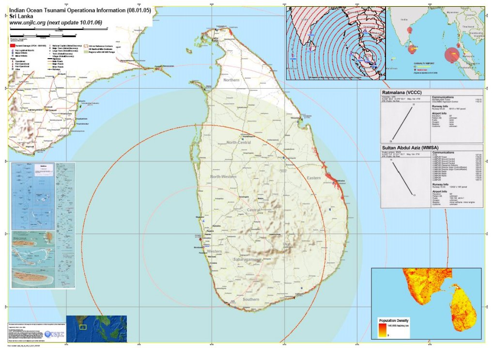
Tsunami, Sri Lanka
https://www.disasterscharter.org/web/guest/-/tsunami-sri-la-30
Sunday, 26 December 2004
Type of Event:
Tsunami, Earthquake
Location of Event:
Sri Lanka
Date of Charter Activation:
26/12/2004
Charter Requestor:
French Civil Protection Agency
Project Management:
Description of the event
Following a 9.0 magnitude earthquake off the coast of Sumatra, a massive tsunami struck Sri Lanka on 26th December 2004, killing over 30,000 people.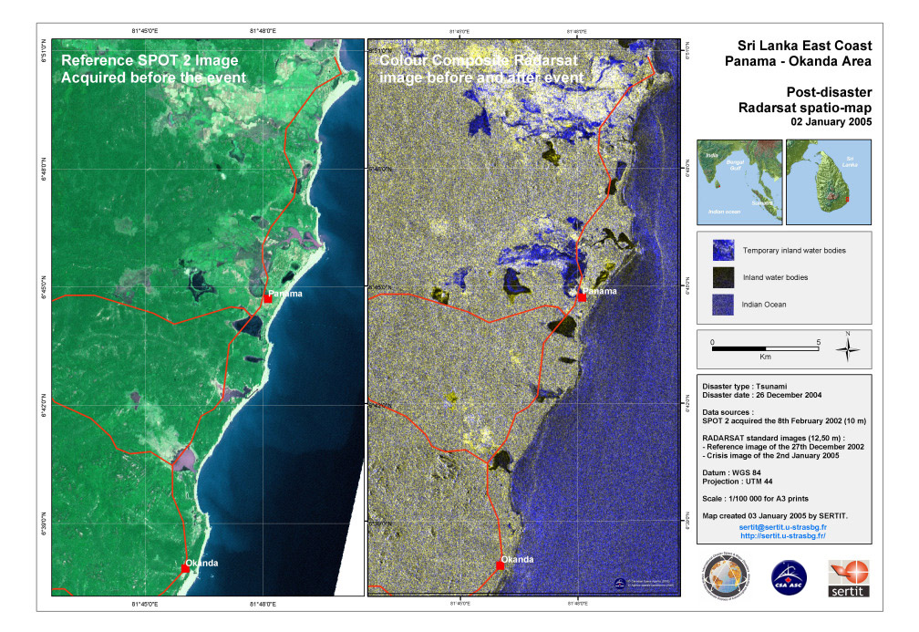
Satellite map of Sri Lanka, Radarsat Composite, Panama Okanda.
Source: SPOT 2, resolution: 10 m ( 08/02/2002)
Radarsat, resolution 12.5 m (02/01/2005 and 27/12/2002)
Radarsat, resolution 12.5 m (02/01/2005 and 27/12/2002)
Acquired: 02/01/2005
Copyright: Map produced 03/01/2005 by SERTIT.
Other info: --
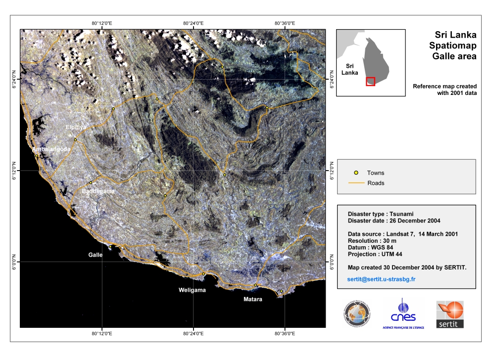
Satellite map of Sri Lanka, Galle area
Source: Landsat 7, 30 m resolution.
Acquired: 14/03/2001
Copyright: Map produced 30/12/2004 by SERTIT.
Other info: --
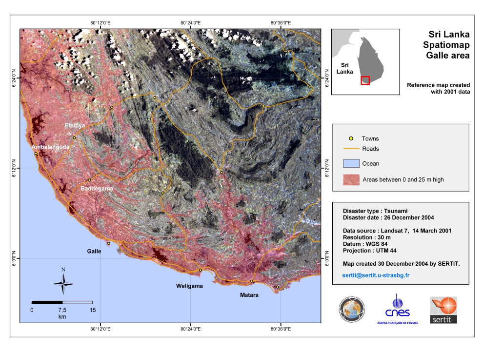
Satellite map of Sri Lanka, Galle area.
Source: Landsat 7, 30 m resolution.
Acquired: 14/03/2001
Copyright: Map produced 30/12/2004 by SERTIT.
Other info: --
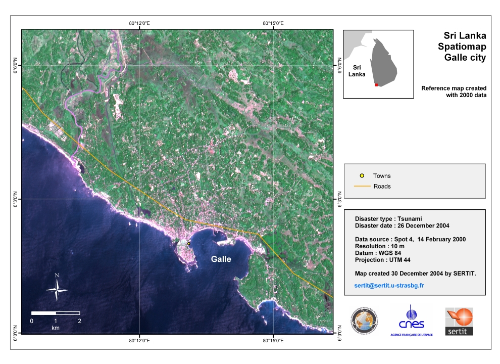
Satellite map of Sri Lanka, Galle area
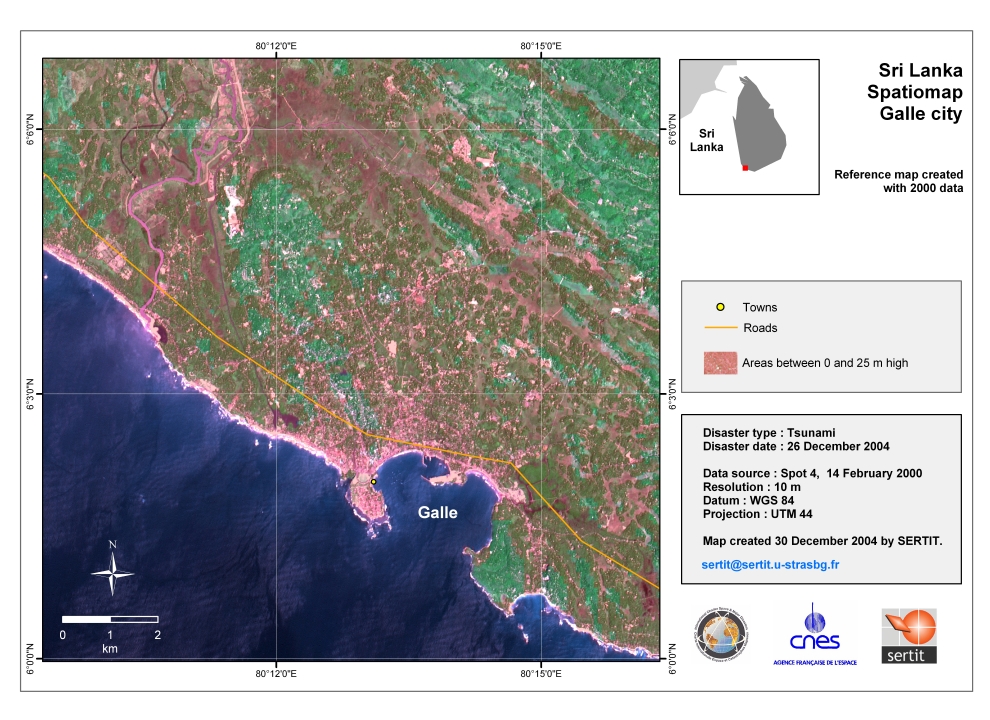
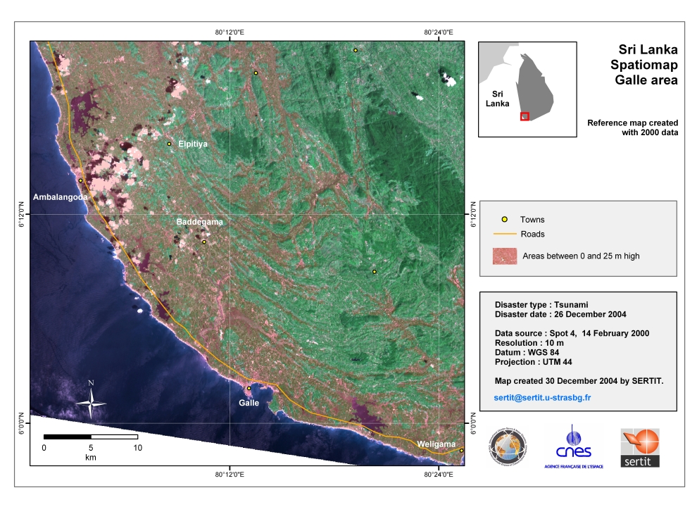
Source: SPOT 4, 10 m resolution.
Acquired: 14/02/2000
Copyright: Map produced 31/12/2004 by SERTIT.
Other info: --
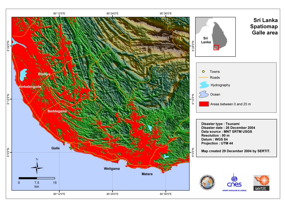
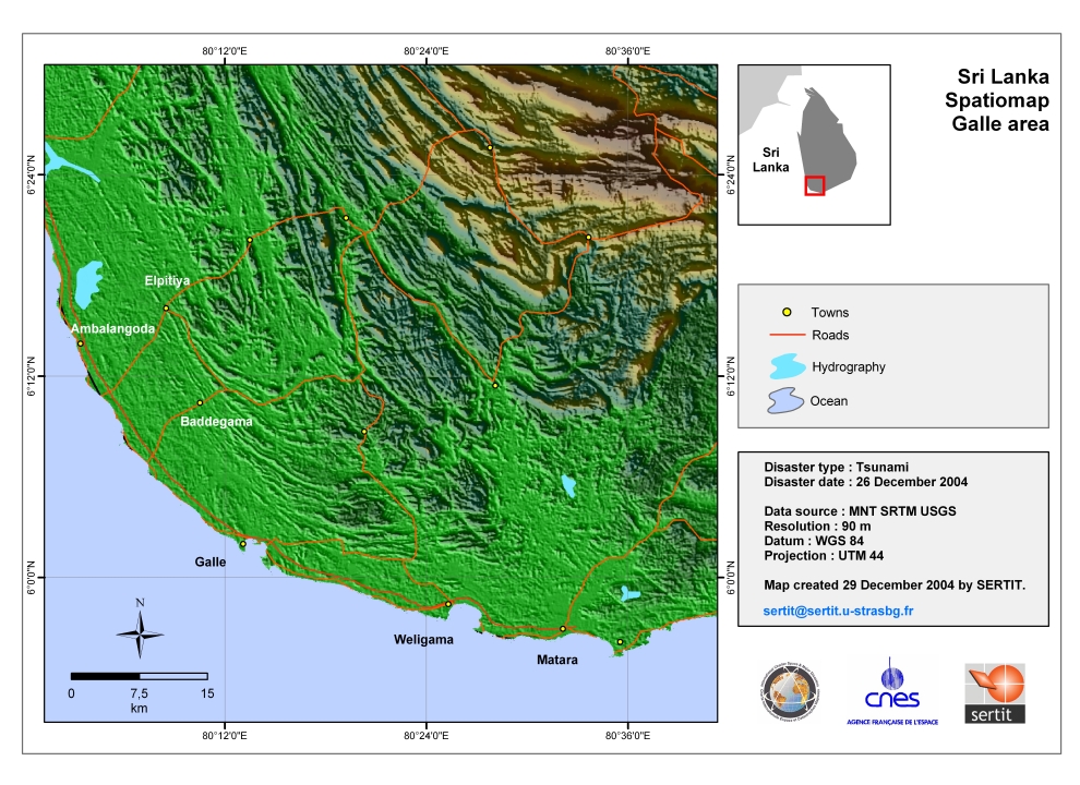
Satellite map of Sri Lanka, lowlands of Galle area
90m resolution.
Source: MNT USGS SRTM (3 arcseconds).
Acquired: --
Copyright: Map produced 30/12/2004 by SERTIT.
Other info: --
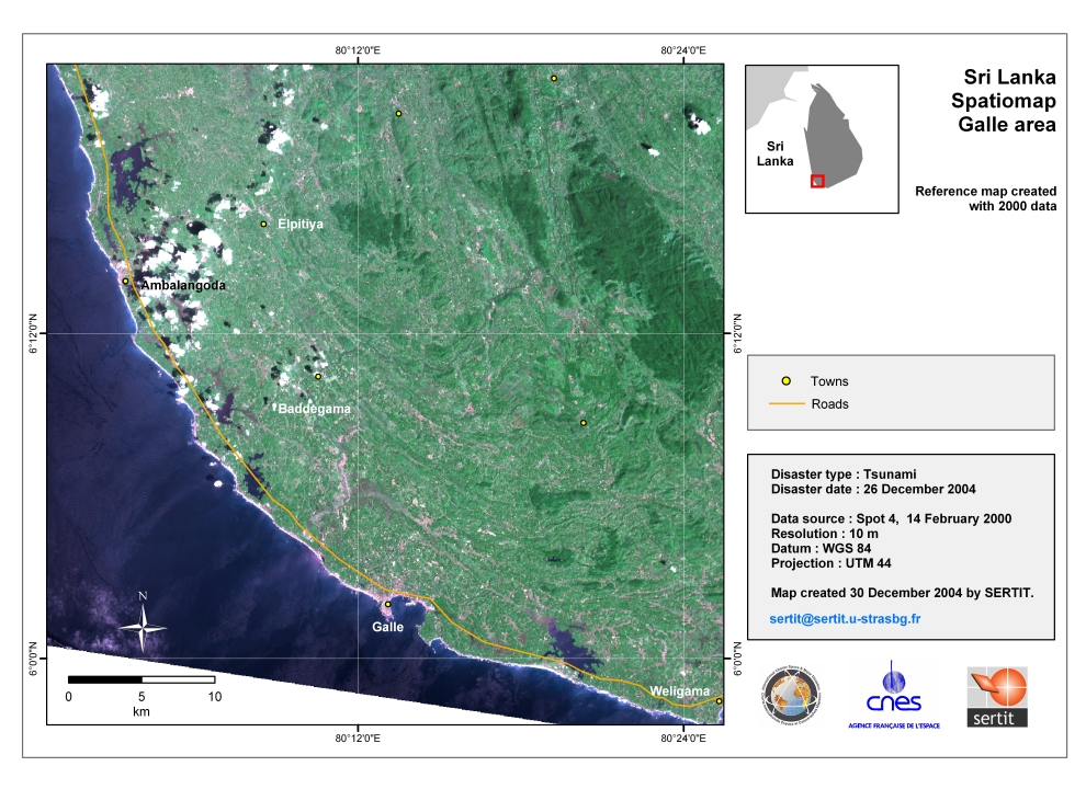
Satellite map of Sri Lanka, Galle area
Source: SPOT 4, 10 m resolution.
Acquired: 14/02/2000
Copyright: Map produced 30/12/2004 by SERTIT.
Other info: --
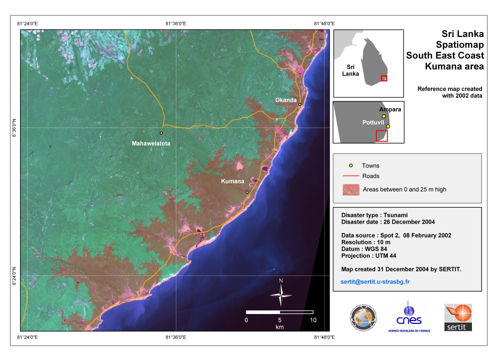
Satellite map of Sri Lanka, Kumana area
Source: SPOT 2, 10 m resolution.
Acquired: 08/02/2002
Copyright: Map produced 31/12/2004 by SERTIT.
Other info: --
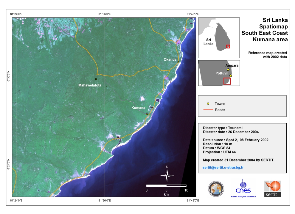
Satellite map of Sri Lanka, Kumana area, reference map
10 m resolution.
Source: SPOT 2
Acquired: 08/02/2002.
Copyright: Map produced 31/12/2004 by SERTIT.
Other info: --
Satellite map of Sri Lanka, Galle area
Source: SPOT 4, 10 m resolution.
Acquired: 11/02/2000
Copyright: Map produced 30/12/2004 by SERTIT.
Other info: --
Satellite map of Sri Lanka, Galle area
.
Source: SPOT 4, 10 m resolution
Acquired: 14/02/2000
Copyright: Map produced 30/12/2004 by SERTIT.
Other info: --
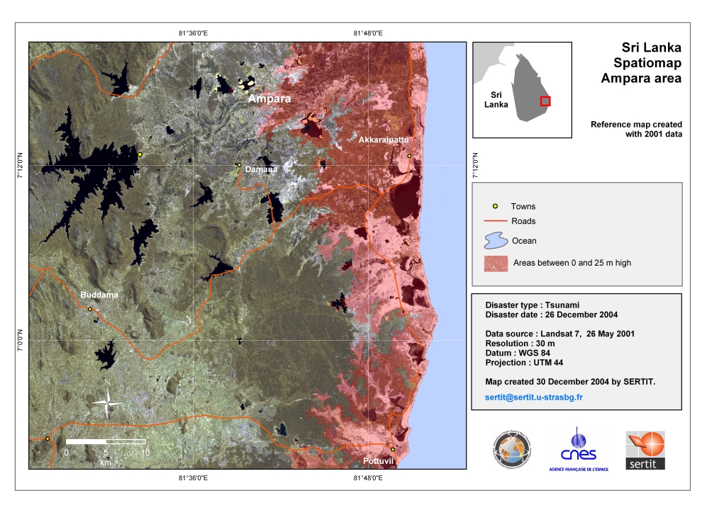
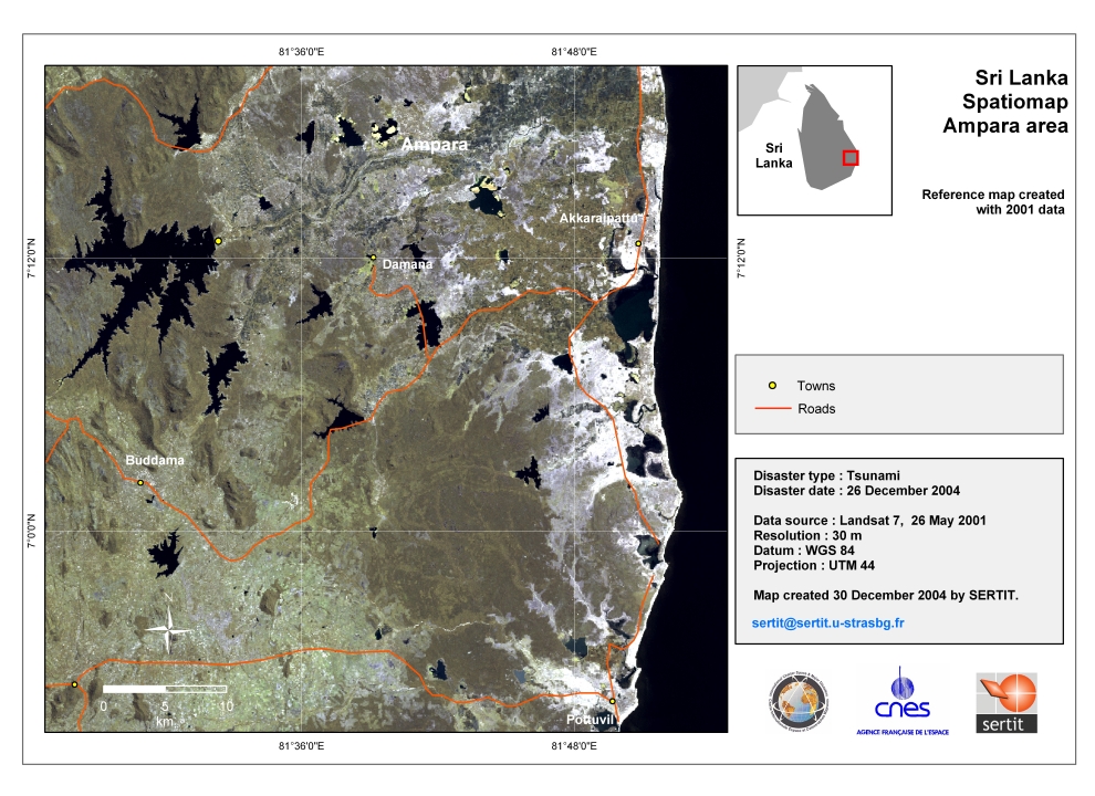
Satellite map of Sri Lanka, Ampara area
Source: Landsat 7, 30 m resolution.
Acquired: 26/05/2001
Copyright: Map produced 30/12/2004 by SERTIT.
Other info: --
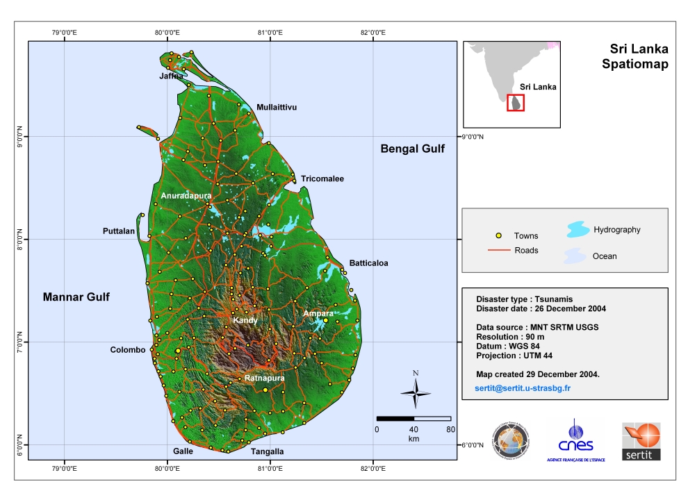
Satellite map of Sri Lanka
90m resolution.
Source: MNT USGS SRTM (3 arc seconds).
Acquired: --
Copyright: Map produced 29/12/2004 by SERTIT.
Other info: --
Satellite map of Sri Lanka, Galle area
90m resolution.
Source: MNT USGS SRTM (3 arcseconds).
Acquired: --
Copyright: Map produced 29/12/2004 by SERTIT.
Other info: --
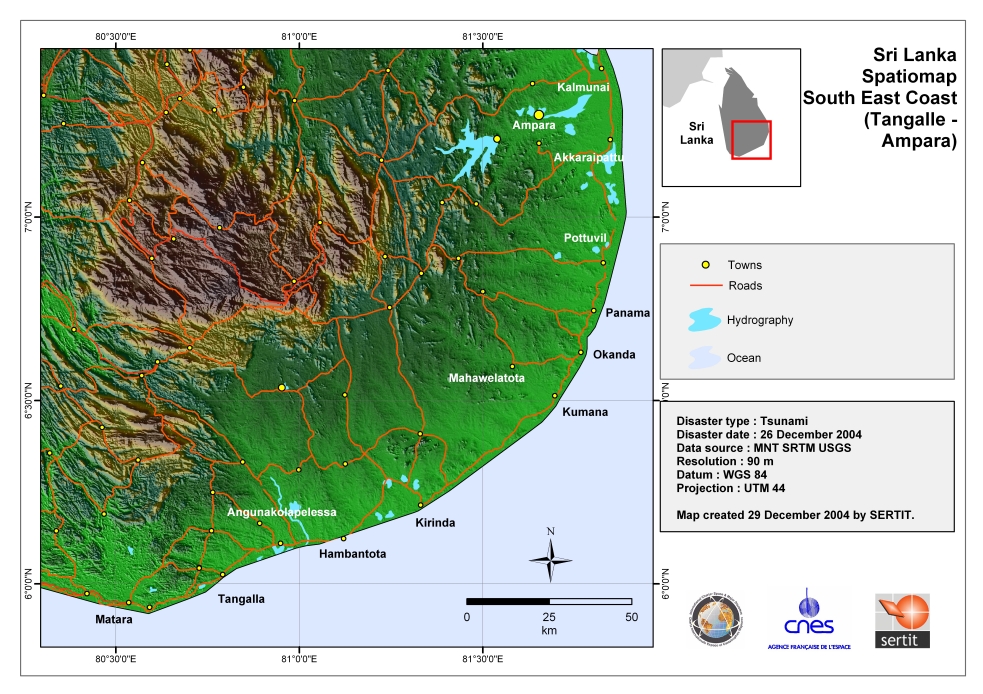
Satellite map of Sri Lanka, Tangalle-Ampara area
90m resolution.
Source: MNT USGS SRTM (3 arcseconds).
Acquired: --
Copyright: Map produced 30/12/2004 by SERTIT.
Other info: --
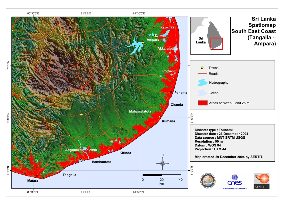
Satellite map of Sri Lanka, lowlands of Tangalle-Ampara area
90m resolution.
Source: MNT USGS SRTM (3 arcseconds).
Acquired: --
Copyright: Map produced 30/12/2004 by SERTIT.
Other info: --
Satellite map of Sri Lanka, Ampara area.
Source: Landsat 7, 26/05/2001, 30 m resolution.
Acquired: --
Copyright: Map produced 30/12/2004 by SERTIT.
Other info: --
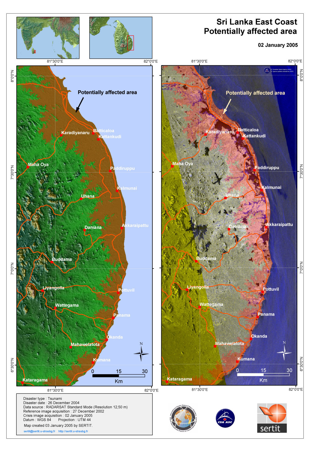
Satellite map of Sri Lanka, Potentially Affected Area, east coast.
Source: Radarsat, 02/01/2005. Resolution: 12.5 m.
Acquired: --
Copyright: Map produced 03/01/2005 by SERTIT.
Other info: --
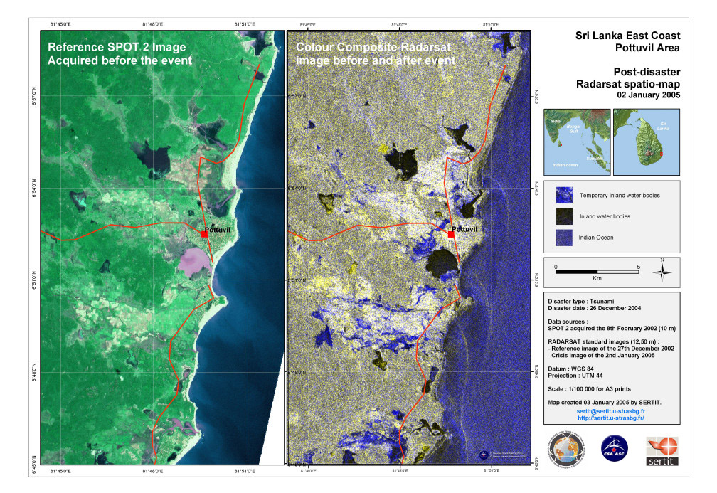
Satellite map of Sri Lanka, Radarsat Composite, Pottuvi.
Source: SPOT 2, 27/12/2002 and Radarsat, 02/01/2005. Resolution: 12.5 m.
SPOT 2, 08/02/2002. Resolution: 10 m.
Acquired: --
Copyright: Map produced 03/01/2005 by SERTIT.
Other info: --
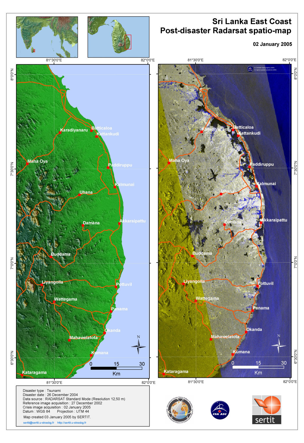
Satellite map of Sri Lanka, Postdisaster Radarsat East coast.
Source: Radarsat, 02/01/2005. Resolution: 12.5 m.
Acquired: --
Copyright: Map produced 03/01/2005 by SERTIT.
Other info: --
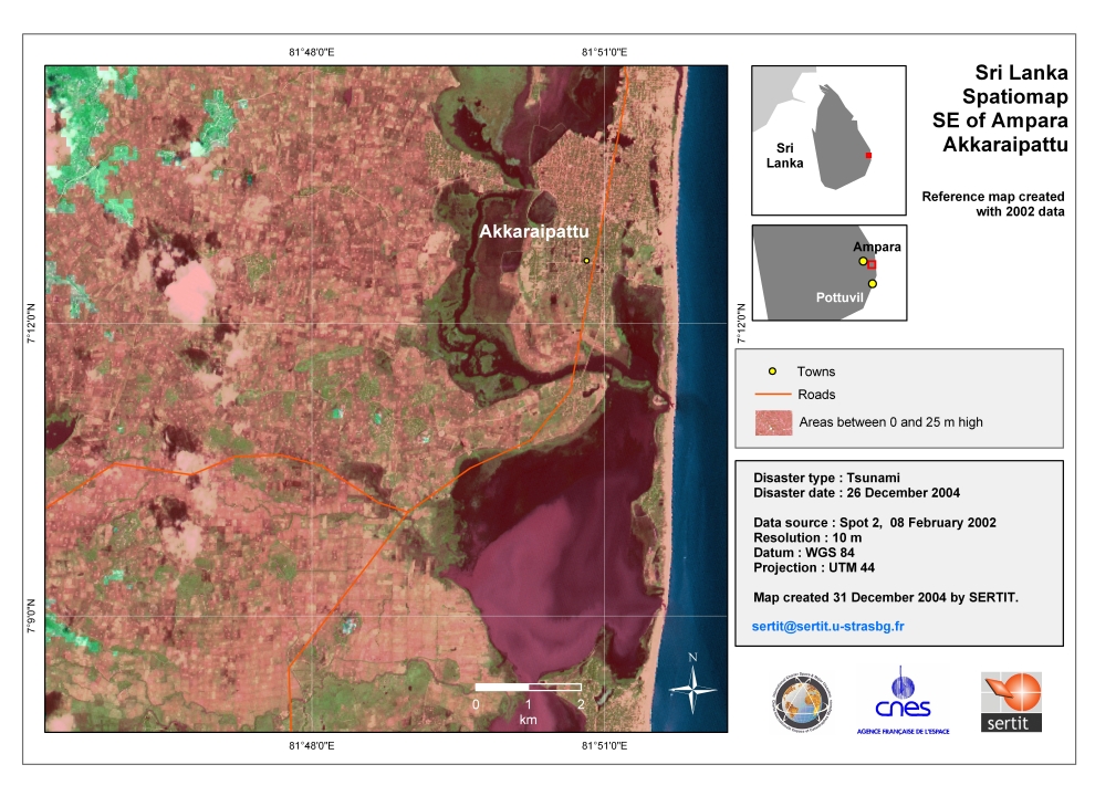
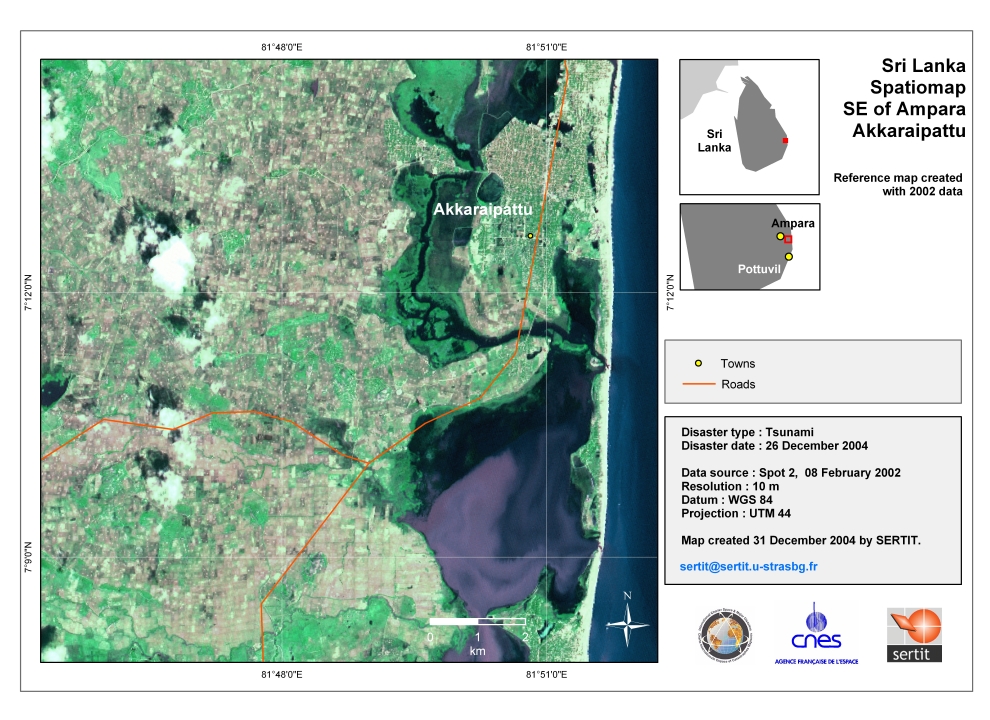
Satellite map of Sri Lanka, Akkaraipattu
Source: SPOT 2, 10 m resolution.
Acquired: 08/02/2002
Copyright: Map produced 31/12/2004 by SERTIT.
Other info: --
Satellite map of Sri Lanka, Akkaraipattu
Source: SPOT 2, 10 m resolution.
Acquired: 08/02/2002
Copyright: Map produced 31/12/2004 by SERTIT.
Other info: --
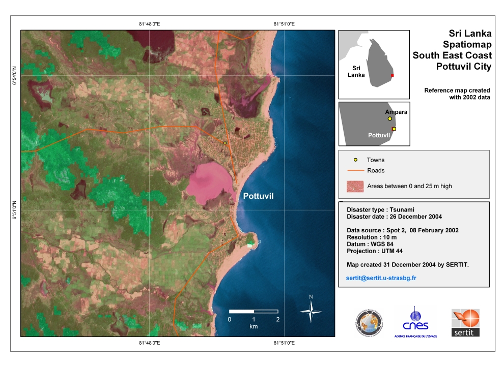
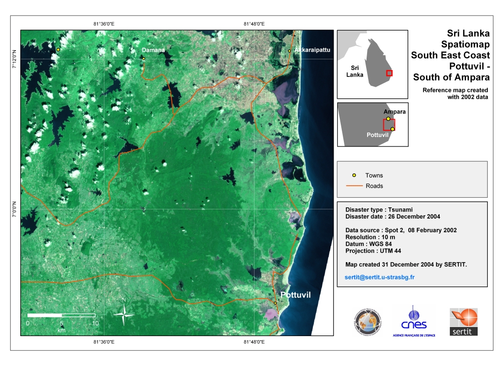
Satellite map of Sri Lanka, Ampara - Pottuvil city, reference map
10 m resolution.
Source: SPOT 2
Acquired: 08/02/2002
Copyright: Map produced 31/12/2004 by SERTIT.
Other info: --
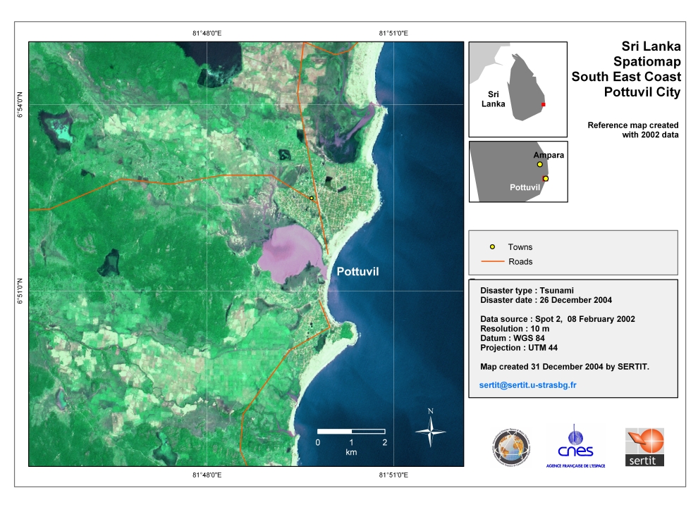
Satellite map of Sri Lanka, Ampara - Pottuvil city
Source: SPOT 2, 10 m resolution.
Acquired: 08/02/2002
Copyright: Map produced 31/12/2004 by SERTIT.
Other info: --
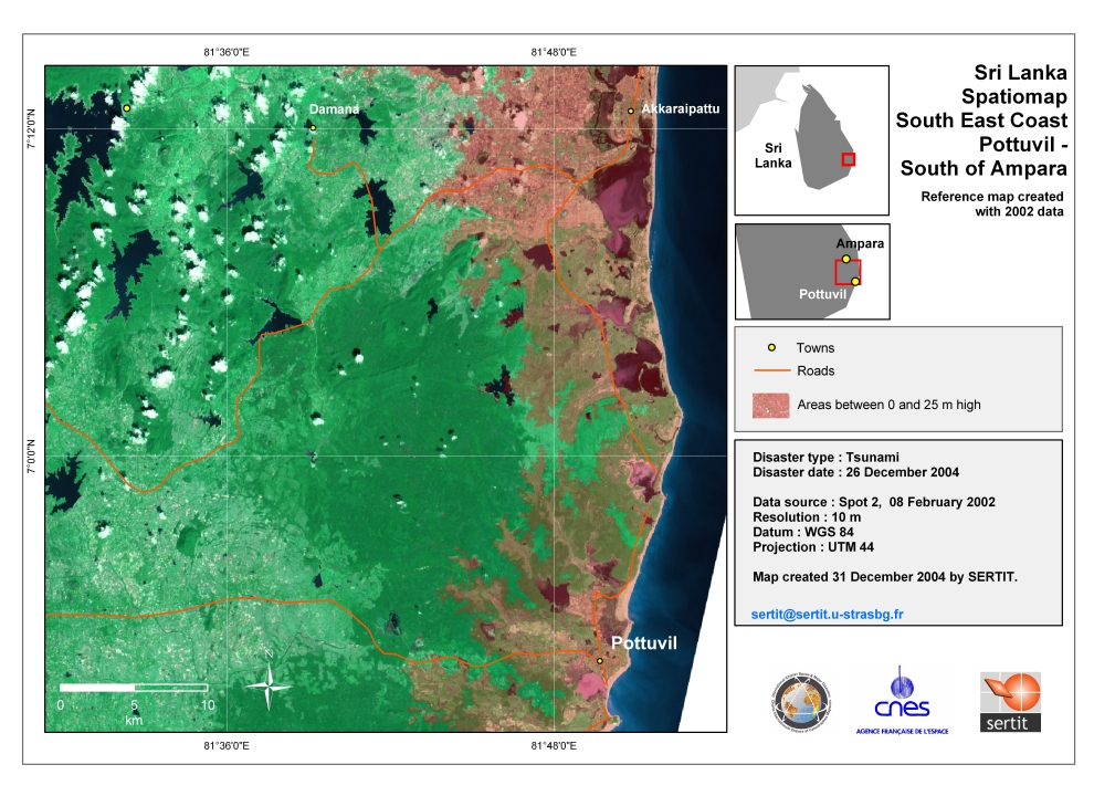
Satellite map of Sri Lanka, Ampara - Pottuvil area
Source: SPOT 2, 10 m resolution.
Acquired: 08/02/2002
Copyright: Map produced 31/12/2004 by SERTIT.
Other info: --
Satellite map of Sri Lanka, Ampara - Pottuvil area
Source: SPOT 2, 10 m resolution.
Acquired: 08/02/2002
Copyright: Map produced 31/12/2004 by SERTIT.
Other info: --
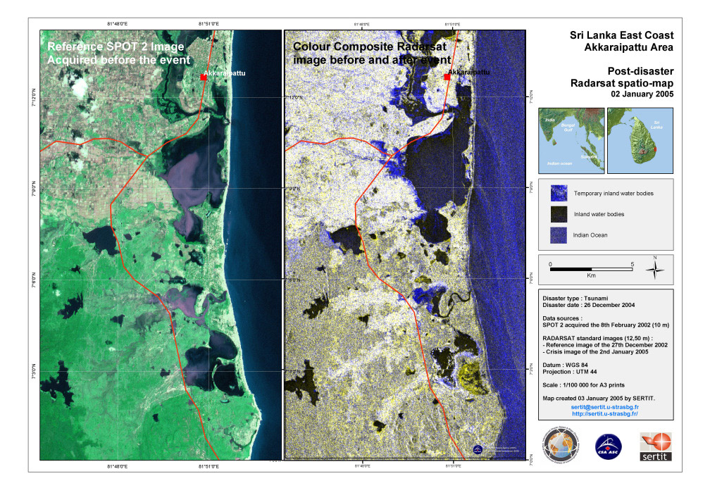
Satellite map of Sri Lanka, Radarsat Composite, Akkaraipattu.
Source: SPOT 2, 27/12/2002 and Radarsat, 02/01/2005. Resolution: 12.5 m.
SPOT 2, 08/02/2002. Resolution: 10 m.
SPOT 2, 08/02/2002. Resolution: 10 m.
Acquired: 02/01/2005
Copyright: Map produced 03/01/2005 by SERTIT.
Other info: --
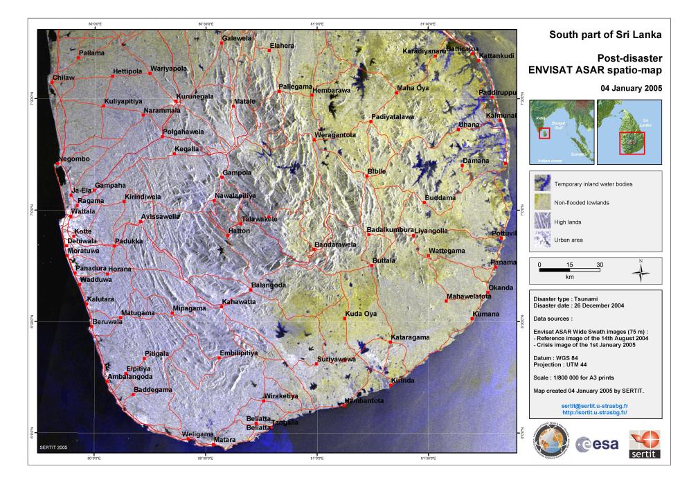
Satellite map of Sri Lanka.
Source: Post-disaster ENVISAT ASAR data.
Acquired: --
Copyright: Map produced 04/01/2005 by SERTIT.
Other info: --
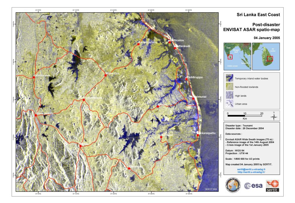
Satellite map of Eastern Sri Lanka.
Source: Post-disaster ENVISAT ASAR data.
Acquired: --
Copyright: Map produced 04/01/2005 by SERTIT.
Other info: --
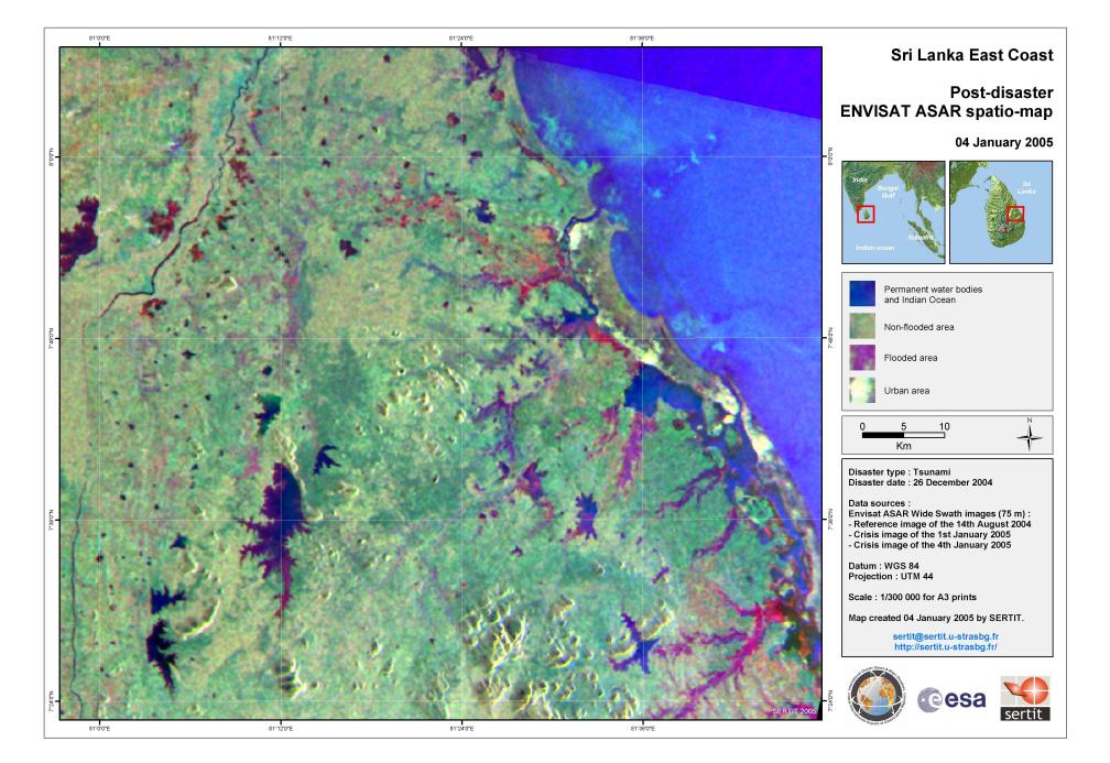
Post-disaster, East Coast.
Source: ENVISAT ASAR Wide Swath (75 m)
Acquired: 01/01/2005, 04/01/2005
Copyright: Map produced 04/01/2005 by SERTIT.
Other info: --

Dendron Poster, Sri Lanka
Source: --
Acquired: --
Copyright: --
Other info: --


